

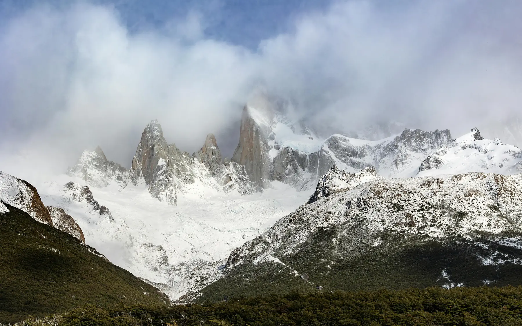
The best hikes in El Chaltén are defined by their accessibility, allowing you to walk from your hotel directly onto trails that lead to the base of the world’s most dramatic granite spires. While the trek to Laguna de los Tres is the undisputed highlight, a balanced itinerary includes the flatter valley walks and the high-altitude panoramas of the surrounding massifs.
Known as the National Capital of Trekking, El Chaltén serves as a unique basecamp where world-class trailheads sit at the end of residential streets. This eliminates the need for expensive transfers for most outings, making it the most hiker-friendly destination in Patagonia. Whether you are looking for a grueling 20-kilometer day or a gentle stroll to a waterfall, the trails of Los Glaciares National Park offer a density of scenery that is unmatched elsewhere in the Andes.
The “Big Three”: El Chaltén’s Iconic Day Hikes
Choosing between the major trails in El Chaltén depends on your fitness level and what you want to see - the vertical granite of Fitz Roy, the ice-choked waters of Cerro Torre, or a 360-degree view of both. These three hikes represent the pinnacle of the region’s trekking, each requiring a full day and a reasonable level of physical preparation.
While Laguna de los Tres is the most famous, it is also the most physically demanding. Laguna Torre offers a more moderate gradient, while Loma del Pliegue Tumbado provides the best perspective for those who want to see the entire landscape at once.
- Distance (RT): 21 km / 18 km / 21 km
- Difficulty: Strenuous / Moderate / Moderate-Strenuous
- Primary Highlight: Mount Fitz Roy base / Floating icebergs / 360-degree panorama
- Best For: Photography / Steady pace / Avoiding crowds
Choose Laguna de los Tres for the iconic close-up, Laguna Torre for a moderate valley walk, or Loma del Pliegue Tumbado for the best panoramic views.
Laguna de los Tres (The Fitz Roy Hike)
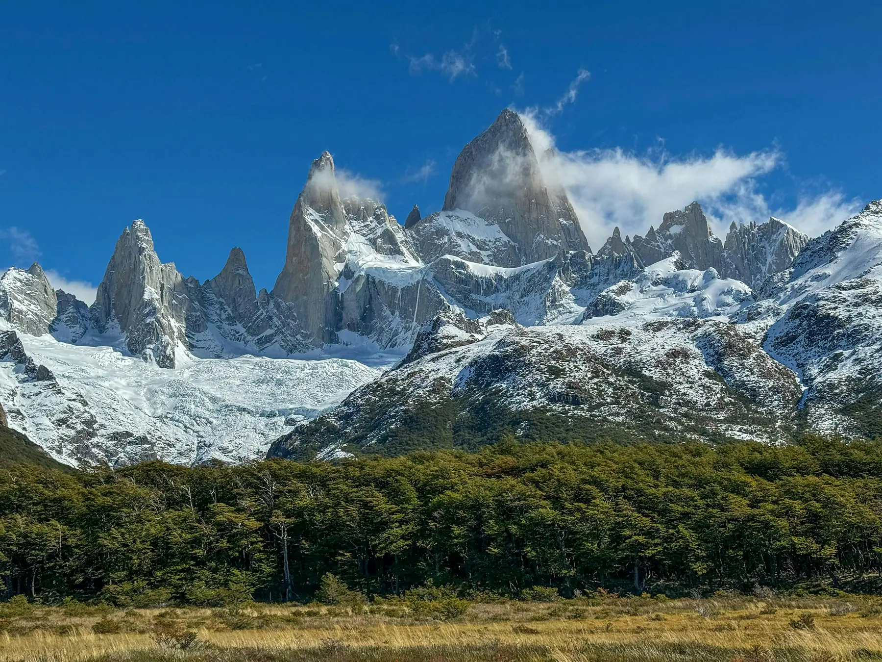
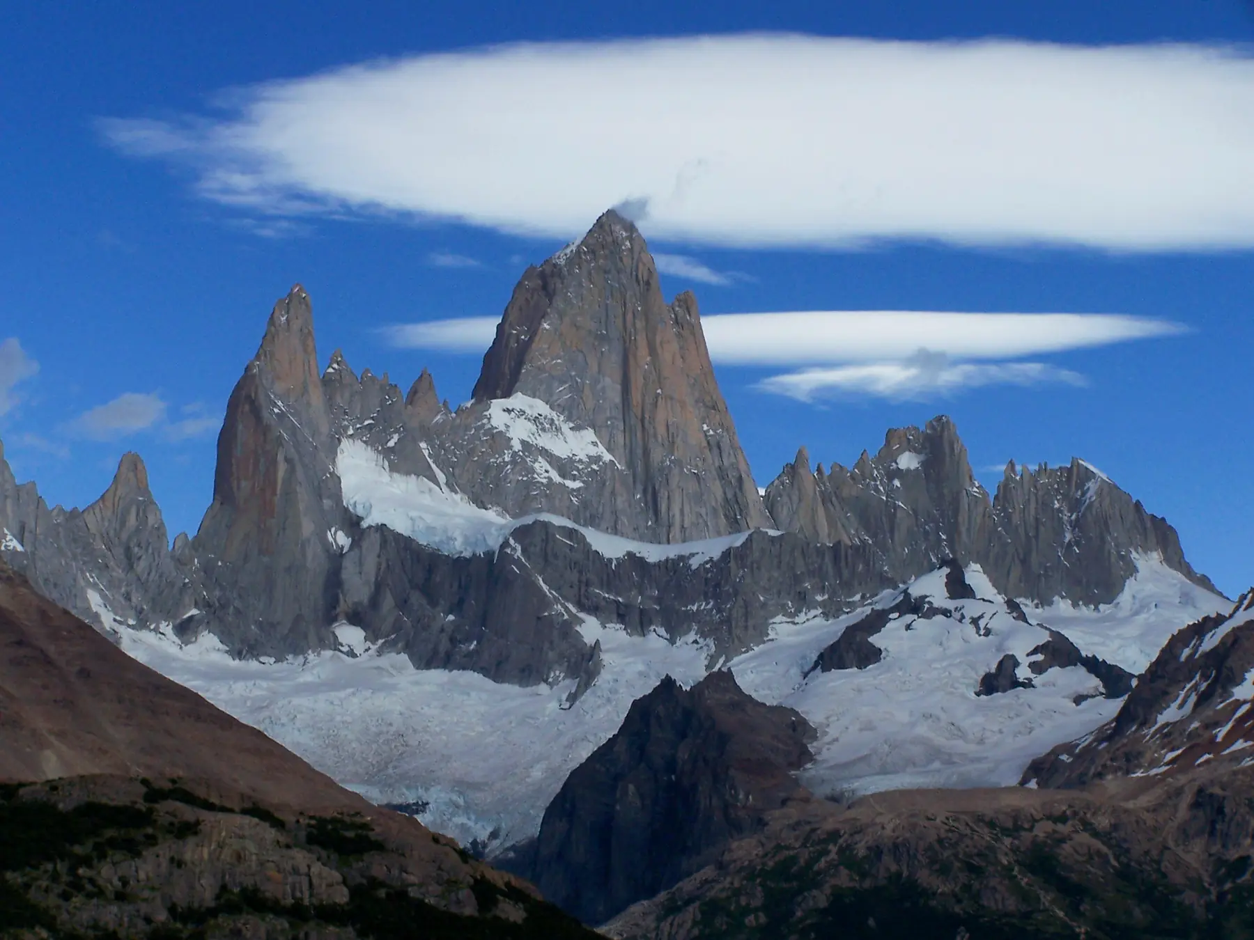
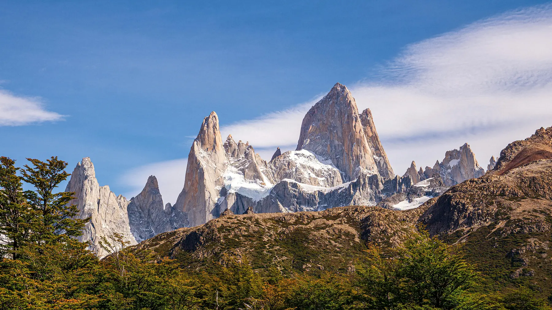
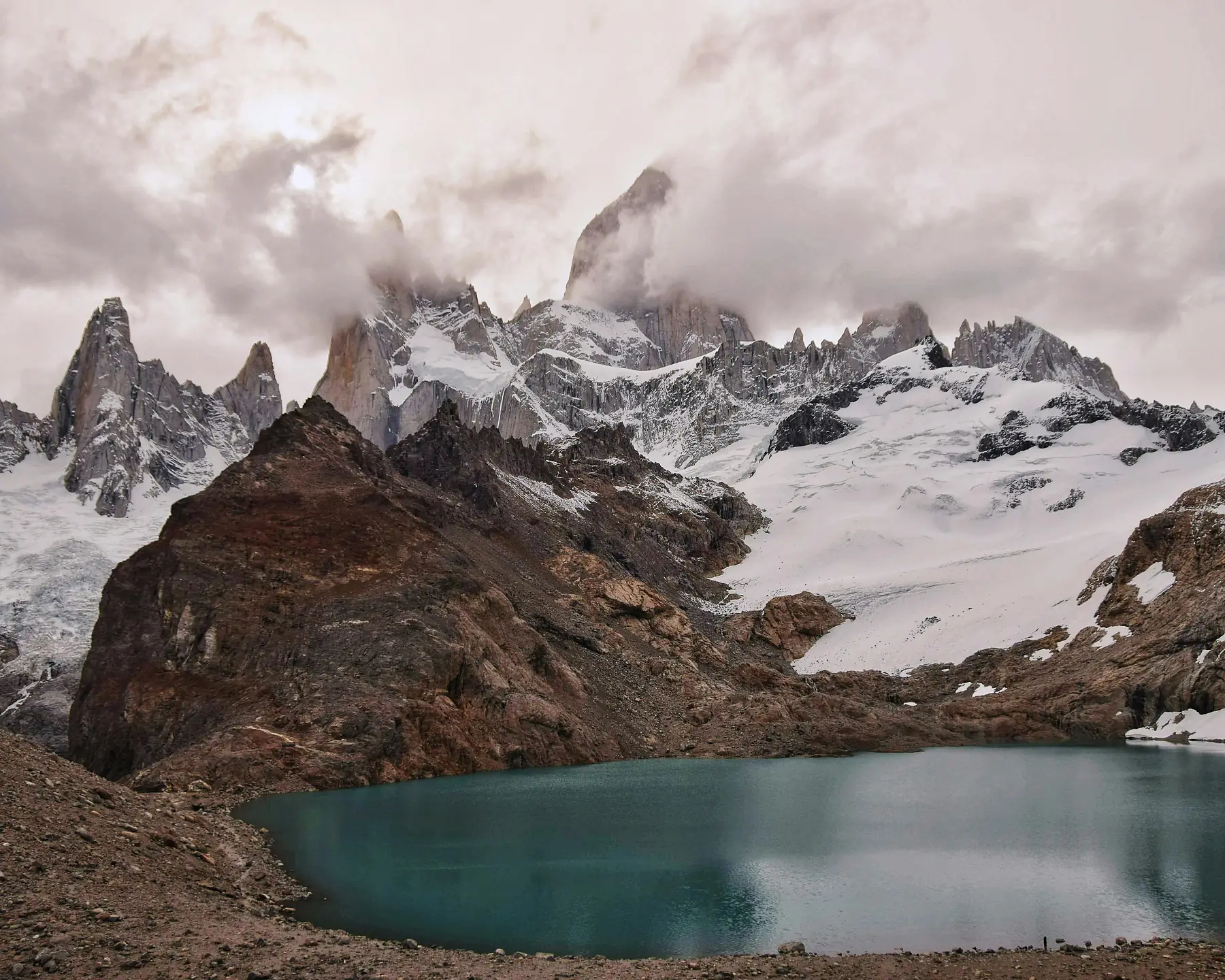
The hike to Laguna de los Tres is the definitive El Chaltén experience, culminating in a turquoise glacial lake sitting directly beneath the 1,500-meter vertical granite face of Mount Fitz Roy. It is the most popular trail in the park, and for good reason: the “Logo View” from the shore of the lake is one of the most recognizable mountain vistas on Earth.
Most hikers start directly from the northern end of town, but a more scenic alternative is to take a morning shuttle to the Río Eléctrico bridge (near Hostería El Pilar). This route allows you to hike a point-to-point trail that passes the Piedras Blancas glacier before joining the main path, saving you from repeating the same scenery on the return leg. Shuttles typically cost between $10 and $20 USD per person.
The final kilometer of the ascent to the lake is a steep scramble that gains 400 meters of elevation over rocky terrain. Trekking poles are highly recommended for the descent to save your knees from the repetitive impact.
While the lake itself is the main attraction, a short five-minute walk to the left of the shore reveals a spectacular overlook of Laguna Sucia, a deeper blue lake hanging hundreds of meters below.
To plan your ascent and see the specific route options from town or El Pilar, read our dedicated guide.
Laguna Torre: The Path of the Granite Spires
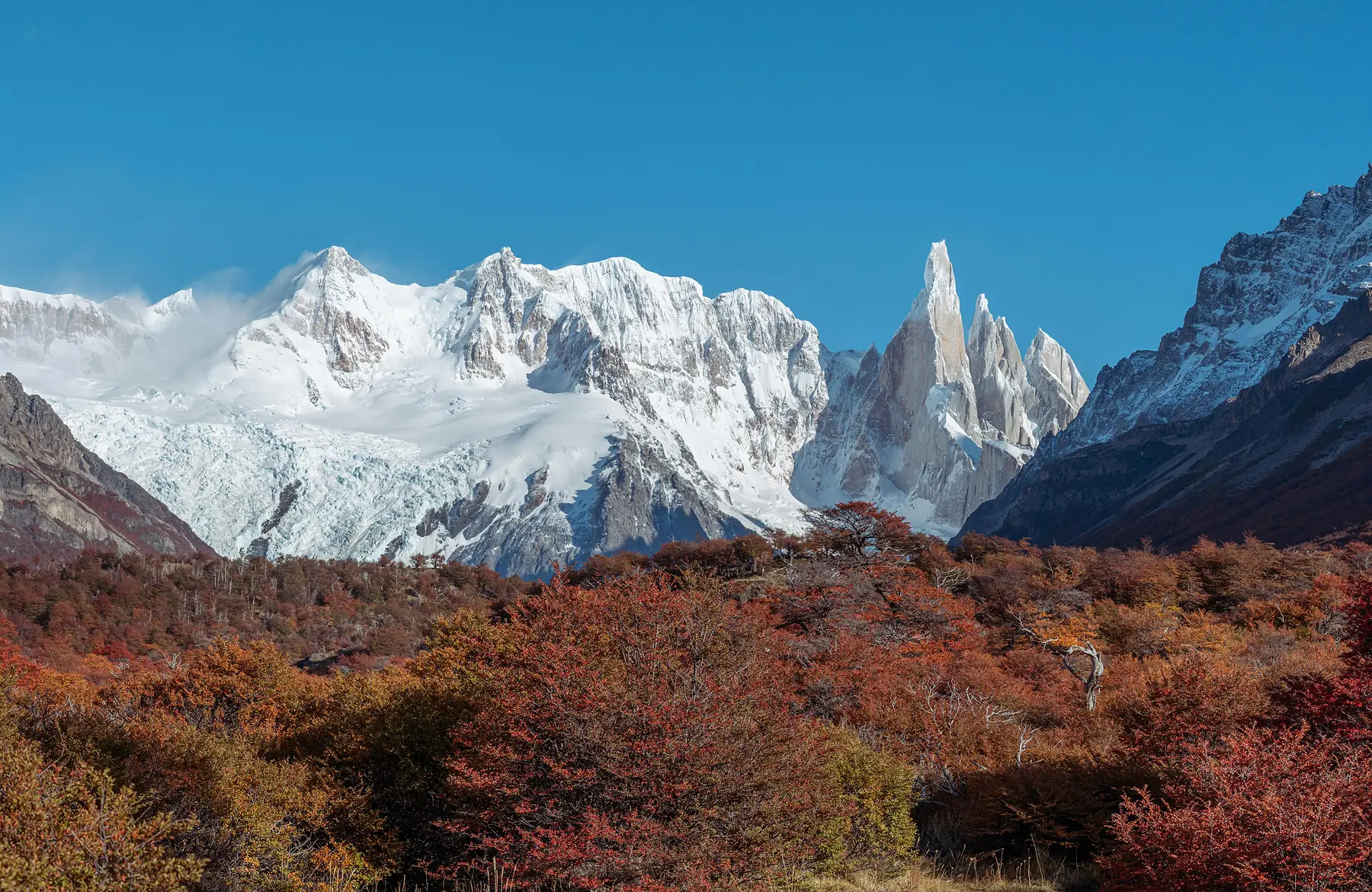
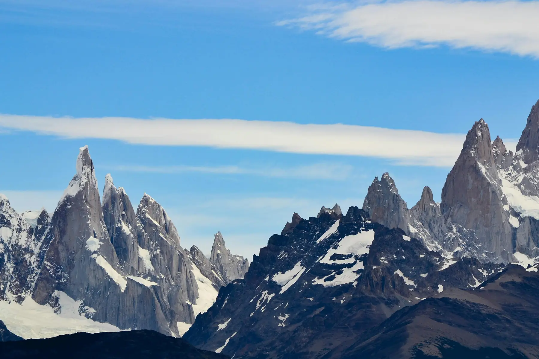
The Laguna Torre trail follows the Fitz Roy River valley toward the base of Cerro Torre, a mountain famous among climbers as one of the most difficult technical peaks in the world. This hike is the best choice for a “moderate” long day, as it lacks the punishing vertical gains found on the Fitz Roy trail while still delivering world-class scenery.
The highlights begin at Mirador Torre, about an hour into the hike, where you get your first glimpse of the needle-like granite spires. At the trail’s end, you reach a glacial lake often filled with floating icebergs that have calved from Glaciar Grande.
For those with extra energy, the trail continues for an additional 2 kilometers (one way) along the right-hand moraine to the Mirador Maestri. This extension provides a much closer look at the glacier and the technical climbing routes on Cerro Torre’s east face.
If you want to see the floating icebergs and explore the valley of the spires, check out our detailed trail guide.
Loma del Pliegue Tumbado: The Best Panorama in Patagonia
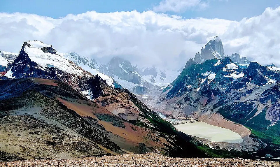
Loma del Pliegue Tumbado is the only trail in the area that climbs high enough to give you a 360-degree view of both the Fitz Roy and Cerro Torre massifs simultaneously. While most trails stay in the valleys looking up, this route takes you to a summit where you can look across the entire landscape of Los Glaciares National Park.
The terrain is a steady, uphill ramp through high-altitude meadows and lenga forests. As you emerge above the treeline, keep an eye on the sky; the thermals here are a favorite spot for Andean Condors to circle. The final section involves crossing an exposed alpine scree slope to reach the summit at approximately 1,500 meters.
This trail is highly exposed to the elements. If the forecast predicts winds exceeding 60-70 km/h, the summit can become dangerous and visibility will likely be zero. Always check the wind speed specifically for this elevation before departing.
For the most expansive view in the region, follow our guide to the summit of Loma del Pliegue Tumbado.
Easy & Short Hikes: Great for Arrival Days or Rest
Not every day in El Chaltén needs to be a 20-kilometer mission. Several shorter trails offer high rewards for minimal effort, making them perfect for your arrival day or as “active recovery” after a big trek.
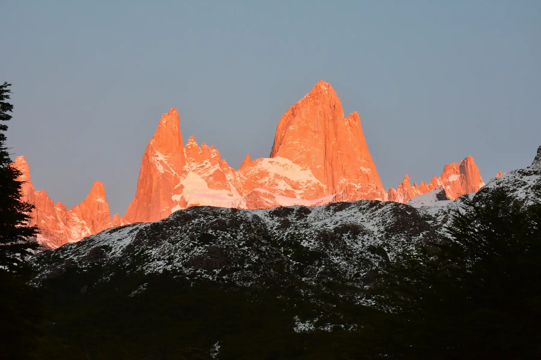
- Mirador Los Cóndores & Las Águilas: Starting from the National Park Visitor Center at the south end of town, this 20-minute walk leads to a panoramic overlook of the town and the mountains. It is the best spot in Chaltén for sunrise or sunset.
- Chorrillo del Salto: A flat, easy 3-kilometer walk from the end of Avenida San Martín leads to a 20-meter waterfall tucked into the forest. It is well-protected from the wind, making it a great option for bad weather days.
- Laguna Capri: If you want a taste of the Fitz Roy trek without the full 21-kilometer commitment, Laguna Capri is a beautiful wooded lake reached in about two hours. It offers a stunning view of the peaks across the water.
- Mirador Margarita: Located on the first section of the Laguna Torre trail, this overlook provides a view of both the Fitz Roy and Torre massifs and can be reached in about 45 minutes from town.
Once you have picked your trails, you can locate the specific trailheads using our interactive map.
Hidden Gems: Reserva Los Huemules (Private Reserve)
Located 17 kilometers north of El Chaltén along the road to Lago del Desierto, Reserva Los Huemules is a private nature reserve that offers a quieter alternative to the National Park. Because the reserve limits the number of daily visitors, the trails feel significantly more wild and pristine.
The reserve is one of the best places to spot the endangered Huemul deer, a shy Andean species that is rarely seen on the more crowded trails near town. The standout trek here is the path to Puesto Cagliero, which leads to a mountain hut overlooking the Cagliero Glacier.
Reserva Los Huemules Logistics
- Access: Requires a shuttle or taxi from El Chaltén (approx. 30-minute drive).
- Fees: As of the 2026/27 season, the entrance fee is approximately $30 USD (payable in ARS).
- Facilities: Visitor center with maps and a small café; well-maintained mountain huts.
- Crowds: Significantly lower than the National Park due to restricted entry.
Beyond Day Hiking: Multi-Day Circuits & Backpacking
For those who want to sleep under the stars, El Chaltén’s trail network is designed for easy overnight loops. You can combine the major day hikes into a multi-day “Chaltén Traverse” by staying at the free backcountry campsites managed by the National Park.
- The Chaltén Traverse: A 3-day loop that connects Laguna de los Tres and Laguna Torre. By camping at Campamento Poincenot and Campamento Agostini, you can see both massifs at sunrise without the long approach from town.
- The Huemul Circuit: This is a world-class, 4-day expedition for experienced trekkers. It involves Tyrolean traverses (using a harness to cross rivers on a cable) and offers unmatched views of the Southern Patagonia Ice Field.
To see how these routes compare to other famous treks in the region, explore our broader Patagonia guide.
Mountaineering Objectives for Hikers
If you are an experienced hiker looking for something more vertical, El Chaltén offers several “non-technical” peaks. These are not standard hiking trails; they involve significant scrambling and route-finding, but they do not require advanced rock climbing skills.
Cerro Madsen, located just above Laguna de los Tres, offers a dramatic perspective looking down on the lake and across the Fitz Roy massif. Cerro Eléctrico is another popular objective, providing views of the “back side” of the mountains and the vast ice fields beyond. For safety, these objectives should only be attempted with an IFMGA-certified guide unless you have significant alpine experience.
Essential Logistics for Hiking in El Chaltén
The trail system in El Chaltén is exceptionally well-maintained, but the environment is remote and the weather is volatile. Understanding the local logistics is key to a safe and successful trip.
Trailheads and Fees
Most trails start at either the North end of town (Avenida San Martín) for Fitz Roy or the South end (near the Visitor Center) for Laguna Torre and Los Cóndores. As of late 2024, an entrance fee has been implemented for the El Chaltén sector of Los Glaciares National Park. For the 2026/27 season, foreign visitors should expect to pay approximately $45,000 ARS (approx. $45 USD) for a day pass, with multi-day Flexipass options available online.
Registration
While registration at the Visitor Center (Centro de Informes) is no longer mandatory for standard day hikes like Laguna de los Tres or Laguna Torre, it remains compulsory for all “Remote Zone” treks, including the Huemul Circuit and mountaineering summits.
Water and Safety
The water in the mountain streams within Los Glaciares National Park is generally safe to drink without treatment. However, you should always take water from fast-moving sections and avoid sources downstream from established campsites like Poincenot.
The Wind Factor
In El Chaltén, the wind dictates the schedule. A day with 80 km/h winds might make the high-altitude Loma del Pliegue Tumbado impossible, but the forested valley walk to Chorrillo del Salto could still be perfectly pleasant.
Use forecasting tools to plan your week. If you see a “clear window” with low wind, prioritize Laguna de los Tres or Loma del Pliegue Tumbado immediately.
For a deep dive into reading local forecasts and understanding how the wind affects specific trails, see our weather guide.
FAQ
Is hiking in El Chaltén free? No. Starting in the 2024/25 season, Los Glaciares National Park began charging an entrance fee for the El Chaltén sector. As of the 2026/27 season, the fee for foreign adults is approximately $45,000 ARS.
What is the best hike in El Chaltén for beginners? The hike to Mirador Los Cóndores or Chorrillo del Salto are the best beginner-friendly options, offering great views with minimal elevation gain.
Can you see Mount Fitz Roy without a long hike? Yes, you can see the peaks of Mount Fitz Roy from several points in the El Chaltén townsite or by taking the short, 20-minute walk to Mirador Los Cóndores.
Do I need a guide for hiking in El Chaltén? Most day hikes in El Chaltén are extremely well-marked and do not require a guide, though a guide is mandatory for the technical Huemul Circuit and recommended for mountaineering summits.
Is the water in El Chaltén safe to drink? The water from the mountain streams along the El Chaltén hiking trails is generally considered some of the purest in the world and safe to drink without treatment.
When is the best time for hiking in El Chaltén? The prime hiking season in El Chaltén runs from November to March, with late March offering spectacular fall colors and calmer winds.