Ruta 40 (RN40) in Patagonia is Argentina’s most iconic highway, a 2,700-kilometer ribbon of asphalt and gravel that connects the lush northern Lake District to the rugged southern tip of the continent. For travelers in 2026, it remains the definitive overland route for experiencing the vastness of the Patagonian steppe and accessing the granite spires of the Andes.
Often called the “Route 66 of Argentina,” this southern stretch of RN40 is more than just a transit corridor; it is a test of preparation and a front-row seat to some of the most dramatic landscapes on Earth. While much of the road is now paved, the legendary “ripio” (gravel) sections and the relentless Atlantic winds ensure that driving here remains a true adventure rather than a simple commute.
Ruta 40 at a Glance
- Total Patagonian Length: Approximately 2,700 km from Neuquén to Cabo Vírgenes.
- Road Surface: Over 97 percent paved, with one critical gravel gap remaining in Santa Cruz province.
- Best Travel Window: October to April (Southern Spring and Summer).
- Key Hubs: Bariloche, Perito Moreno (town), El Chaltén, and El Calafate.
- Primary Hazard: High-speed gravel driving and extreme crosswinds.
What is Ruta 40? An Overview of the Patagonian Stretch
Ruta 40 is one of the longest roads in the world, spanning over 5,000 kilometers from the Bolivian border in the north to the edge of the Atlantic in the south. However, it is the Patagonian section that has earned the road its legendary status among overlanders.
This stretch begins as you move south from Neuquén into the Lake District, where the arid high desert gives way to deep blue glacial lakes and ancient forests. As you continue south, the landscape undergoes a dramatic transition. The trees disappear, replaced by the yellow coirón grass of the Atlantic steppe, a landscape defined by its immense scale and the visible curve of the horizon.
The Patagonian RN40 is iconic because it offers a sense of solitude that is increasingly rare. You can drive for hours without seeing another vehicle, passing only the occasional gaucho on horseback or a lonely estancia gate. It provides the essential link between UNESCO World Heritage sites, from the ancient rock art of Cueva de las Manos to the towering peaks of the Los Glaciares National Park.
To help visualise the sheer scale of this journey, it is helpful to view the route in the context of the wider region.
To see how this highway bisects the continent, view our Patagonia Map.
Road Conditions: Pavement vs. Ripio in 2026
The most common question regarding Ruta 40 is whether it is fully paved. As of the 2026/27 season, the answer is almost, but not quite. While the vast majority of the road from Bariloche to El Calafate is now smooth asphalt, a notorious section of “ripio” remains a rite of passage for every traveler.
The primary gravel gap exists in southern Santa Cruz, specifically the 72-kilometer stretch between Gobernador Gregores and Tres Lagos (specifically between the junction with RP 29 and Tres Lagos). While crews are frequently working on these sections, the harsh winters often stall paving progress.
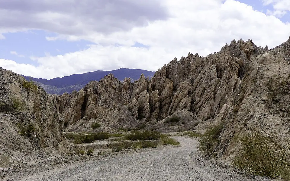
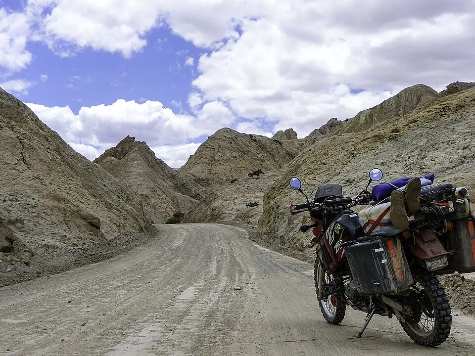
Driving on ripio requires a fundamental shift in technique. The surface consists of loose, often sharp volcanic stones. If you drive too fast, the car will “float” on top of the stones, leading to a loss of steering control. You should maintain a maximum speed of 60 km/h on these sections, and always slow down further when a vehicle approaches from the opposite direction to prevent flying stones from cracking your windshield.
Do not underestimate the Patagonian wind, known locally as the “escoba de Dios” (God’s broom). Sustained winds of 80-100 km/h are common. In a high-profile vehicle like a campervan, these crosswinds can physically push you into the opposite lane or off the road entirely. Always keep two hands on the wheel.
Vehicle Selection and Rental Tips
Choosing the right vehicle is the difference between a comfortable journey and a stressful one. While you will see locals driving standard sedans on every section of the road, a rental car requires more consideration due to insurance and comfort.
For most travelers, a high-clearance 2WD vehicle (such as a compact SUV) is the “sweet spot.” You don’t necessarily need the complex gears of a 4x4, but you do need the extra space between the road and your oil pan to navigate the deep ruts that can form in the gravel sections.
- Cost: Lower rental and fuel costs vs. Higher daily rate.
- Comfort: Rough on gravel sections; high vibration vs. Much smoother handling of potholes and ripio.
- Safety: Higher risk of undercarriage damage vs. Better visibility and protection from stones.
- Capability: Limited to the main highway vs. Allows for detours into remote national parks.
The SUV is the superior choice for comfort and safety on the gravel gaps.
When renting a vehicle, you must be explicit about your plans. If you intend to cross into Chile to drive the Carretera Austral, you must request a “permiso de salida” (notarized authorization) at least 72 hours in advance. This is a document that allows the car to leave Argentina. Without it, you will be turned back at the border. Additionally, ensure your insurance specifically covers windshield (parabrisas) and tire damage, as these are the most common claims on Ruta 40.
The Best Sections of Ruta 40 in Patagonia
If you do not have the three weeks required to drive the entire Patagonian stretch, you should focus your time on these high-impact segments.
The Seven Lakes Road (Ruta de los Siete Lagos)
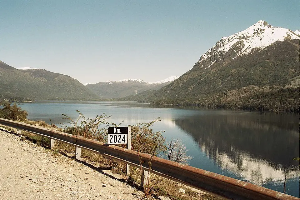
This 107-kilometer stretch between Villa La Angostura and San Martín de los Andes is arguably the most beautiful paved road in Argentina. It winds through temperate rainforests, passing seven distinct glacial lakes, each with a different hue of blue or emerald. It is the perfect, gentle introduction to the route before the landscape opens up into the steppe.
The Central Steppe: Perito Moreno to Bajo Caracoles
This is the “lonely” Ruta 40. South of the town of Perito Moreno, the road straightens into infinity. This section offers the most profound sense of isolation and is the best area for spotting local wildlife from the car. The tiny settlement of Bajo Caracoles, with its single fuel pump and dusty general store, feels like a frontier outpost from a different century.
The Approach to El Chaltén
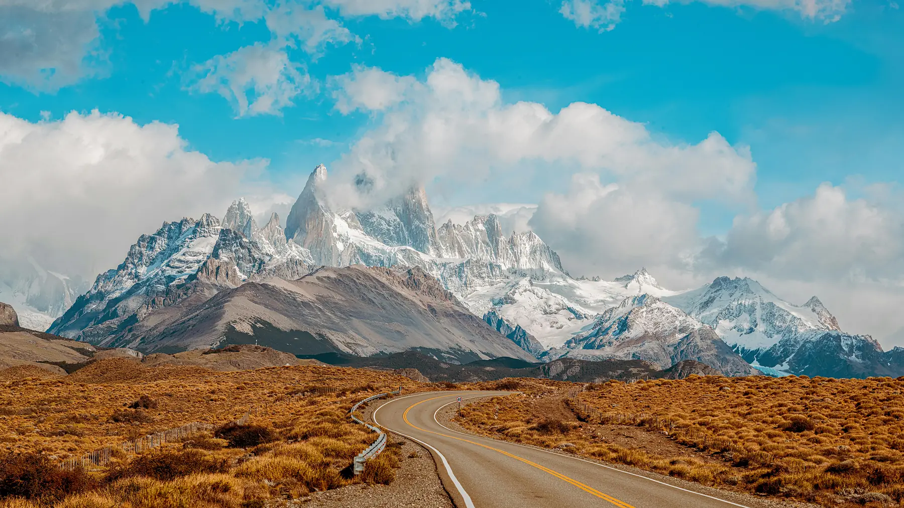
As you head south toward the Viedma Glacier, the skyline is dominated by the Fitz Roy massif. On a clear day, the granite spires are visible from over 100 kilometers away. The final turn-off toward El Chaltén provides one of the most photographed views in the world: a perfectly straight road pointing directly at the heart of the mountains.
The Southern End: Cabo Vírgenes
For those who want to finish the journey properly, the road ends at Cabo Vírgenes. This is the “Kilometre 0” point of Ruta 40. It is a windswept lighthouse at the entrance to the Strait of Magellan, home to a massive colony of Magellanic penguins and the profound feeling of having reached the end of the world.
Essential Logistics: Fuel, Cash, and Connectivity
The remote nature of the southern steppe means that logistical errors have real consequences. In 2026, while infrastructure is improving, you should still operate with a “frontier mindset.”
The “Full Tank” Rule
Fuel stations in the central steppe can be over 300 kilometers apart. More importantly, stations in remote towns like Bajo Caracoles or Tres Lagos occasionally run out of fuel while waiting for a tanker truck. You should stop at every YPF or Axion station you see and refill, even if your tank is still half-full. The stretch between Bajo Caracoles and Gobernador Gregores is particularly critical; never bypass a pump here.
Download the “YPF” app or use “Fuel Map Argentina” before you leave. While signal is poor on the road, these apps can show you the location of official stations and, occasionally, user-reported updates on fuel availability.
The Cash Crisis
While major hubs like Bariloche and El Calafate accept international credit cards and digital payments (like Mercado Pago), remote fuel stations often demand cash. ATMs in small towns like Rio Mayo or Perito Moreno frequently run out of bills or reject international cards. Always carry enough Argentine Pesos in cash to cover at least two full tanks of fuel and a night of emergency accommodation.
Digital Connectivity
Expect zero mobile signal for 90 percent of the drive between major towns. Your phone’s GPS will work, but Google Maps will not load new data. You must download offline maps via Google Maps, or better yet, use dedicated offline apps like Maps.me or Gaia GPS.
Key Stops and Must-See Detours
While the road itself is the attraction, several waypoints are essential for understanding the history and soul of Patagonia.
- Cueva de las Manos: A 45-minute detour (approx. 45km on RP 97) from RN40 near Bajo Caracoles leads to this UNESCO site. The canyon walls are covered in stencilled handprints and hunting scenes dating back 9,000 years. It is one of the most significant archaeological sites in South America.
- Los Alerces National Park: Located near Esquel, this park protects ancient Alerce trees, some of which are over 2,000 years old. It offers a lush, forested alternative to the dry steppe of the main highway.
- Perito Moreno National Park: Not to be confused with the glacier or the town, this is one of Argentina’s most remote national parks. Accessed via a long gravel road (RP 37) from RN40, it offers turquoise lakes and absolute solitude for those with a 4x4 and extra fuel.
- Estancia Stays: To truly experience the steppe, book a night at a working sheep farm (estancia). Places like Estancia La Angostura or Estancia Cuevas de las Manos offer a glimpse into the “Gaucho” lifestyle and serve the best lamb (cordero) you will ever taste.
Wildlife and Nature Along the Steppe
The Patagonian steppe is far from empty. As you drive, you are moving through a massive biological corridor. Because the road is unfenced in many sections, wildlife is a constant presence and a primary safety concern.
The “Big Three” you will see are Guanacos (wild relatives of the llama), Choiques (Darwin’s Rhea, a flightless bird), and the occasional Armadillo scurrying across the asphalt. Guanacos are the most dangerous; they are incredibly athletic but unpredictable, often jumping across the road at the last second.
If you see one guanaco near the road, assume there are ten more you can’t see. They travel in family groups. Slow down immediately until you are well past the group.
For a full guide on the animals you’ll encounter, see our Patagonia Wildlife Guide.
Driving at night is highly discouraged. The risk of hitting a 150kg guanaco is significantly higher after dusk, and the lack of visibility makes it impossible to spot deep potholes or “sand drifts” on the gravel sections.
Connecting Ruta 40 to the Carretera Austral
Many travelers choose to combine the open vistas of Ruta 40 with the fjords and glaciers of Chile’s Carretera Austral. This creates one of the world’s great “loop” road trips.
The most common connection point is via Los Antiguos. You leave Ruta 40 at Perito Moreno, drive to the border at Los Antiguos, and cross into Chile Chico. From there, you can take a ferry across Lago General Carrera to reach the heart of the Carretera Austral.
For the more adventurous, Paso Roballos is a remote mountain pass that connects the two roads through the Patagonia National Park. This route is almost entirely gravel and requires a sturdy vehicle and self-sufficiency, but it offers some of the most spectacular, untouched scenery in the Andes.
If you are planning to cross the border, use this checklist:
- Permiso de Salida: Notarized rental car authorization.
- SAG Forms: Chilean agricultural declarations (no fresh fruit, honey, or meat allowed into Chile).
- Insurance: Verification that your “Seguro” (specifically the Mercosur extension) is valid in both Argentina and Chile.
To turn this logistical knowledge into a day-by-day plan, see our 12-Day Ruta 40 Road Trip itinerary, which drives the whole highway from Bariloche to El Calafate via Los Alerces and Cueva de las Manos.
FAQ
Is the Ruta 40 in Patagonia fully paved?
As of the 2026/27 season, over 97% of Ruta 40 in Patagonia is paved, but a significant 72km gravel (ripio) section remains between Gobernador Gregores and Tres Lagos.
Do I need a 4x4 to drive Ruta 40 in Patagonia?
A 4x4 is not strictly necessary for the main Ruta 40, as high-clearance 2WD vehicles can handle the gravel sections if driven slowly, though a 4x4 offers more comfort and security.
Are there enough fuel stations on Ruta 40 in Patagonia?
Fuel stations are sparse in the central Patagonian steppe; you should follow the “half-tank rule” and refill at every opportunity in towns like Perito Moreno, Bajo Caracoles, and Gobernador Gregores.
Is it safe to drive Ruta 40 in Patagonia at night?
Driving Ruta 40 at night is highly discouraged due to the extreme risk of hitting wildlife, such as guanacos, and the lack of visibility for deep potholes or gravel drifts.
Can I take a rental car from Ruta 40 in Argentina into Chile?
Yes, but you must arrange a specific notarized permit (permiso de salida) with your rental agency at least 72 hours in advance and ensure your insurance covers both countries.
What is the best time of year to drive Ruta 40 in Patagonia?
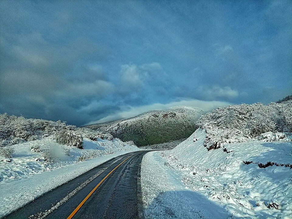
The best window is between October and April; outside of these months, snow can close the mountain passes and many remote estancias and service stations shut down for the winter.