
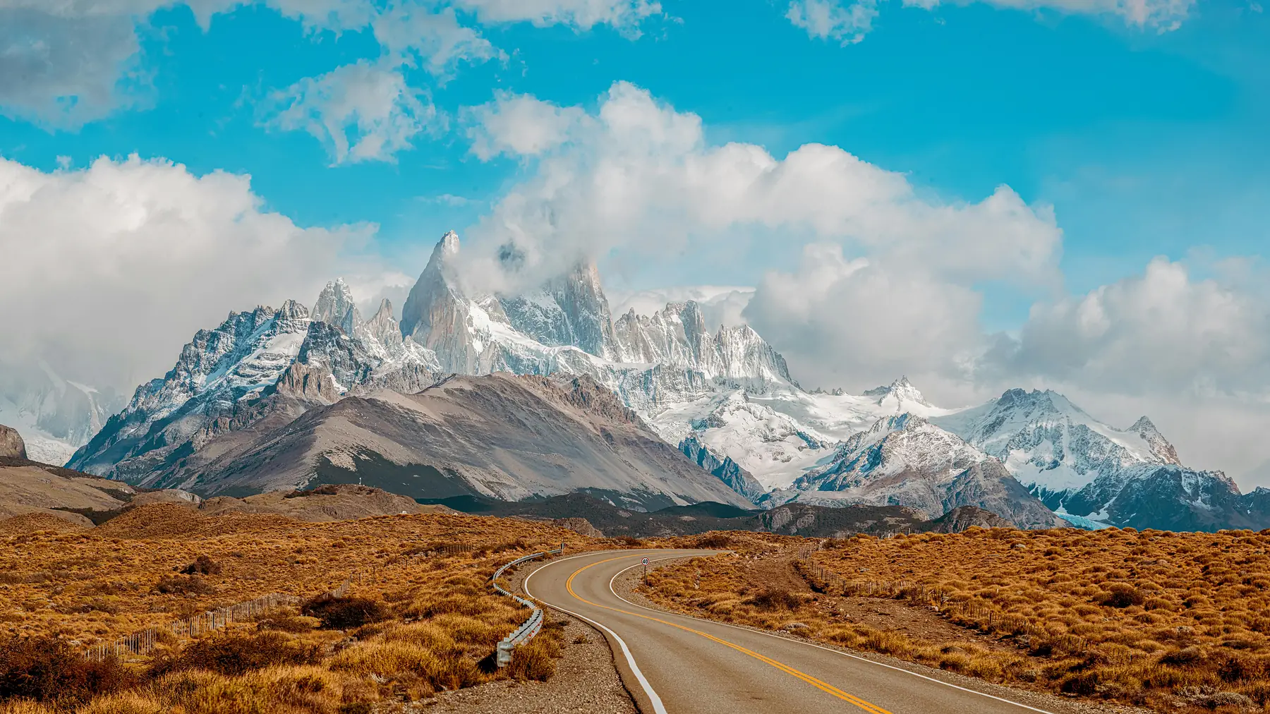
Ruta 40 is Argentina’s Route 66, a 5,000-kilometre national obsession running the length of the country along the spine of the Andes. Its Patagonian stretch, from the Lake District down to the ice fields, is the section every road-tripper dreams about: a two-lane ribbon across an ocean of steppe where guanacos outnumber cars and the next fuel pump is a topic of genuine conversation.
This twelve-day itinerary drives Ruta 40 southbound from Bariloche to El Calafate, and its heart is the part most visitors fly straight over: the UNESCO-listed alerce forests of Los Alerces National Park, the 9,000-year-old handprints of Cueva de las Manos, and the vast, humbling emptiness in between. It finishes on a high with the big two of Argentine Patagonia, the Fitz Roy trails of El Chaltén and the Perito Moreno Glacier.
If you simply want to link Bariloche and El Chaltén as efficiently as possible, our 14-day Bariloche to El Chaltén itinerary does it by air and bus with more trail time. This route is for travellers who believe the road itself is the destination, and who want to earn the granite skyline of Fitz Roy by watching it rise from the steppe through the windscreen.
Itinerary At-A-Glance
- Total Duration: 12 days (11 nights on the ground)
- Start/End Point: Bariloche (BRC) to El Calafate (FTE), Argentina
- Country: Argentina only (no border crossings)
- Focus: Self-drive road trip, steppe landscapes, rock art, alpine day hikes, glaciers
- Best Months: November to March (long daylight for the big driving days)
- Estimated Budget: $2,200 to $4,000 USD per person, excluding international flights
- Fitness Level Required: Moderate. Two optional big hiking days (up to 25 km); otherwise driving and short walks
- Vehicle: One-way rental, Bariloche to El Calafate (book months ahead); ~1,600 km total driving
Route Overview and Logistics
Ruta 40 has been transformed over the past two decades: the Bariloche-to-El Calafate stretch is now almost entirely paved, which is precisely why this trip is possible in twelve relaxed days rather than three bruising weeks. The planning battles are the vehicle, the fuel, and the wind.
The One-Way Rental Problem
One-way rentals from Bariloche to El Calafate are the scarcest resource on this route. Only a handful of agencies permit them, drop-off fees are substantial (often $300 to $600 USD), and summer inventory disappears months out. Book the car before you book anything else, and confirm the drop-off fee, unlimited mileage, and gravel-road cover in writing; our car rental guide explains what to check. A standard car handles the paved highway fine, but choose something with reasonable clearance for the gravel access roads to Cueva de las Manos and any roadwork diversions.
Treat fuel as a planning item, not an errand. South of Esquel, reliable YPF stations sit at Río Mayo, Perito Moreno, Bajo Caracoles (a single, occasionally dry pump), Gobernador Gregores, and Tres Lagos, and some of those close overnight or run out after holiday weekends. Fill the tank at every station regardless of the gauge, carry cash because card terminals fail, and consider a jerrycan for peace of mind on the Bajo Caracoles-to-Tres-Lagos leg.
Wind, Distances, and Daily Rhythm
The Patagonian westerlies are not a detail here. They are a daily force that rocks the car, doubles the effort of every fuel stop, and has ripped more than one rental door off its hinges. Always park nose into the wind and hold the door with both hands when opening it. Distances between towns are honest: two days of this itinerary exceed 400 kilometres, so start those days early, treat 90 km/h as a good average, and never plan to arrive after dark, because guanacos on the tarmac at dusk are the route’s most genuine hazard.
Download offline maps for the whole route before leaving Bariloche and top up a cash reserve in pesos; between Esquel and El Chaltén you will pass exactly two ATMs, both temperamental. Mobile signal vanishes for two-to-three-hour stretches on the middle section, which is precisely what you came for.
Day 1: Collect the Car and Circle the Lake in Bariloche
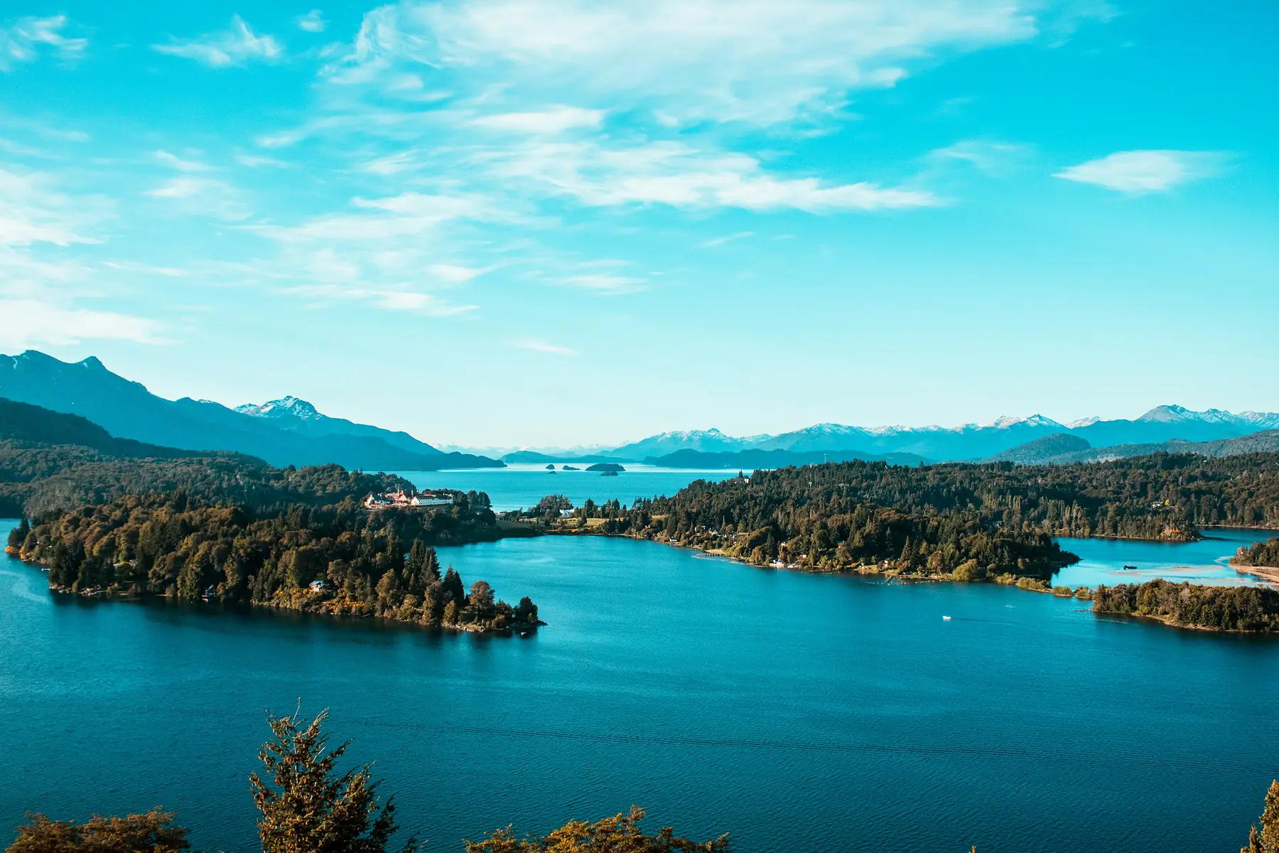
Fly into Bariloche and collect your rental. Before pointing south, spend the afternoon on the Circuito Chico, the classic 60-kilometre loop west of town around the Llao Llao peninsula. It is a gentle first day of driving with constant reward: viewpoints over Lago Nahuel Huapi’s island-studded blue, the chocolate-box Llao Llao Hotel, and a late-afternoon chairlift (or 30-minute walk) up Cerro Campanario, whose summit panorama regularly makes lists of the best views in South America.
Back in town, do the big shop for road snacks, water, and breakfast supplies, and withdraw plenty of cash. Bariloche’s supermarkets are the best you will see until El Calafate on Day 10.
Day 2: Bariloche to Esquel via El Bolsón
Today Ruta 40 begins in earnest. The first 120 kilometres south to El Bolsón are a scenic warm-up, winding between forested ridges with the white wall of the Andes on your right. El Bolsón earned its reputation as Argentina’s hippie capital in the 1970s and still runs on craft beer, berry farms, and its famous artisan market on Plaza Pagano. The market is busiest on Tuesdays, Thursdays, and Saturdays, so time your lunch stop accordingly and eat your way through the waffle and empanada stalls.
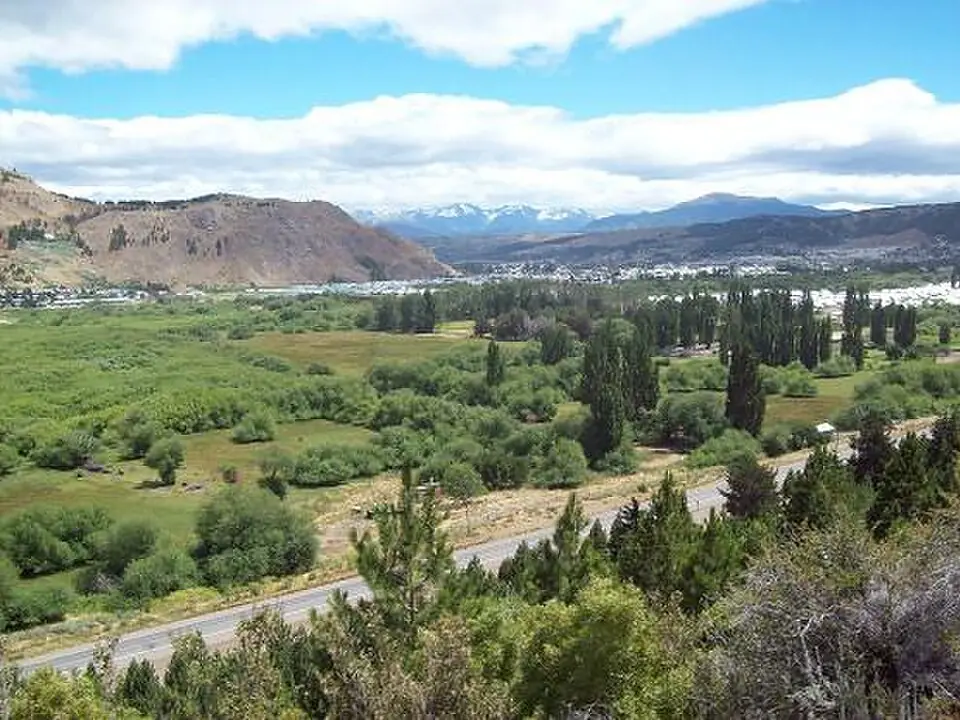
Continue south past Lago Puelo and through ranch country to Esquel, a no-nonsense mountain town of around 40,000 that makes the perfect base for tomorrow’s park day. Rail enthusiasts should check the timetable for La Trochita, the narrow-gauge steam train made famous by Paul Theroux’s The Old Patagonian Express, which still puffs out of Esquel on scheduled tourist runs.
Day 3: The Ancient Forest of Los Alerces National Park
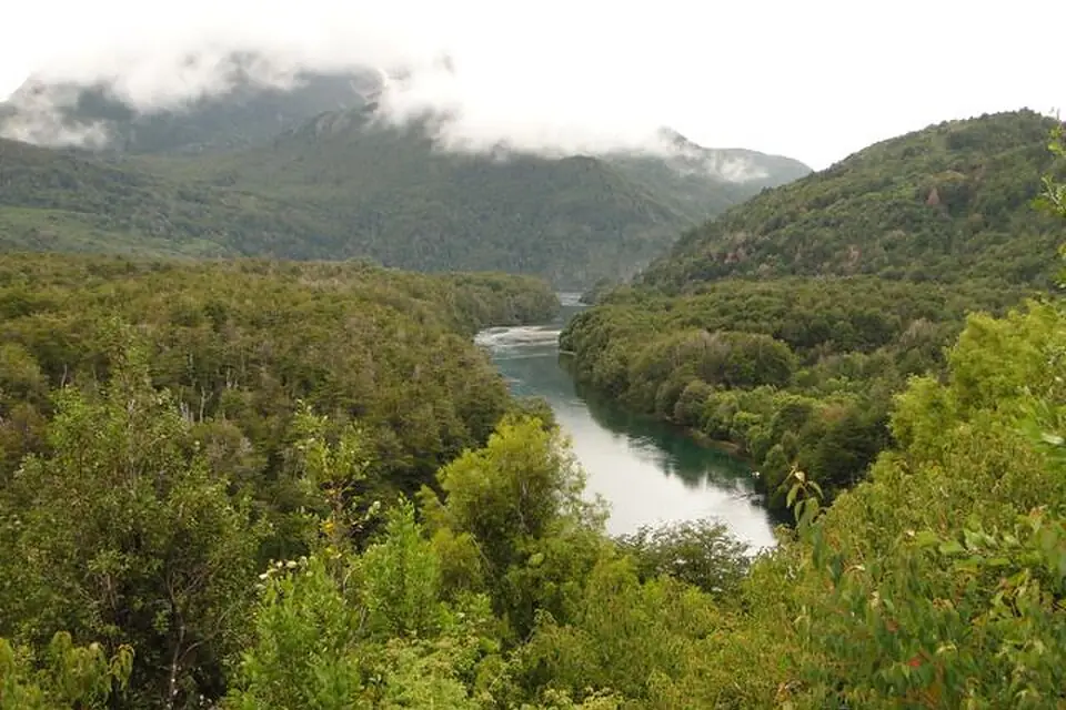
Give the whole day to Los Alerces National Park, a 45-minute drive west of Esquel and a UNESCO World Heritage site since 2017. The park protects one of the last great stands of alerce, the Patagonian cypress and among the longest-lived trees on earth, spread around a chain of interconnected lakes so still they mirror the peaks on a calm morning.
Drive the gravel park road along Lago Futalaufquen and Lago Verde, walking the short trails from the roadside: the Pasarela suspension bridge over the Río Arrayanes and the lakeshore loop beyond it are the essentials. If you secured a place on the lake excursion across Lago Menéndez (book ahead in high season through the park’s licensed operator), it lands you at El Abuelo, “the grandfather”, an alerce more than 2,600 years old. Return to Esquel for a second night.
The park road is slow, dusty gravel, and the best light on the lakes is early. Enter at opening time with a packed lunch rather than planning on park services; facilities inside are limited to a couple of seasonal kiosks and campsites.
Day 4: The Long Steppe Day, Esquel to Perito Moreno
This is the day that separates Ruta 40 romantics from everyone else: roughly 500 kilometres south to the town of Perito Moreno, almost all of it across open steppe. The mountains fall away, the horizon flattens to 360 degrees, and the traffic thins to a vehicle every ten minutes. Fill the tank in Esquel, again at Río Mayo, and settle into the rhythm of guanacos posing on ridgelines, rheas sprinting alongside the car, and dust devils spinning across the pampa.
Perito Moreno town (population 5,000, and no relation to either the glacier or the national park, since Francisco “Perito” Moreno lent his name to half of Patagonia) is a functional overnight stop: fuel, a supermarket, simple hotels. Its job is to position you an hour from tomorrow’s highlight.
Do not confuse your Perito Morenos. Tonight’s stop is Perito Moreno, a steppe town in Santa Cruz province. Perito Moreno National Park is a remote wilderness park 200 kilometres further south (optional on Day 6), and the Perito Moreno Glacier, the one on the postcards, is near El Calafate, which you reach on Day 10.
Day 5: Cueva de las Manos, Hands Across Nine Millennia
An hour south of town, a gravel side road drops off the steppe into the canyon of the Río Pinturas, where a rock overhang shelters one of the most moving artworks in the Americas: the Cueva de las Manos, a UNESCO World Heritage panel of nearly a thousand stencilled handprints, hunting scenes, and guanaco herds, the oldest painted around 9,000 years ago. Visits run as guided tours on the hour from the interpretation centre. The negative handprints, made by blowing mineral pigment over an outstretched hand, connect across the millennia in a way no photograph prepares you for.
Take the canyon rim walk if the wind allows, then rejoin Ruta 40 south to Bajo Caracoles, a crossroads hamlet whose lone fuel pump is a genuine Ruta 40 institution. Fill up whatever the gauge says. Overnight either at the basic hotel here or, far better, at one of the working estancias signposted off this stretch of the 40, where dinner is lamb from the property and the silence at night is total. Book estancia stays at least a few weeks ahead in season.
Day 6: The Empty Quarter from Bajo Caracoles to Tres Lagos
Today covers the loneliest, most hypnotic leg of the route: some 330 kilometres from Bajo Caracoles to Tres Lagos with essentially no services between. Committed wilderness lovers can detour west at Las Horquetas to Perito Moreno National Park, 90 kilometres of rough gravel each way to a free, staggeringly remote park of turquoise lakes and huemul deer that receives fewer visitors in a year than Torres del Paine sees in a day. It deserves a full day and self-sufficiency (there is no fuel, food, or phone signal); with a 4x4 and supplies, it is one of Patagonia’s great secrets. Everyone else should enjoy the drive south, break at Gobernador Gregores for fuel and lunch (a short detour east, and worth it for the fuel margin), and sleep at Tres Lagos or push the extra stretch toward Lago del Desierto country.
Day 7: The Approach from Tres Lagos to El Chaltén
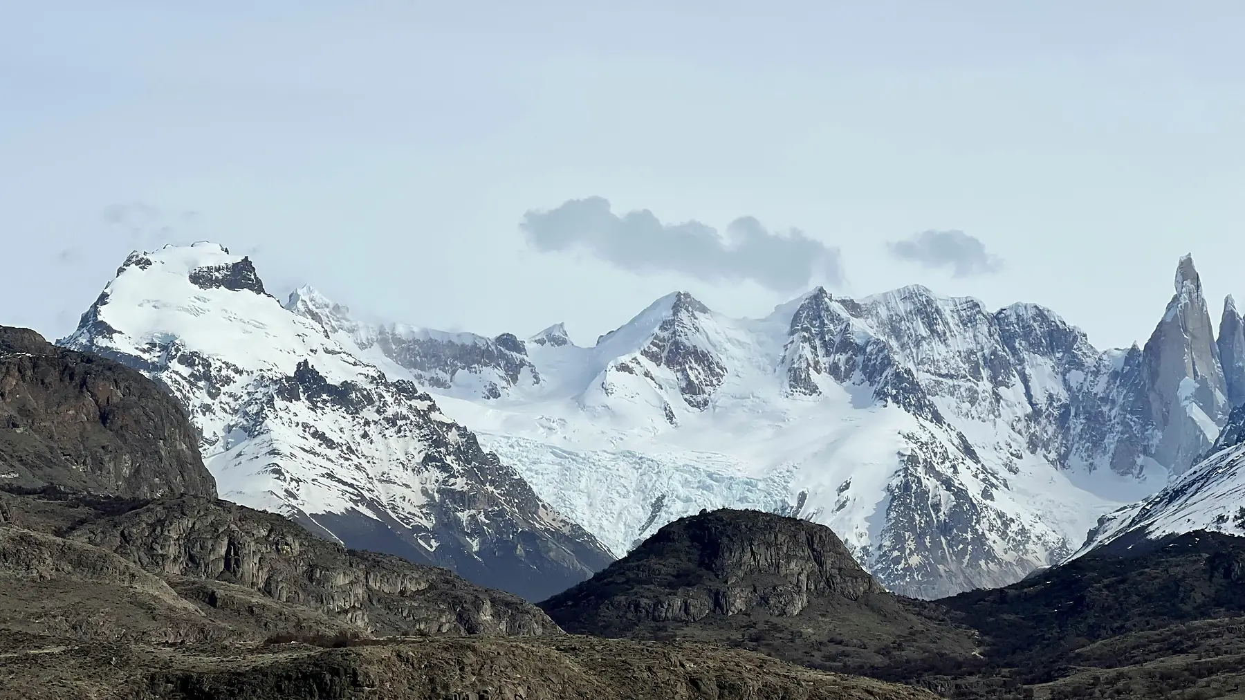
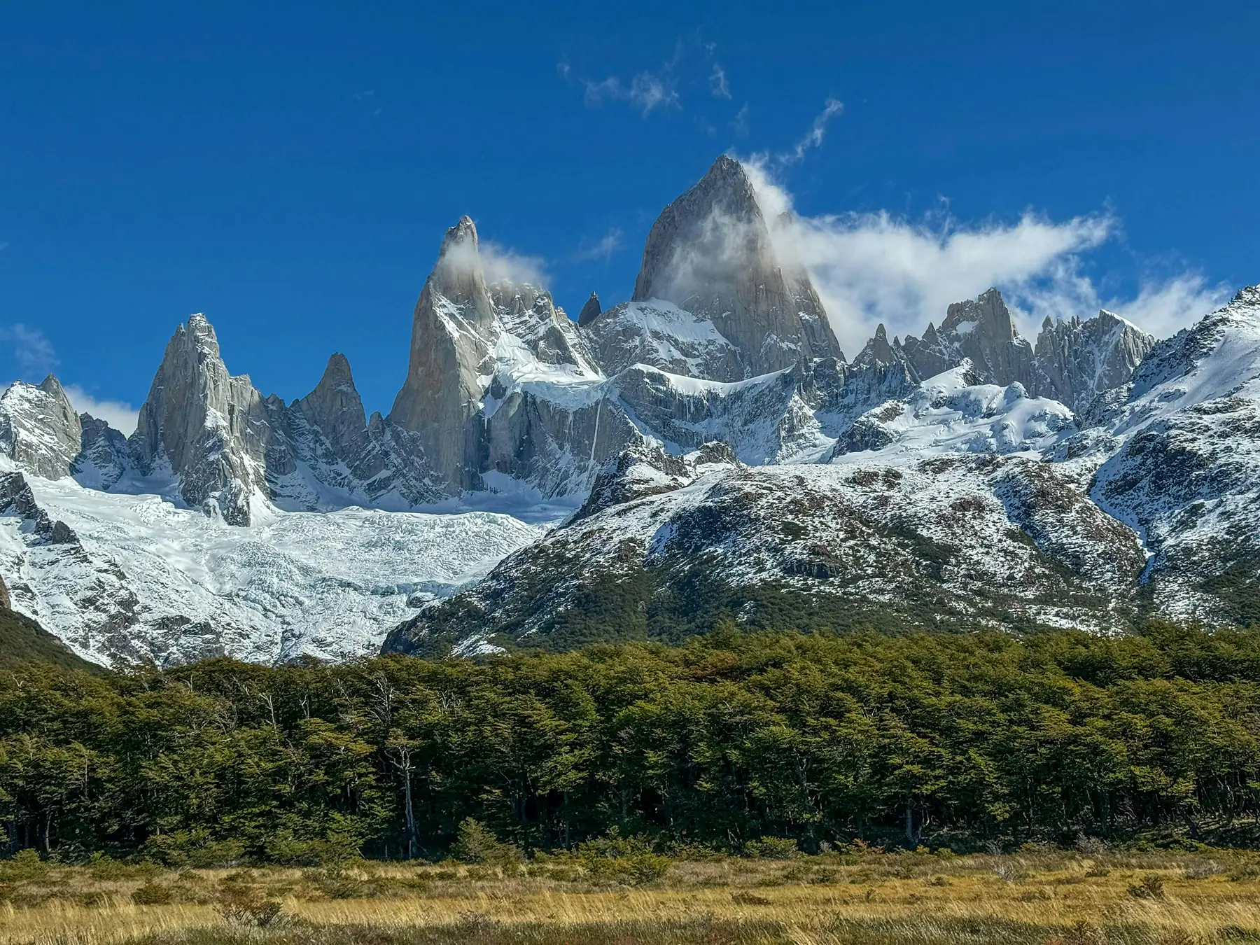
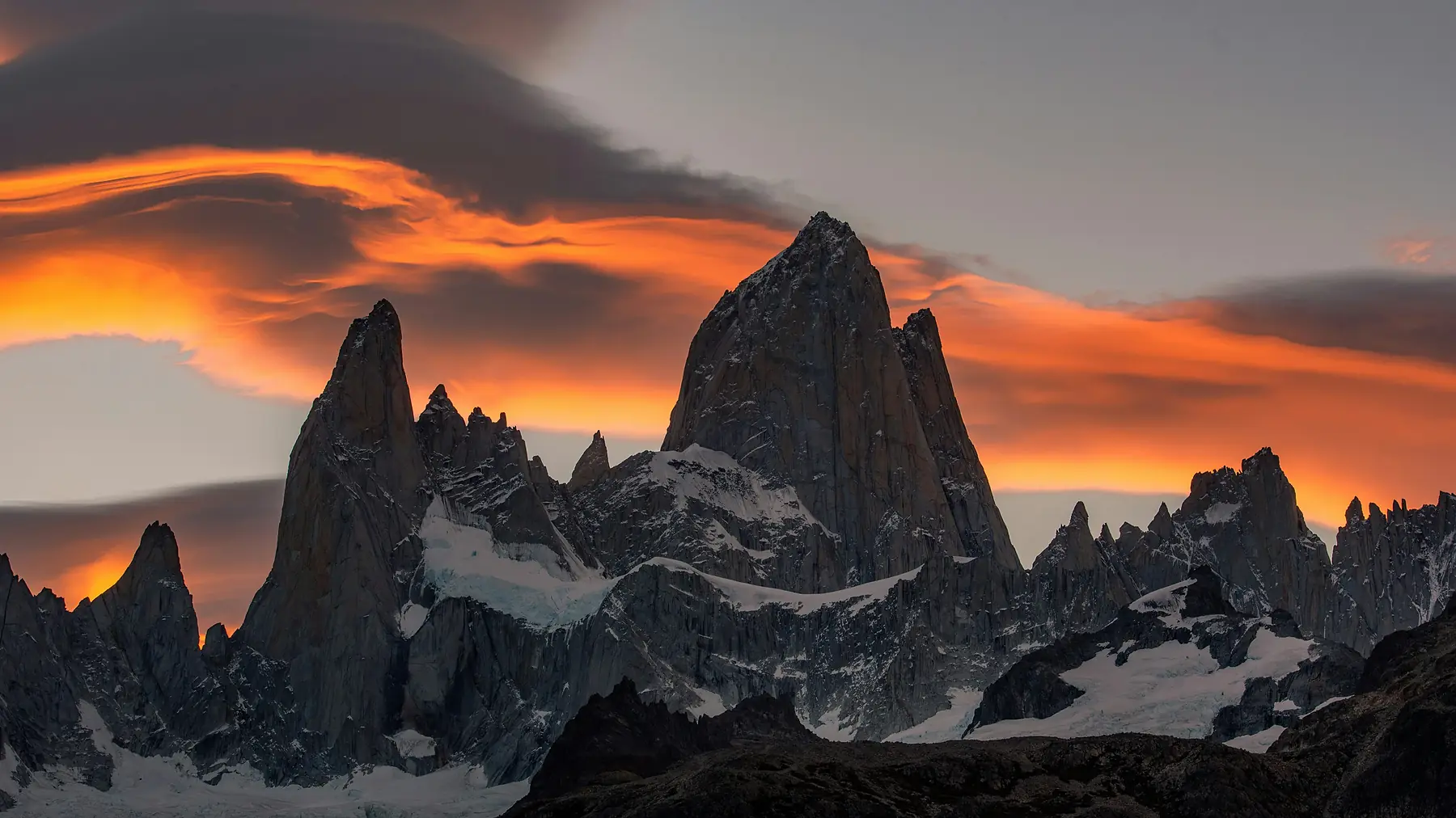
A short driving day with the best final hour in Argentina. From Tres Lagos, Ruta 40 runs south to the junction with Route 23, which swings west along the milky-turquoise sweep of Lago Viedma. Somewhere past the halfway point, the clouds permitting, the entire Fitz Roy massif heaves itself over the horizon and proceeds to fill the windscreen for forty straight minutes. Pull over at the signed miradors and let it.
Arrive in El Chaltén by early afternoon. Check trail conditions and the mountain forecast at the park ranger station on the way into town (Windguru and Meteoblue are the local bibles), then stretch your driving legs on the one-hour round trip to Mirador de los Cóndores above the village. Study the forecast tonight: of your two full days here, send the clearest, calmest one on tomorrow’s Laguna de los Tres.
Days 8–9: Granite Payoff in El Chaltén
Two full days in Argentina’s trekking capital, on foot at last. Deploy the better weather day on the trail to Laguna de los Tres at the foot of Mount Fitz Roy: roughly 25 kilometres round trip with 850 metres of gain, the final kilometre a steep scree staircase that earns you the most iconic viewpoint in Argentine Patagonia. Having a car helps here. Drive or shuttle to the El Pilar trailhead and hike the quieter Río Blanco approach, descending directly to town.
Use the second day for Laguna Torre, 18 gentler kilometres up the valley to the iceberg-dotted lake beneath Cerro Torre’s granite needle. If the big day left nothing in the tank, take the short waterfall walk to Chorrillo del Salto and a well-earned afternoon in the village’s microbreweries instead. If weather wrecks both days, treat it as Patagonia’s standard tax and remember the region rewards return visits.
Day 10: El Chaltén to El Calafate
Retrace Route 23 with Fitz Roy in the mirrors and rejoin Ruta 40 south around the head of Lago Argentino to El Calafate: 215 easy kilometres, around three hours. Arrive by early afternoon and enjoy town. Walk the Laguna Nimez wetland reserve for flamingos ten minutes from the main street, browse Avenida del Libertador, and book tomorrow’s glacier entry (national park tickets are purchased online in advance) plus any boat add-on tonight.
Day 11: The Perito Moreno Glacier
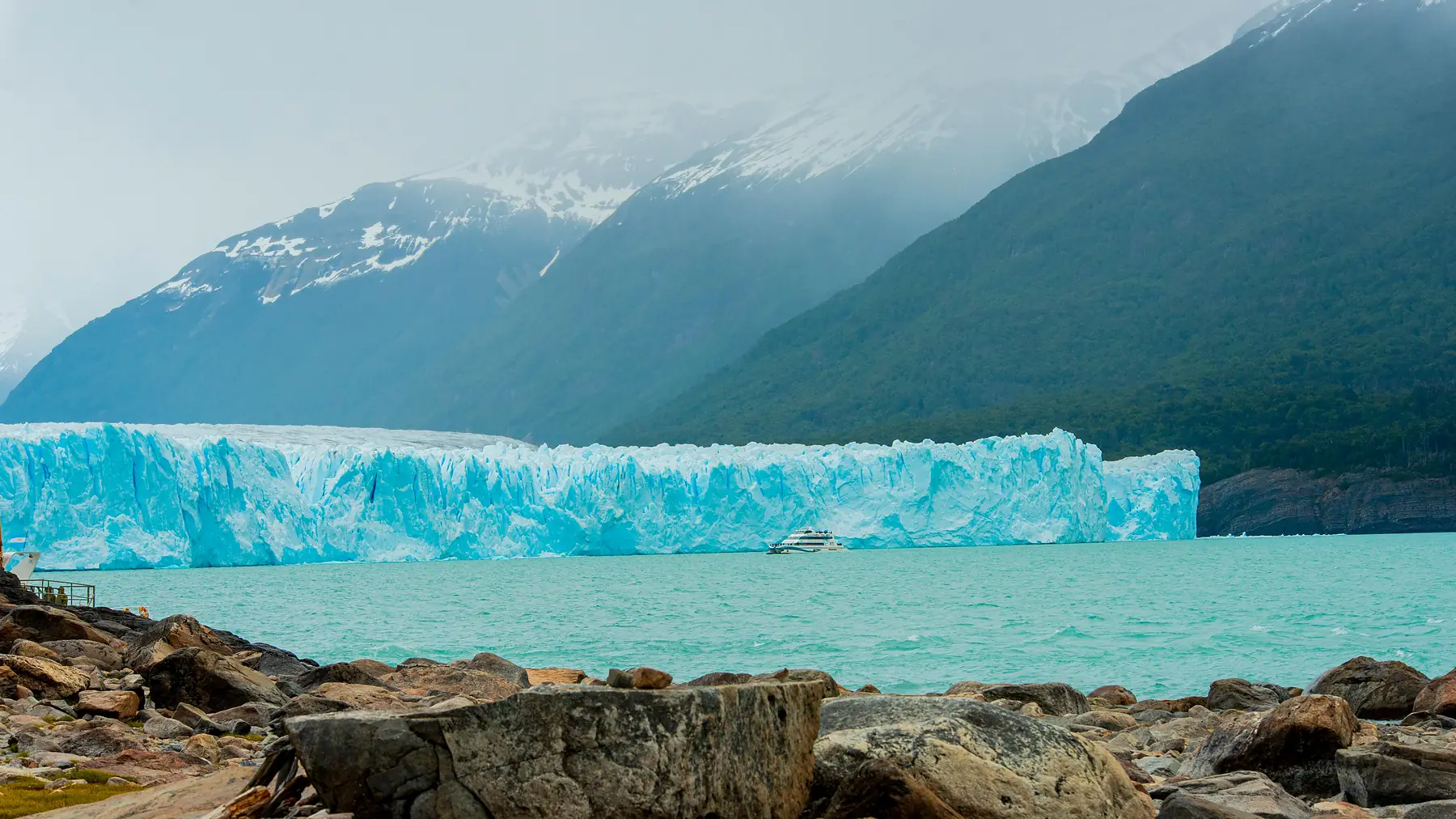
Drive the 80 kilometres west into Los Glaciares National Park for the route’s grand finale: the Perito Moreno Glacier, a five-kilometre-wide, 70-metre-high wall of blue ice that calves apartment-sized blocks into the lake with a boom you feel in your chest. Having your own car means arriving before the tour buses. Be at the boardwalks for opening and work the lower balconies first, closest to the ice. Add the hour-long catamaran from Bajo de las Sombras for the water-level perspective, or, if you booked ahead, a crampon-clad minitrekking walk on the ice itself.
Day 12: Drop the Car and Fly Home
El Calafate’s airport is 20 minutes from town. Refuel before returning the vehicle (agencies charge painfully for missing fuel), photograph the car from every angle at drop-off, and fly north with the satisfaction of having driven a road most people only fly over.
If you are connecting to an international flight out of Buenos Aires the same day, book generous margins or, better, an overnight buffer in the capital, as El Calafate departures are routinely delayed by wind. Note also that domestic flights to Buenos Aires land at either Aeroparque (AEP) or Ezeiza (EZE); if your long-haul leaves from Ezeiza, check which airport you arrive into before booking a tight connection.
Practical Notes and Variations
Driving Ruta 40 Today
The Bariloche–El Calafate stretch is now paved almost end to end, with two caveats: roadworks appear every season (expect short gravel diversions with timed convoys), and the access roads to the sights, meaning Los Alerces’ park road, the Cueva de las Manos canyon, and Perito Moreno National Park, remain proper ripio. On gravel, halve your speed, keep distance from dust clouds, and never swerve for washboard. The wind deserves the same respect on tarmac: both hands on the wheel through open sections, and park facing into it.
Northbound Instead?
The route works equally well south to north, and one-way rental availability sometimes dictates it. Driving northbound puts the glacier and Fitz Roy in the first half and saves the lakes for a gentle finish, but you lose the slow crescendo of the mountains rising from the steppe, which is, for our money, the whole point of the southbound run.
If You Have More Time
With three or four extra days, the natural extensions are: a second night in El Bolsón hiking country; the Lago del Desierto detour north of El Chaltén; or crossing to Chile from El Calafate for Torres del Paine, and our 14-day trekking highlights itinerary shows how that side connects. Cyclists and overlanders should also read our cycling Patagonia guide; Ruta 40 is one of the world’s great (and windiest) bike-touring roads.
FAQ
Do I need a 4x4 to drive Ruta 40 from Bariloche to El Calafate?
No. The main road is now almost entirely paved on this stretch, and a standard car completes this itinerary comfortably. What you gain from a higher-clearance vehicle is confidence on the gravel access roads to Los Alerces, Cueva de las Manos, and especially the optional Perito Moreno National Park detour, which genuinely does warrant a 4x4. Whatever you rent, confirm gravel-road cover in the contract, check the spare tyre before departure, and treat roadwork diversions with patience.
How bad is the fuel situation, really?
Manageable with discipline, dangerous without it. The critical stretch is Esquel to Tres Lagos: fill at Esquel, Río Mayo, Perito Moreno town, Bajo Caracoles (its single pump is famous precisely because it is sometimes dry), and Gobernador Gregores. The simple rule of filling at every station you pass, regardless of the gauge, removes all drama. A 10-litre jerrycan costs little and converts the emptiest leg from a gamble into a comfortable margin. Carry cash for fuel; remote stations regularly lose card connectivity.
Is 12 days enough for this route?
Yes. This itinerary is deliberately paced so no day exceeds about six hours of driving, with two genuine rest-from-the-wheel blocks (Los Alerces and El Chaltén). Ten days is possible if you cut the Los Alerces day and compress the middle, but you would arrive in El Chaltén with no weather buffer for the hikes. With fourteen days, add the Perito Moreno National Park detour properly and a third night in El Chaltén, the single best upgrade this route can buy.
When is the best time of year to drive Ruta 40?
November to March. The long daylight matters more here than on any other Patagonian itinerary: December and January give you light past 22:00, which turns the 500-kilometre days from a race into a cruise. November and December offer green steppe and fewer travellers; January and February are warmest and busiest in El Chaltén; March brings autumn colour and calmer winds. Outside this window, services along the middle section thin out dramatically and snow can affect the southern passes.
Can I do this route by bus instead of driving?
Partially. Comfortable long-distance buses link Bariloche, El Bolsón, and Esquel, and separate services connect El Chaltén and El Calafate, but the middle section (Cueva de las Manos, Bajo Caracoles, the empty quarter) has extremely sparse public transport, often limited to a few weekly services aimed at through-travellers. Without a car you will likely skip the rock art and the steppe crossings that define this route. If bus travel is your plan, our Bariloche to El Chaltén itinerary is built exactly for it.
Is the wind on Ruta 40 dangerous for driving?
It demands respect rather than fear. Spring and summer westerlies regularly gust past 80 km/h on the open steppe, enough to shove the car across the lane, exhaust an inattentive driver, and slam doors hard enough to bend hinges. Drive with both hands on the wheel, slow down through exposed sections and when passing trucks, park nose into the wind, and never let children open doors unsupervised. High-sided vehicles and roof boxes feel it most. The wind typically eases in the evening and in autumn.
Where should I stay along the middle section?
The steppe towns of Esquel, Perito Moreno, and Gobernador Gregores offer simple, functional hotels and cabañas that need booking only days ahead outside peak weeks. The memorable alternative is an estancia stay: several working sheep stations along the middle 40 take guests, with home-cooked lamb dinners and absolute silence. These book out weeks ahead in January and February, so reserve when you book the car. In El Chaltén and El Calafate, book as far ahead as you can, because both towns sell out in high season.
Should I drive Bariloche to El Calafate or fly?
Fly if your priority is maximum trail time; the flight takes 90 minutes and our bus-and-air itineraries put those saved days to work in the mountains. Drive if the journey itself is the point: no flight shows you Los Alerces’ ancient forest, nine-millennia-old handprints in a desert canyon, or Fitz Roy rising slowly out of the steppe. The honest trade-off is roughly three full days spent behind the wheel; this route pays that cost gladly.