Cycling Patagonia is a world-class test of endurance that rewards travelers with total autonomy in one of Earth’s last great wildernesses. For most cyclists, the ideal window for a tour is between November and March, focusing on the lush Carretera Austral in Chile or the wind-swept pampas of Argentina’s Ruta 40.
This is not a journey for the casual rider. To succeed here, you must be your own mechanic, your own navigator, and occasionally, your own psychologist when the legendary Patagonian wind threatens to halt your progress entirely. Whether you are planning a two-week highlight reel or a three-month epic from Puerto Montt to Ushuaia, this guide provides the logistical framework to turn a daunting expedition into a manageable reality.
Patagonia Cycling at a Glance
- Best Months: November to March (Southern Hemisphere summer)
- Primary Routes: Carretera Austral (Chile) and Ruta 40 (Argentina)
- Average Duration: 4 - 8 weeks for a full crossing
- Road Conditions: Mix of pavement and ripio (loose gravel/crushed stone)
- Top Challenge: Sustained winds of 40–60 km/h with gusts exceeding 100 km/h
- Bike Type: Gravel or mountain bike with 2-inch (50mm) tires
Why Cycle Patagonia? The Reality of the Road
The appeal of Patagonia from the saddle lies in the transition of landscapes that motorized travelers often miss. On a bike, the change from the temperate rainforests of the Lakes District to the hanging glaciers of the Queulat National Park happens at a human pace. You feel the temperature drop as you approach a mountain pass and smell the dry coirón grass of the steppe before you even see the horizon open up.
Beyond the scenery, there is a deep-rooted “cicloviajero” (bike traveler) culture. Because the routes are so established, you will frequently meet other riders at water stops or in the backrooms of local bakeries. One of the most famous hubs is the Panadería La Unión in Tolhuín, Tierra del Fuego. Despite a fire in 2021 and the passing of its legendary owner Emilio Sáez, the bakery has been rebuilt and continues its tradition of providing a dedicated space for weary cyclists to rest and refuel. These touchpoints of humanity make the vast distances feel less isolating.
While the physical challenge is high, the infrastructure for cyclists has improved significantly. The rise of offline mapping and better gear means you can now focus more on the ride and less on whether you’ll find water before sunset. For a broader look at how cycling fits into the regional transport mix, see our guide on getting around Patagonia.
The Big Three: Primary Cycling Routes in Patagonia
Most riders choose one of three main corridors, or a combination of them, depending on their appetite for wind and gravel.
The Carretera Austral (Chile Route 7)
Often called the most beautiful road in the world, the Carretera Austral runs 1,240km from Puerto Montt to Villa O’Higgins. It is the “Gold Standard” for bike touring because of its constant access to water, frequent small villages, and stunning proximity to fjords and glaciers. The road is currently a work in progress: as of the 2026/27 season, approximately 45% of the route is paved (mostly in the northern half), while the southern sections remain dominated by rugged ripio.
The Argentine Steppe (Ruta 40)
If the Carretera Austral is a visual feast, Ruta 40 is a mental test. This route takes you through the vast, open pampas of Argentina. The distances between services are much longer (often 100km+), and the scenery is starkly beautiful but repetitive. The payoff is the iconic approach to El Chaltén, where the granite spires of the Fitz Roy massif grow larger with every pedal stroke.
Tierra del Fuego
The “Final Push” involves crossing the Strait of Magellan by ferry and riding through the heart of the island to reach Ushuaia. This section combines the rolling hills of the north with the dramatic Darwin Range in the south, culminating in the literal end of the road at Bahia Lapataia.
To help you choose between the two primary north-south arteries, consider this breakdown:
- Landscape: Rainforests, fjords, and glaciers vs. High desert, steppe, and mountains
- Road Surface: ~45% paved / 55% ripio vs. 90% paved / 10% ripio (variable)
- Services: Frequent towns and water vs. Long gaps (100km+) between supply points
- Wind Risk: Moderate (shielded by forests) vs. Extreme (completely exposed)
Choose the Carretera Austral for scenery and water; choose Ruta 40 if you want the challenge of the open plains and have a high tolerance for wind.
For a deeper dive into the specific stops and logistics of the Chilean side, see our Carretera Austral guide.
When to Go: The Patagonian Cycling Season
The window for cycling is narrow. Outside of the November to March window, snow can close the high passes, and many ferries (essential for the Carretera Austral) reduce their frequency or stop running entirely.
- November & December: The best balance of daylight and fresh scenery. The “Horsefly Factor” (Tábanos) is lower in early November but peaks in late December. These large, biting flies are attracted to movement and dark colors: they can be a significant nuisance in the Chilean Lake District.
- January & February: Peak summer. This is when the wind is statistically at its strongest, particularly in the Santa Cruz province of Argentina, where gusts frequently exceed 100 km/h. It is also the busiest time on the roads, meaning you’ll share narrow gravel paths with more dust-kicking trucks.
- March: The “Golden Window.” The winds begin to die down, the horseflies are gone, and the autumn colors (especially around El Chaltén) are spectacular. However, the nights become significantly colder.
For a detailed breakdown of what to expect each month, including temperature and rainfall charts, visit our Patagonia weather guide and our overview of the best time to visit.
Facing the Wind: Tactical Advice for Cyclists
In Patagonia, the wind is not just weather: it is a geographical feature you must navigate. The prevailing winds blow from the Northwest to the Southeast. For this reason, the vast majority of cyclists ride North to South. Attempting to ride South to North against the wind on Ruta 40 is a grueling experience that can reduce your speed to 5 km/h on flat ground.
Do not underestimate crosswinds. On the open plains of Argentina, a 100 km/h gust can catch your panniers like a sail and push a loaded 40kg bike into the middle of the road. Always lean into the wind and stay alert when large trucks pass, as their wake can create a vacuum that pulls you toward the vehicle.
Tactical Tips for the Wind:
- Use the Windy App: This is the gold-standard tool for cyclists. It provides hyper-local wind gusts and direction data. If the forecast shows 70 km/h headwinds, it is often better to sleep in and wait for a “wind window” than to exhaust yourself for 20km of progress.
- The Dawn Strategy: Winds usually peak in the mid-afternoon. Start your ride at 5:00 AM or 6:00 AM to get 4-5 hours of relatively calm riding before the “Patagonian fan” turns on.
- Find “Wind-Shadows”: When wild camping, look for depressions in the ground, large boulders, or abandoned buildings. A tent that isn’t low-profile can easily have its poles snapped by a midnight gust.
For more on navigating the region’s digital tools, see our guide to Patagonia apps.
Bike Logistics: Getting There and Staying Moving
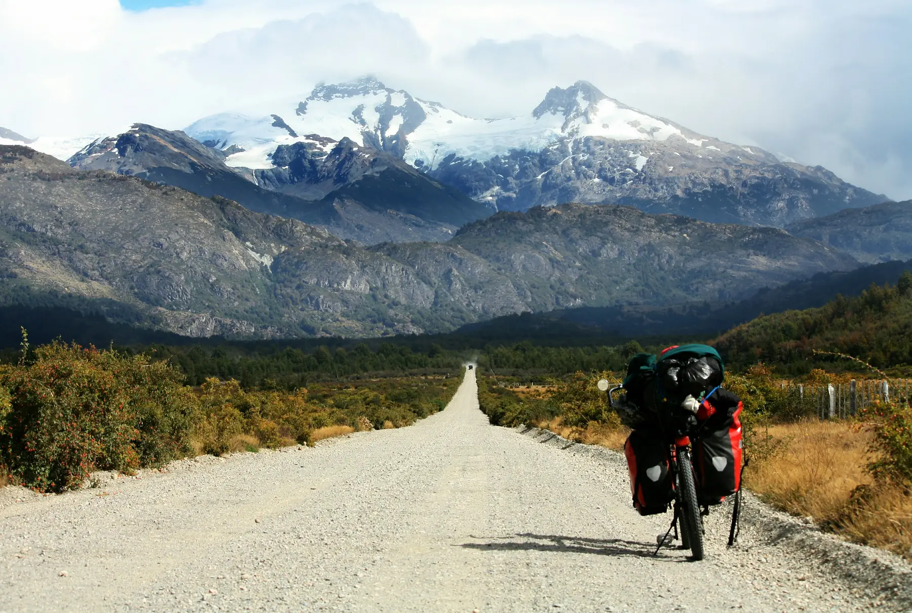
Your choice of bike will determine your level of suffering on the ripio. While people have cycled Patagonia on everything from carbon road bikes to unicycles, the ideal setup is a steel-framed touring or gravel bike.
The Bike Setup
- Tires: A minimum width of 40mm to 50mm (2 inches) is essential. The “ripio” often consists of loose, marble-like stones; thin tires will sink and slide, leading to frequent falls.
- Gearing: Ensure you have a very low “granny gear.” The climbs on the Carretera Austral aren’t necessarily long, but they are incredibly steep (often 10-12% grades on loose gravel).
- Frame: Steel is preferred because it is durable and, in the event of a catastrophic failure, can be welded in almost any small town.
Repairs and Parts
You must be a competent mechanic. Outside of Coyhaique and Punta Arenas, there are no “high-end” bike shops. You should carry:
- 2x spare tubes and a patch kit
- A spare folding tire
- 3x spare spokes (specific to your wheel size)
- A spare derailleur hanger (a common casualty of bike shipping or falls)
- A high-quality multi-tool and chain breaker
Shipping and Transport
Most cyclists fly into Puerto Montt (Chile) or Bariloche (Argentina) to start their journey. When flying, you will need a bike box. These can be sourced from local bike shops in major hubs, but they are highly sought after in “end-point” cities like Ushuaia or Punta Arenas. If you are finishing in Ushuaia, contact the local bike shops at least a week in advance to reserve a box for your flight home.
Gear Essentials: The Patagonian Packing List
The goal for Patagonia is to keep your center of gravity low to combat the wind while ensuring 100% protection from the rain. For a full list of general outdoor equipment, refer to our Patagonia packing guide.
Panniers vs. Bikepacking Bags
Traditional panniers (like Ortlieb) are still the preferred choice for most. They offer more volume for the bulky food and cold-weather gear required for long stretches between towns. Crucially, they must be fully waterproof. A “water-resistant” bag will fail during a three-day downpour in the Aysén region.
The Tent
Your tent must be a sturdy 3-season or 4-season model with a low profile. Tunnel tents or geodesic shapes handle the wind better than high-profile “hub-and-pole” designs. If your tent cannot be pitched “outer-first,” you risk soaking the interior during a rainy setup.
The Stove
Multi-fuel stoves (that run on white gas or benzina) are the most reliable for long-distance touring. While screw-top canisters (isobutane/propane) are generally available in larger hubs like Coyhaique and Cochrane at hardware stores (ferreterías), they can occasionally sell out during peak season. Benzina can be bought at any gas station (bencinera).
Daily Life: Water, Food, and Wild Camping
Water
In the Chilean fjords, water is one of the few things you don’t have to worry about. You can often fill your bottles directly from mountain streams. However, in the Argentine pampas, water is scarce and often contaminated by livestock. Always carry a filter (like a Sawyer Squeeze) for the flatter, drier sections.
Food and Supplies
Cyclists in Patagonia burn between 4,000 and 6,000 calories per day. Stock up on staples like pasta, tuna, and “manjar” (a calorie-dense caramel spread). In Argentina, currency mechanics remain volatile; check our guide on currency and money for the latest on exchange rates and payment tips.
Wild Camping
Wild camping is generally legal and socially accepted in most of Patagonia, provided you follow “Leave No Trace” principles.
- Chile: Very easy to find spots, especially along the Carretera Austral. Look for “pesca y caza” (fishing and hunting) access points.
- Argentina: More difficult due to extensive fencing of private estancias. Look for road maintenance huts (casitas de vialidad) which often provide a wind-shielded place to sleep.
- iOverlander: This app is the bible for Patagonian cyclists. It lists hundreds of proven wild camping spots, water sources, and cyclist-friendly hostels.
The Border Crossing: Villa O’Higgins to El Chaltén
This is the most legendary section of the South American bike touring circuit. It is a “no-man’s-land” that is impassable for cars, meaning only hikers and cyclists can cross here.
The First Ferry
Take the ferry from Villa O’Higgins across Lago O’Higgins to Candelario Mancilla. As of the 2026/27 season, the crossing costs approximately 60,000 CLP (~$65–70 USD) per person, with bikes usually included for free. The ferry typically runs 2–3 times per week in high season but is notoriously weather-dependent.
The No-Man's-Land
From Candelario Mancilla, you face a 22km trek to the Argentine border. The first 15km is a steep, gravel road. The final 7km is a narrow, muddy single-track through the forest where you will likely have to push or carry your loaded bike.
The Second Ferry
Once you reach Laguna del Desierto, you can either take a second ferry (approx. 30,000 CLP / $35 USD) or hike the narrow 12km trail along the lake’s edge (not recommended with a bike). From the southern end of the lake, a 37km gravel road leads you directly into El Chaltén.
Ensure you have your exit stamp from Chile and entry stamp for Argentina handled at the remote border stations. For more on the paperwork required, see our guide to Patagonia border crossings.
Biking in Torres del Paine National Park
A common question for cyclists is whether they can ride the famous “W” or “O” treks in Torres del Paine. The answer is a firm no. Bikes are strictly prohibited on all hiking trails within the park.
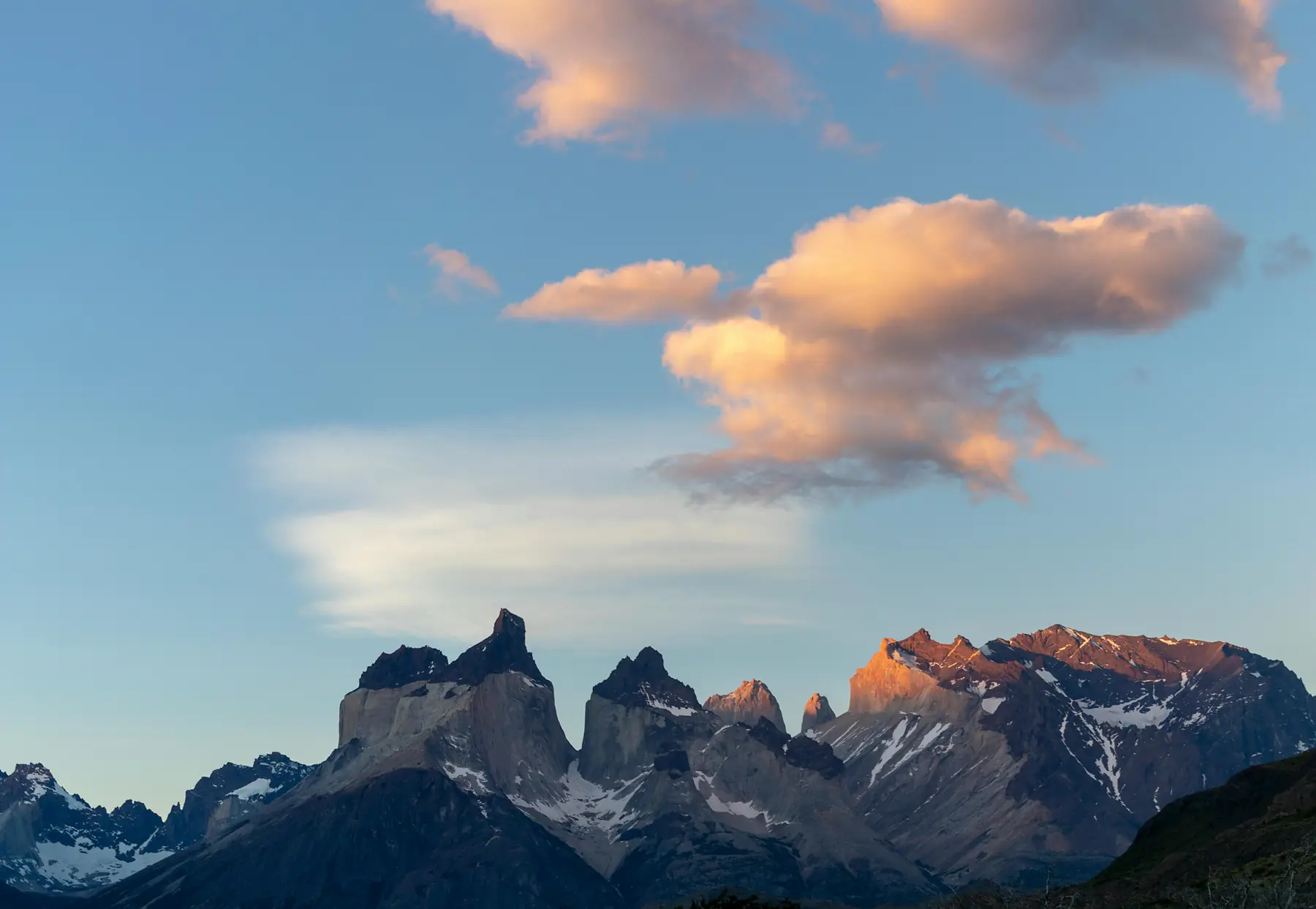
However, cycling the park’s vehicle roads is a spectacular way to see the massif. The route from the Laguna Amarga entrance to Pudeto offers some of the best views of the “Cuernos” (Horns) of the Paine.
Bike Logistics in the Park:
- Storage: If you want to hike the W Trek, you can leave your bike and panniers at the Welcome Center (near Central) or at the Pudeto cafeteria storage area for a small daily fee.
- Rentals: Most bike rentals are based in Puerto Natales. Inside the park, limited mountain bike and e-bike rentals are available primarily for guests of specific hotels like Hotel Las Torres or through organized day tours.
To plan the hiking portion of your trip, visit our Torres del Paine hub.
FAQ
Is cycling Patagonia safe for solo travelers?
Yes, Patagonia is exceptionally safe regarding crime, though the primary risks are environmental (wind and cold) and traffic on narrow Argentine highways. Solo cyclists are common, and the community of riders provides a safety net of information and support. For more on general safety, see our safety guide.
How much does it cost to cycle Patagonia per day?
Budget travelers can spend $25 - $35 USD per day by wild camping and cooking, while those using hostels and eating out should budget $70 - $90 USD. Prices are generally higher in Chile than in Argentina for food, but camping is often free.
Do I need a mountain bike to cycle the Carretera Austral?
While a mountain bike is not strictly necessary, a “touring” or “gravel” bike with at least 2-inch tires and low gearing is essential for the unpaved ripio sections. The extra volume in the tires provides the necessary suspension for the corrugated road surfaces.
Can I rent a bike for a long-distance Patagonia tour?
Long-distance rentals are rare and expensive; most cyclists buy a bike at home and fly with it, or buy/sell a used one in hubs like Puerto Montt or Punta Arenas. Some local operators offer supported tours with rentals included, but DIY rentals for 1,000km+ trips are not standard.
How do I handle the wind while cycling in Argentina?
Always check the forecast using apps like Windy, start your rides at dawn before the winds peak, and be prepared to wait out dangerous gusts in a sheltered spot. Riding in the early morning is the single most effective way to avoid the worst of the afternoon wind.
Is the water safe to drink while cycling Patagonia?
In the Chilean fjords and mountains, stream water is generally pristine and safe, but you should always filter water near livestock areas or in the flat Argentine pampas. When in doubt, a simple 0.1-micron filter is sufficient for most Patagonian water sources.