
Perito Moreno National Park Guide: The “Other” Patagonia (2026)
Perito Moreno National Park is Argentina’s most isolated wilderness, a 126,830-hectare expanse of turquoise lakes and jagged peaks that sees fewer visitors in a year than the famous glacier of the same name sees in a single afternoon. Located in the northwest of Santa Cruz province, this park offers the rarest commodity in Patagonia: true solitude. It is a place where the mountains are unnamed, the guanacos outnumber humans a thousand to one, and the silence is only broken by the relentless Patagonian wind.
This is not a destination for the casual sightseer. Reaching the park requires a full day of driving across the high steppe, most of it on unpaved gravel roads that demand a high-clearance vehicle and a spare tire. However, for those willing to make the journey, the reward is an untouched landscape of eight interconnected lakes, the massive granite wall of Monte San Lorenzo, and a trail network where you are unlikely to encounter another soul.
The Perito Moreno Confusion: Park vs. Glacier vs. Town
The single most important thing to know before booking your trip is that Perito Moreno National Park is not home to the Perito Moreno Glacier. While both are named after the 19th-century explorer Francisco “Perito” Moreno, they are located roughly 410 kilometers apart—a distance that takes 8 to 9 hours to drive due to the rugged terrain.
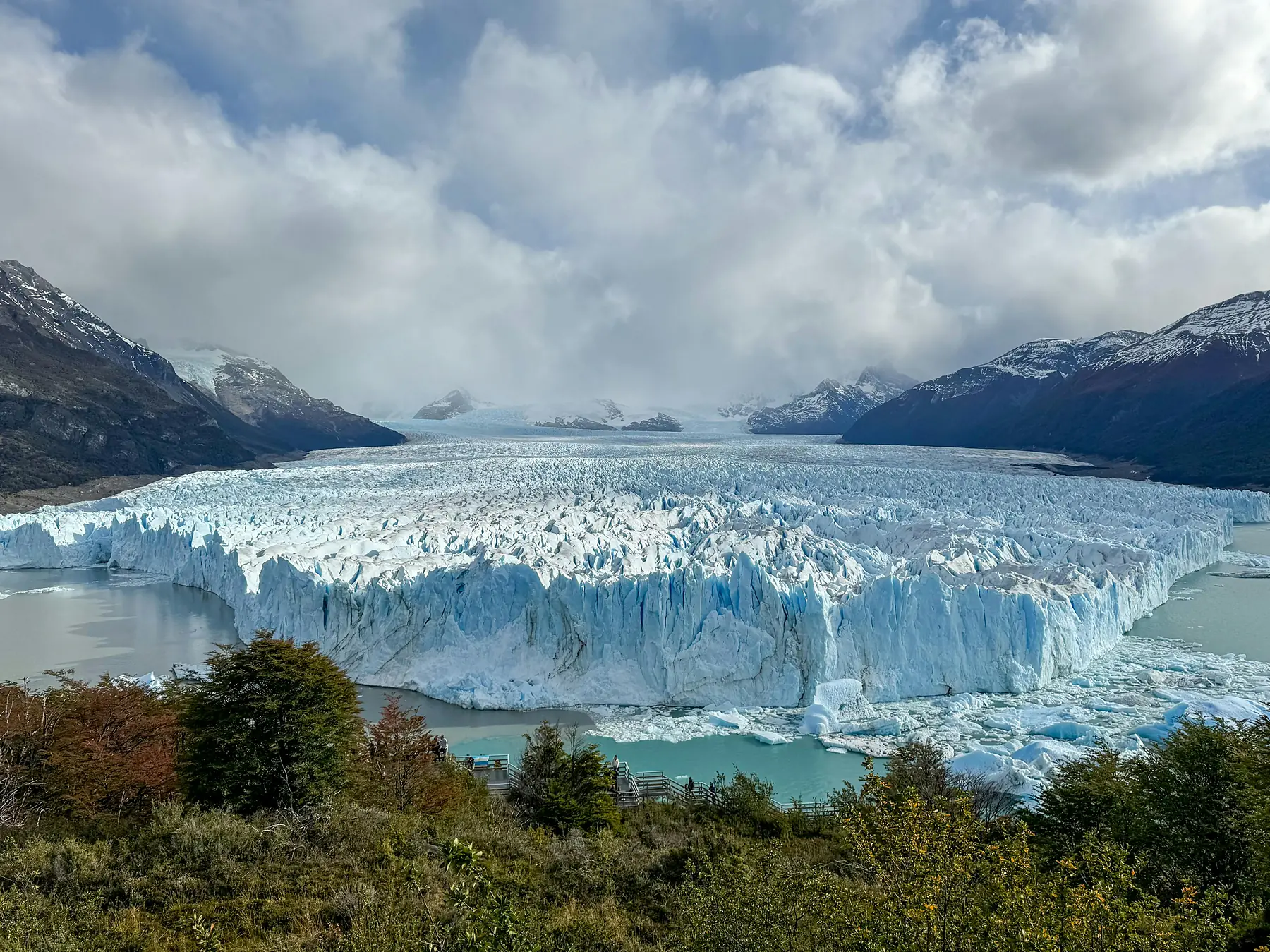
If your goal is to walk on ice or see giant blocks of glacier calving into the water, you are looking for the Perito Moreno Glacier, which is located inside Los Glaciares National Park near the town of El Calafate.
To ensure you are planning the right trip, consider the three distinct locations that share this name:
- Location: Remote park on Ruta 40, ~600 km north of El Calafate (National Park)
- Location: In Los Glaciares National Park near El Calafate (Glacier)
- Location: Small town on Ruta 40 in northwestern Santa Cruz Province (Town)
- Primary Draw: Wild landscapes, hiking, lakes, and solitude (National Park)
- Primary Draw: Glacier calving, walkways, boat tours, and ice trekking (Glacier)
- Primary Draw: Transit stop for Ruta 40 travelers and access to nearby attractions like Cueva de las Manos (Town)
- Accessibility: Moderate — remote but reachable via Ruta 40 and limited transport (National Park)
- Accessibility: Easy — paved road access from El Calafate, ~1.5 hrs (Glacier)
- Accessibility: Easy–moderate — accessible by road and regional bus routes (Town)
- Crowds: Low — quiet and far less visited (National Park)
- Crowds: High — one of Patagonia’s busiest attractions (Glacier)
- Crowds: Low — mainly overland travelers and locals (Town)
- Atmosphere: Remote, rugged, and peaceful (National Park)
- Atmosphere: Touristic, dramatic, and highly developed (Glacier)
- Atmosphere: Functional, local, and low-key (Town)
- Best For: Nature lovers seeking isolation and wilderness (National Park)
- Best For: First-time Patagonia visitors wanting an iconic experience (Glacier)
- Best For: Travelers needing supplies, transport links, or a stopover on Ruta 40 (Town)
Choose the National Park if you want remote hiking and solitude; choose the Glacier for iconic ice views; avoid the town unless you are visiting Cueva de las Manos.
The town of Perito Moreno sits even further north on Ruta 40. While it serves as a useful transit hub for those visiting the nearby Cueva de las Manos, it is not within walking distance of either the national park or the glacier. If you find yourself in the town of Perito Moreno expecting to see a glacier, you are approximately 600 kilometers away from your destination.
Why Visit Perito Moreno National Park?
The primary reason to visit Perito Moreno National Park is to experience Patagonia as it existed before the arrival of mass tourism. While El Chaltén has become a global trekking hub with crowded trails and bustling craft beer bars, this park remains a raw, functional wilderness where self-sufficiency is the rule.
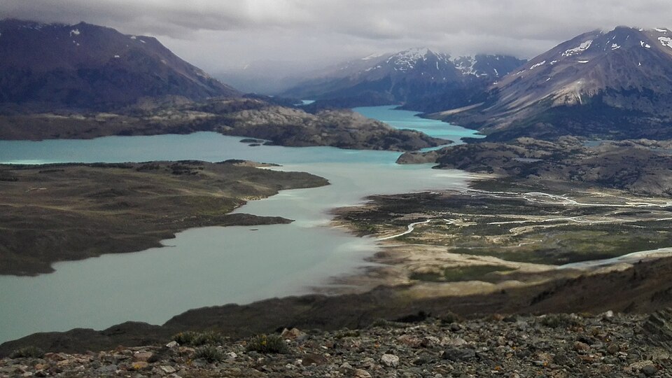
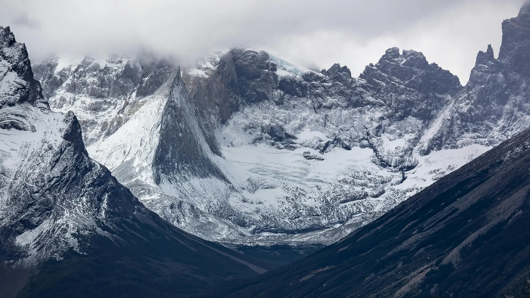
The landscape here is a dramatic transition zone. To the east lies the arid Patagonian steppe, an “amphitheater” of golden grass that hosts the highest density of guanacos in the country. To the west, the terrain rises sharply into the Andes, culminating in the 3,706-meter peak of Monte San Lorenzo. Between the two are the eight lakes of the Belgrano system, each a different shade of blue or green depending on the glacial sediment they carry.
Beyond the scenery, the park is a sanctuary for wildlife. Because human presence is so minimal, animals here are less skittish. It is one of the best places in South America to see pumas in the wild, particularly in the early morning hours near the park entrance. You will also find Andean condors nesting in the cliffs of Cerro León and flamingos feeding in the shallow lagoons.
For those interested in history, the park contains archaeological sites with evidence of human habitation dating back 9,000 years. These early hunter-gatherers utilized the same valleys you will hike today, leaving behind stone tools and cave paintings that speak to a millennium of survival in this harsh environment. If you are exploring this region of Santa Cruz, you may also want to visit the nearby “La Ascensión” sector of Parque Patagonia, which offers a similar focus on rewilding and steppe restoration.
How to Get to Perito Moreno National Park
Reaching the park is a logistical challenge that requires careful planning and a reliable vehicle. There is no public transport to the park, and most major tour operators in El Calafate do not run regular day trips here because of the sheer distance involved.
The most common route is to drive north from El Calafate. This journey typically takes between 8 and 9 hours depending on road conditions and how often you stop for photos or wildlife.
The Ruta 40 Leg
Drive north from El Calafate on Ruta 40 for approximately 320 kilometers to the junction with Provincial Route 37 (Las Horquetas). This section is paved and relatively straightforward, passing through the vast expanses of the Santa Cruz hinterland.
The Essential Fuel Stop
You must stop in the town of Gobernador Gregores to fill your tank and any spare fuel canisters. This is your last chance for petrol before entering the park. The YPF station here generally accepts international credit cards, but system outages are common in remote areas; always carry enough cash (Argentine Pesos) to cover a full tank as a backup.
The RP 37 Gravel Drive
From Ruta 40 at Las Horquetas, turn west onto Provincial Route 37 (RP 37). The next 90 kilometers are unpaved gravel. As of the 2026/27 season, the road remains rough with significant “serrucho” (washboard) ripples and loose stones, requiring slow speeds and high-clearance vehicles.
Before you set out, ensure you have a full-sized spare tire and are comfortable changing it. While a 4x4 vehicle is not strictly required during the height of summer (January and February), a high-clearance SUV is strongly recommended. The rocks on RP 37 are sharp enough to puncture standard sedan tires, and the clearance is necessary for navigating occasional ruts or mud. For more advice on navigating these roads, see our Patagonia car rental guide.
Best Hikes and Sights in the Park
The trail system in Perito Moreno National Park is divided into short day walks and the more demanding Azara Circuit. Unlike the trails in Torres del Paine, these paths are often narrow and marked by simple wooden stakes rather than heavy signage.
Belgrano Peninsula
For those with limited time, the Belgrano Peninsula offers the highest reward for the least effort. A 1-2 hour loop trail takes you across a narrow neck of land into the center of Lake Belgrano. From the far end of the peninsula, you are surrounded by turquoise water with the San Lorenzo massif providing a massive granite backdrop to the west.
Cerro León
Rising directly behind the park’s administrative area, Cerro León is the best vantage point for birdwatching. The hike to the summit takes roughly 3-4 hours round trip and involves a steady climb. From the top, you can often look down on Andean condors catching thermals. It also provides the best perspective on the “amphitheater” layout of the park’s central valley.
The Azara Circuit
This is the park’s premier multi-day trekking route, typically taking 3-5 days to complete. It leads hikers into the most remote corners of the park, visiting the De los Témpanos lagoon where small icebergs often float, having broken off from the glaciers of Monte San Lorenzo.
The circuit involves staying in basic mountain shelters (refugios) or camping. The “Blue Rock” trail section is particularly stunning, winding through ancient lenga forests that have been shaped into strange, horizontal forms by the wind.
Wildlife of the Steppe and Forest
Because Perito Moreno National Park receives so few visitors, the wildlife remains the true owner of the landscape. You do not need to go looking for animals here; they will be visible from your car window the moment you enter the park boundaries.
Guanacos are the most visible residents. These wild relatives of the llama thrive in the park’s central valley, which acts as a natural windbreak. During the spring (November and December), you will see large numbers of “chulengos” (baby guanacos) practicing their sprints across the grass.
The park is also a critical habitat for the Huemul, the endangered South Andean deer. While they are famously elusive, they are occasionally spotted in the forested areas near Laguna Burmeister. If you are lucky enough to see one, keep a respectful distance, as they are highly sensitive to human presence.
If you want to learn more about the predators that roam these plains, our guide to pumas in Patagonia covers their behavior and the best ways to view them safely and ethically.
Where to Stay: Camping and Estancias
Accommodation in this part of Santa Cruz is limited to one historic ranch and several rugged campsites. You must arrive with all the supplies you need for your entire stay.
Estancia La Oriental
Located just inside the park boundaries, this is the only formal lodging available. It is a traditional Patagonian ranch run by the Lada family. Staying here offers a glimpse into the “pioneer” lifestyle of the region, with home-cooked meals (often Patagonian lamb) and basic but comfortable rooms. The estancia is confirmed to be accepting bookings for the 2026/27 and 2026/27 seasons (typically operating November to March).
Camping and Refugios
The park offers several free campsites managed by the National Parks Administration (APN).
- Laguna Burmeister: A wind-sheltered site set within a forest. It is beautiful but can be very buggy in mid-summer.
- El Rincón: Located near the base of the Azara Circuit.
- Refugios: There are four basic shelters on the Azara Circuit (Caleta, René Ferrari, San Lorenzo, and Azara). These are simple wooden or stone huts with no heating, electricity, or running water. They are intended for hikers and are available on a first-come, first-served basis.
There are no shops or Wi-Fi services in the park. You must bring 100% of your food and be prepared to pack out every piece of trash you generate. While there are streams with potable water, it is always wise to check with the park rangers about current water safety before drinking from the lakes.
Essential Planning Tips for 2026/27
A trip to Perito Moreno National Park can be the highlight of a Patagonia itinerary, but it can also be a disaster if you arrive unprepared.
Entrance Fees and Registration As of the 2026/27 season, Perito Moreno National Park does not charge an entrance fee for visitors, making it a rare exception among Argentina’s major national parks. However, you must register with the Guardaparque (Ranger) at the Onelli entrance station. They need to know your intended hiking route and expected exit date for safety reasons.
The Best Time to Visit The window for visiting is narrow: November to March. Outside of these months, snow and mud can make RP 37 impassable even for 4x4 vehicles. Even in January, the wind can be extreme. Expect sustained winds of 70-90 km/h, which are strong enough to damage car doors if they are not held firmly when opened.
Supplies Checklist Before leaving Gobernador Gregores, ensure you have:
- Enough food for 2 extra days (in case of road closures or breakdowns).
- A minimum of 20 liters of extra fuel in a certified container.
- A physical map (GPS is unreliable in the deep canyons).
- Heavy-duty tent stakes if camping; the ground is hard and the wind is fierce.
If you find that the 8-hour drive is too much for your schedule, there are many excellent hiking options closer to El Calafate that offer a taste of the landscape without the logistical burden.
To plan the rest of your Santa Cruz adventure:
FAQ
Is Perito Moreno National Park the same as the Perito Moreno Glacier?
No, Perito Moreno National Park is a remote wilderness area located about 410 kilometers north of the famous Perito Moreno Glacier, which is actually inside Los Glaciares National Park.
How do I get to Perito Moreno National Park from El Calafate?
You must drive north on Ruta 40 for approximately 8 to 9 hours, refueling at Gobernador Gregores before taking Provincial Route 37 into the park.
Do I need a 4x4 to visit Perito Moreno National Park?
While a 4x4 is not strictly required in mid-summer, a high-clearance vehicle is strongly recommended due to the 90 kilometers of rough gravel on Provincial Route 37.
Can I see the Perito Moreno Glacier from this national park?
No, the glacier is not visible from Perito Moreno National Park; however, you can see the massive Monte San Lorenzo, the second-highest peak in Patagonia.
Are there hotels inside Perito Moreno National Park?
There are no hotels inside the park, but Estancia La Oriental offers traditional lodging within the park boundaries, and there are several free, basic campsites.
What is the best time of year to visit Perito Moreno National Park?
The best time to visit is during the Patagonian summer from November to March, as the access roads can become impassable due to snow and mud during the winter months.