
W Trek Day by Day: 5-Day Trail Breakdown & Distances (2026)
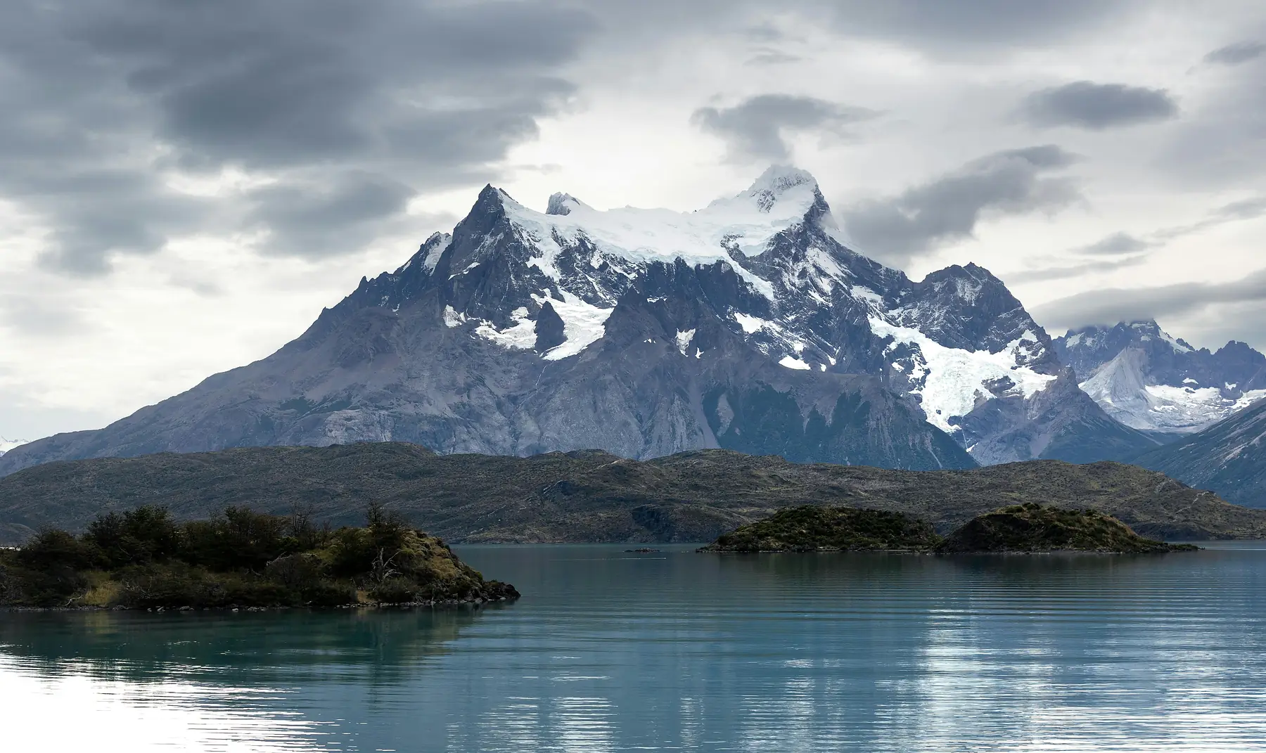
The W Trek covers approximately 74km (46 miles) of rugged trail, typically completed over five days of hiking through the heart of Torres del Paine National Park. This page acts as your on-trail companion, providing a mile-by-mile visualization of the terrain, elevation, and sensory landmarks you will encounter from the moment you leave the Welcome Centre to your final departure on the Lake Pehoé catamaran.
While logistics and booking are covered elsewhere, the following breakdown focuses on the physical reality of the trail. You will find descriptions of the specific path underfoot, the timing required to reach key lookouts, and the markers that signal you are on the right track.
W Trek at a Glance: Distances and Timing
The standard 5-day itinerary follows an East-to-West (E-W) route, beginning at the Central Sector and finishing at Glacier Grey. This direction is favored by most hikers as it builds toward the massive ice fields of the west after tackling the steep ascent to the Towers on day one.
For a full spatial understanding of how these stages connect across the park’s topography, you should consult our W Trek map which includes detailed elevation profiles. If you are still deciding on the length of your trip, our guide to choosing a W Trek itinerary compares 4-day and 5-day variations.
| Day | Route | Distance | Est. Time |
|---|---|---|---|
| 1 | Central to Base Torres (Return) | 19.5km / 12.1mi | 8 - 9 hours |
| 2 | Central to Francés Sector | 16.5km / 10.2mi | 6 - 7 hours |
| 3 | Francés to Mirador Británico to Paine Grande | 20km / 12.4mi | 9 - 10 hours |
| 4 | Paine Grande to Refugio Grey | 11km / 6.8mi | 4 - 4.5 hours |
| 5 | Grey to Bridges and Exit via Paine Grande | 15km / 9.3mi | 5 - 6 hours |
Trek Snapshot
- Total Distance: Approximately 74km - 80km (46 - 50 miles) depending on side trips.
- Total Elevation Gain: Over 2,700m (8,850ft) across 5 days.
- Daily Hiking Window: 6 - 10 hours depending on pace and side trips.
- Highest Point: Mirador Base Las Torres (870m / 2,854ft).
- Trail Marking: High (yellow-topped stakes and junction signage).
Day 1: The Ascent to Las Torres (The Eastern Highlight)
The journey begins with the most iconic climb in Patagonia: the trek to the base of the granite towers. Starting from the Central Sector, the trail climbs steadily through open ranch land before narrowing into the Ascencio Valley.
The first major landmark is the Paso de los Vientos (Windy Pass). As you round this exposed shoulder, the valley opens up and you can see the Ascencio River winding far below. From here, the trail levels out slightly as it skirts the mountainside toward Refugio Chileno. After Chileno, you enter a dense Lenga forest where the path is shaded and relatively soft underfoot, a brief respite before the final challenge.
The “Moraine” is the final 45-minute push to the lookout. This section is a steep, relentless scramble over large granite boulders. There is no single defined path here; instead, you follow the markers across the rock field. Proper foot placement is essential, especially if the rocks are wet or icy. For more detail on the physical demands of this specific climb, see our guide on W Trek difficulty.
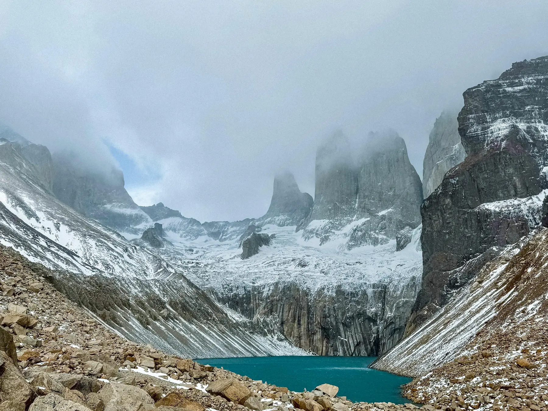
Once you reach the Mirador Base Las Torres (870m), the three granite spires rise abruptly from a turquoise glacial lake. It is a sight that requires time to absorb, but keep an eye on the clock: the return journey to the valley floor takes nearly as long as the ascent due to the technical nature of the descent.
The final Moraine climb is significantly easier with trekking poles. If you are not using them for the rest of the trek, consider collapsing them and strapping them to your pack until you reach this rocky section, where they provide vital stability on the descent.
Day 2: The Lake Walk to Los Cuernos or Francés
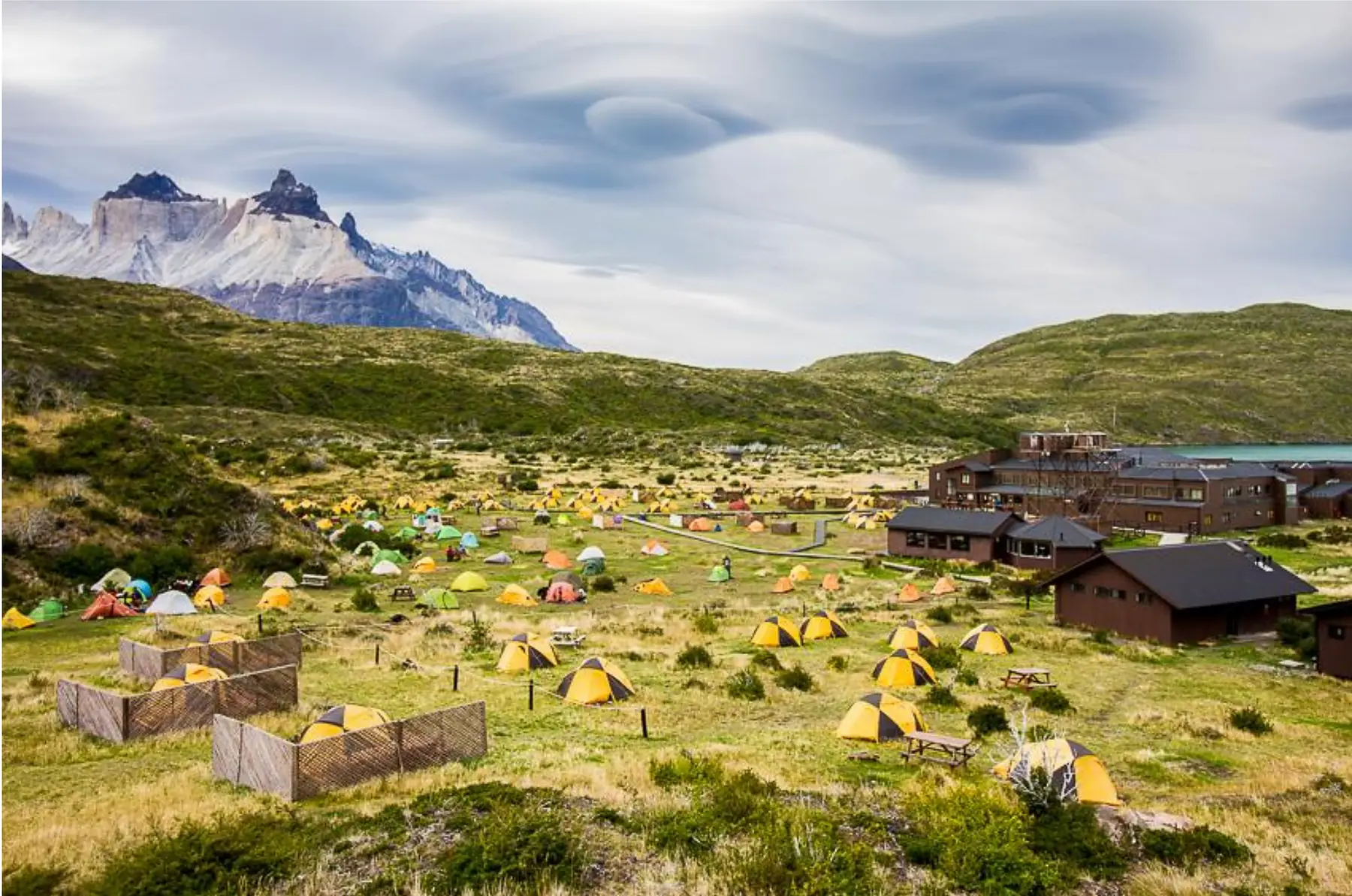
Day two is a transitional stage that moves you from the eastern edge of the park toward the central “W” massif. Most hikers depart from the Central or Chileno area and head west along the shores of Lago Nordenskjöld. This section is often called “Patagonian Flat,” a local joke referring to the fact that while there are no major mountain passes, the trail is a constant series of short, rolling ups and downs.
The sensory experience of this day is dominated by the lake. The water is a startling, milky turquoise, and the trail stays close enough to the shore that you can hear the waves hitting the pebble beaches. You will walk through fields of Ciruelillo (fire bush), which erupts in bright red flowers during the spring.
As you progress, the “Horns” (Los Cuernos) of the Paine Massif begin to loom over the trail. These multi-colored granite peaks, with their distinct black sedimentary caps, provide a dramatic backdrop for the entire afternoon. The trail crosses several small streams and a notable “Swing Bridge” near the beach crossings where the wind off the lake can be particularly strong.
Depending on your booking, you will finish the day at either Refugio Los Cuernos or the Francés Sector. Cuernos is nestled right at the base of the peaks, while Francés is located slightly further along the trail, shortening your hike for the following morning.
Day 3: The French Valley & Mirador Británico (The Heart of the W)
This is the most physically demanding day of the trek, but it is also the most rewarding. The goal is to hike deep into the French Valley, a hanging cirque surrounded by the park’s highest granite walls.
The day begins at the Italiano Ranger Station. This is a critical logistical hub where the “Pack Drop” occurs. It is standard etiquette to leave your large trekking pack in the designated (though unsheltered) area and switch to a small daypack for the steep out-and-back hike up the valley. This allows you to move much faster on the root-entwined forest paths and rocky scrambles ahead.
The first viewpoint is Mirador Francés. From here, you look directly across at the French Glacier on the side of the Paine Grande massif. You will likely hear the glacier before you see it: the thunderous “crack” of ice calving off the mountain sounds like a localized storm. Continue upward for another hour through the forest to reach Mirador Británico. This is the ultimate destination, offering a 360-degree amphitheater of peaks including Cerro Hoja, Cerro Máscara, and the back side of Los Cuernos.
After descending back to Italiano and retrieving your pack, the final leg of the day takes you west toward Paine Grande. You will pass through the “Dead Forest,” a stark landscape of silver, sun-bleached trees killed in the 2011/12 fire. The trail follows the edge of Lago Sköttsberg, where the wind often whips up “water devils” across the surface.
While the pack drop at Italiano is generally safe and respected by the trekking community, never leave valuables (passport, cash, electronics) in your abandoned pack. Keep these in your daypack for the hike up the valley.
Day 4: To the Ice Fields of Glacier Grey
The fourth day leads you to the western edge of the “W.” Leaving the bustle of Paine Grande behind, the trail climbs steadily into a narrow valley that acts as a natural wind tunnel. This area is famous for “Banshee” winds that can funnel through the gap at incredible speeds, sometimes requiring hikers to crouch low to maintain balance.
The terrain here is a mix of rocky outcrops and low-lying scrub. After about 1.5 to 2 hours of climbing, you will reach the “Grey Lookout.” This is the moment the Southern Patagonian Ice Field reveals itself. You will see the massive tongue of Glacier Grey in the distance and, closer to shore, giant blue icebergs (tempanos) floating in the grey-green water of the lake.
The final descent toward Refugio Grey takes you through lush Lenga forests. The temperature often drops as you get closer to the glacier, as the ice creates its own microclimate. The forest provides a welcome windbreak, and the trail becomes softer with leaf litter and soil.
Day 5: The Suspension Bridges and the Exit
The final day offers a choice between a relaxing morning by the ice or one last push for the best views in the park. To see the face of Glacier Grey up close, you must continue past the Refugio toward the suspension bridges.
The first bridge is a 15-minute walk from the Refugio; the second, and more dramatic bridge, is about an hour further. Standing on these swaying structures, hundreds of feet above the ravines, you get a clear, unobstructed view of the glacier’s cracked, blue surface.
After returning to the Refugio, you will retrace your steps back to Paine Grande. This return leg feels different as you are now walking away from the ice and toward the open pampa. You must time your arrival at Paine Grande to coincide with the Lake Pehoé catamaran departures. The boat ride across the turquoise water of Lake Pehoé is the emotional end of the trek, offering a final panoramic view of the entire W massif you just navigated.
The journey officially concludes at Pudeto, where the catamaran connects with the buses back to Puerto Natales. For the 2026/27 season, afternoon catamaran departures from Paine Grande are typically scheduled for 11:00, 16:15, and 18:00, though you should verify the current seasonal timetable at your refugio as times can shift based on weather and demand.
Directional Note: Hiking West-to-East (W-E)
While this guide follows the East-to-West flow, many hikers choose to start at Glacier Grey and finish at the Towers. This direction allows you to save the park’s most famous landmark for the final morning.
If you are hiking West-to-East, you can use this guide by reading the sections in reverse (Day 5 to Day 1). The primary difference is the wind: on the W-E route, you will often find the prevailing winds at your back rather than hiking directly into them. For a detailed comparison of which direction is right for you, refer back to our itinerary planning guide.
To prepare for the specific terrain and weather conditions described in these stages, use the resources below to finalize your kit and logistics.
Related guides

FAQ
What is the hardest day on the W Trek day by day? Most hikers find Day 3 (the French Valley and Mirador Británico) to be the most difficult due to the 20km+ distance and the steep, rocky terrain in the valley.
How many miles do you walk each day on the W Trek? You will typically walk between 7 and 13 miles per day on the W Trek, with the shortest day being the trek to Glacier Grey and the longest being the French Valley.
Is the W Trek trail well-marked for every day of the hike? The W Trek is exceptionally well-marked with yellow-topped stakes and frequent signage at every major junction, making it easy to navigate self-guided.
Are there toilets available during the day on the W Trek? Toilets are only available at the official Refugios and Ranger Stations (Italiano and Laguna Amarga); there are no facilities on the trail between these sectors.
Do I need a map for the W Trek day by day? While the trail is well-marked, you should carry a physical or offline digital map of the Torres del Paine circuit to track your progress and understand elevation changes.