
Cerro Castillo Trek Guide: 2026 Circuit & Route Planning
The Cerro Castillo trek is the premier wilderness alternative to the W Trek for hikers who prioritize solitude and rugged terrain over refugio comforts. This 54 kilometer circuit delivers the same dramatic aesthetic as Torres del Paine - jagged basalt spires, turquoise glacial lagoons, and hanging ice - but with a fraction of the foot traffic and a significantly higher degree of self-sufficiency required.
For the 2026 season, Cerro Castillo remains a true backcountry experience. Unlike the highly regulated trails to the south, there are no luxury lodges or pre-set tents here. You will carry your own gear, pitch your own tent, and navigate scree slopes that feel worlds away from the manicured paths of the more famous national parks. If you want to see the “old Patagonia” before the crowds arrived, this is the trail to hike.
Why the Cerro Castillo Trek is the “New W Trek”
The comparison to the W Trek is inevitable because the landscapes are strikingly similar, yet the experience of hiking them is diametrically opposed. While the W Trek sees hundreds of hikers per day during the peak summer months, you may only encounter a dozen other people on the Cerro Castillo circuit.
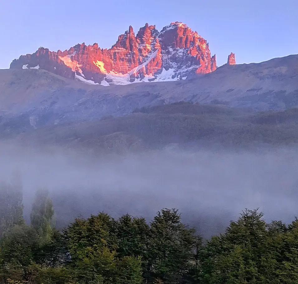
This solitude comes from a difference in infrastructure. There are no refugios on this trek; you must be prepared to camp every night. The rewards for this effort are views that rival any in the world, specifically the “castle” basalt spires that give the range its name. While the W Trek follows a lower-elevation valley floor for much of its length, Cerro Castillo stays high, offering constant panoramic views of the Aysén region’s wild interior.
To see how this route fits into the broader landscape of Patagonian hiking, you can explore our guide to the best multi-day treks in Patagonia.
- Crowds: Low; dozen hikers per day - vs - High; hundreds per day
- Accommodation: Wild camping only - vs - Luxury refugios and serviced campsites
- Trail Condition: Rugged, loose scree, minimal signage - vs - Well-maintained, clear signage
- Logistics: Flexible; usually first-come, first-served - vs - Rigid; must book 6-10 months in advance
Choose Cerro Castillo if you are an experienced hiker seeking solitude and a rugged, self-supported wilderness experience.
Logistics: Reaching the Aysén Region from Puerto Natales
It is important to understand the geography before you pack your bags. Cerro Castillo is located in the Aysén region, approximately 850 kilometers north of Puerto Natales. While many travelers visit both, you should treat them as two distinct legs of a journey rather than a single local area.
To bridge the gap between the Puerto Natales cluster and the Aysén region, you have three primary options. The most scenic is the Navimag ferry, which travels from Puerto Natales to Puerto Yungay or Puerto Chacabuco through the Patagonian fjords over four days. For those short on time, seasonal flights connect Punta Arenas (PUQ) to Balmaceda (BBA) via Aerovías DAP, or you can fly from Puerto Natales (PNT) to Balmaceda with a connection in Santiago or Puerto Montt. The third option is a long-haul bus journey that crosses into Argentina via Ruta 40 and back into Chile, which typically takes 18-24 hours.
For more information on coordinating your arrival in the south, see our Puerto Natales how-to-get-there guide.
Coyhaique is your essential supply hub. It is the last place to buy high-quality trekking food, specialized gear, or white gas and isobutane canisters before heading to the trailhead. Villa Cerro Castillo has very limited supplies.
The 4-Day Circuit: Route Summary and Map
The standard Cerro Castillo circuit covers roughly 54 kilometers and involves significant elevation gain, particularly on days two and three. Most hikers complete the route in four days, which allows for a side trip to the Laguna de los Témpanos.
The most logical flow is to hike from north to south, starting at the Las Horquetas trailhead and ending in the village of Villa Cerro Castillo. This direction ensures the wind is generally at your back and allows you to finish the trek by walking directly into town for a celebratory meal. While the trail is marked with yellow and white paint on rocks, these markers disappear in the high scree fields. You should carry a digital navigation tool like Gaia GPS or AllTrails with offline maps downloaded.
Cerro Castillo Trek at a Glance
- Total Distance: 54 km (33.5 miles)
- Duration: 4 days / 3 nights
- Total Elevation Gain: ~2,800 meters
- Difficulty: Challenging (Grade 4)
- Best Time: December - March
- Permits: Entrance fee paid via PasesParques.cl or at Las Horquetas
Day 1: Las Horquetas to Campamento Turbio
The first day is a relatively gentle introduction to the Aysén backcountry. You will start at the Las Horquetas ranger station, located on the Carretera Austral about 75 kilometers south of Coyhaique.
The trail begins on a flat 4x4 track through old-growth Lenga forests and river valleys. The primary challenge on this day is often mud, as the valley floors retain moisture long after the rain stops. You will cross several small streams that can be hopped over or waded through easily. The day ends at Campamento Turbio, a forested site that provides excellent protection from the wind.
You must arrive at the Las Horquetas ranger station before 1:00 PM to start the trek. Rangers strictly enforce this cutoff for the 2026/27 season to ensure hikers reach the first campsite safely before nightfall.
As of the 2026/27 season, the entrance fee for the national park is 30,000 CLP for international visitors. It is highly recommended to purchase your ticket in advance through the official PasesParques.cl platform, though cash payments may still be accepted at the ranger station depending on connectivity.
Day 2: The Peñon Pass and the Iceberg Lagoon
Day two is the most physically demanding section of the trek. You will climb roughly 900 meters to the summit of Paso El Peñon, the highest point on the circuit. The terrain shifts from forest to loose, shifting scree that requires careful footing. Even in mid-summer, you should expect to encounter snow patches on the south side of the pass.
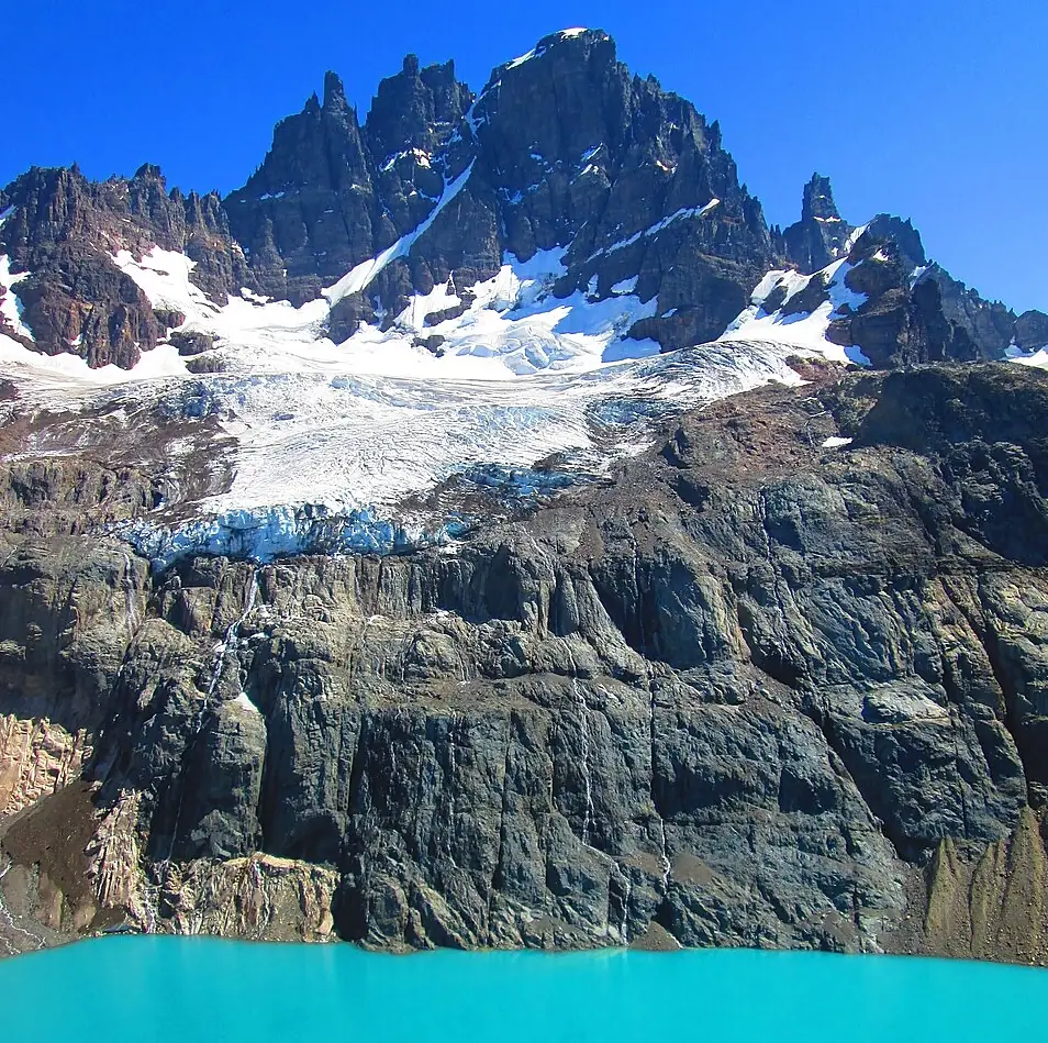
Once over the pass, the trail drops toward the iconic Laguna de los Témpanos (Iceberg Lagoon). This is a detour from the main circuit but is non-negotiable for the views of the hanging glacier calving into the turquoise water. After visiting the lagoon, you will descend a steep, technical section of scree. Note that Campamento El Bosque is currently closed for overnight camping to allow for forest recuperation; hikers must continue to Campamento El Peñon or Campamento Porteadores.
Day 3: Laguna Cerro Castillo and the “Castle” View
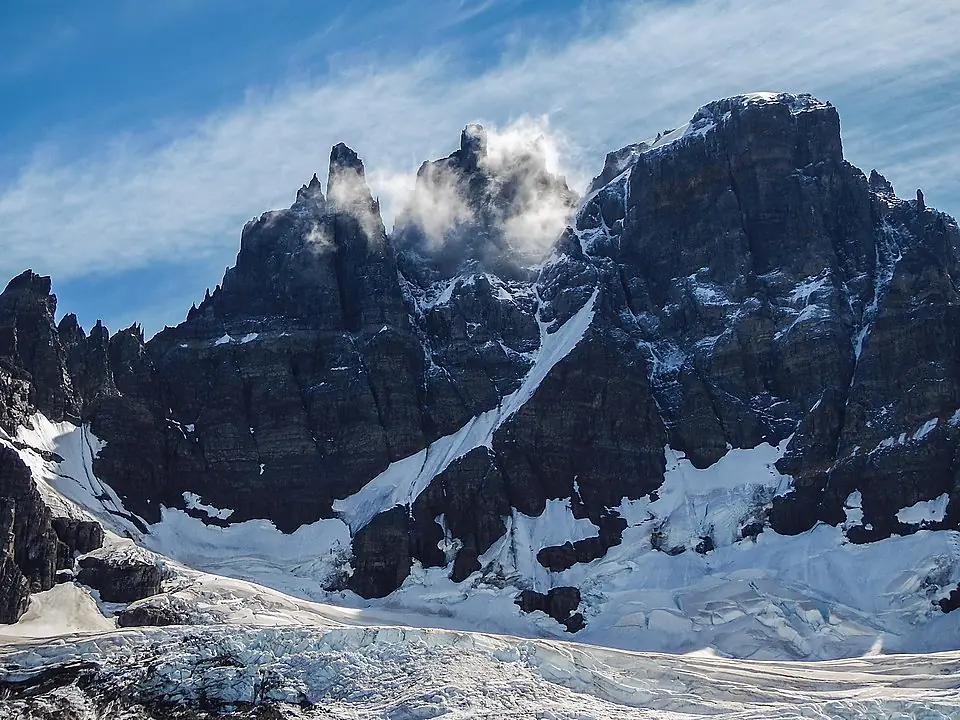
This is the day you came for. The trail climbs out of the forest to the rim of the Laguna Cerro Castillo. This is the “postcard view” of the trek: the jagged basalt spires of the mountain rising vertically above a deep blue glacial lake.
After spending time at the lagoon, you will cross the Morro Negro Pass. From this vantage point, you have 360-degree views that include the massive General Carrera Lake to the south and the distant, snow-capped Hudson Volcano.
At this point, you have a choice. You can take the “Emergency Route” (Sendero de Emergencia) which drops steeply and directly down to the village of Villa Cerro Castillo if you are tired or the weather is turning. However, if conditions are good, continue to Campamento Neozelandés. This site is the most beautiful on the trek and serves as a base for a side trip to Laguna Duff, a high-alpine basin surrounded by granite walls.
Day 4: Descent to Villa Cerro Castillo
The final day is a long, steady descent from the high mountains into the Ibáñez River valley. You will have constant views of the winding river and the sprawling pampa below as you drop back into the forest.
The trail eventually meets a farm track that leads directly into the village of Villa Cerro Castillo. Walking into town after four days in the wilderness is a highlight of the trip. The village is small and dusty but has a growing number of amenities for trekkers.
If you are planning your return to the southern hubs after your time in Aysén, you can find more information in our Puerto Natales destination guide.
Difficulty, Safety, and River Crossings
The Cerro Castillo trek is a Grade 4 hike, meaning it is significantly more difficult than the W Trek. The primary challenges are the steepness of the passes, the instability of the scree slopes, and the lack of bridges over several river crossings.
When crossing unbridged streams, always unbuckle your backpack’s hip belt and chest strap. If you fall, you need to be able to shed your pack immediately so it doesn’t pin you down in the current. Bring a pair of lightweight sandals or neoprene socks specifically for these crossings to protect your feet from sharp rocks while keeping your hiking boots dry.
The water on the trail is generally safe to drink directly from glacial streams. However, in the first section near Las Horquetas and the final descent into the village, cattle may graze near the water. In these lower-elevation areas, it is recommended to use a filter or purification tablets.
Planning Your 2026 Trek: Permits and Packing
For the 2026 season, the Cerro Castillo circuit remains a first-come, first-served experience for the backcountry campsites. You do not need to book specific campsites months in advance like you do in Torres del Paine, but you must purchase a park entry permit. It is highly recommended to do this via the official CONAF portal (PasesParques.cl) before arrival.
Because of the rugged terrain, specific gear is required. Sturdy, high-ankle hiking boots are mandatory for navigating the loose scree on the passes. Trekking poles are highly recommended to save your knees on the 900-meter descents. Finally, ensure your tent is a true 4-season model; the winds on the exposed passes can reach 80 km/h, which will easily snap the poles of a standard summer tent.
If you find that the logistics or difficulty of Cerro Castillo seem too high for your current experience level, consider looking at other multi-day hikes in the region that offer more infrastructure.
FAQ
How hard is the Cerro Castillo trek compared to the W Trek? The Cerro Castillo trek is significantly more difficult than the W Trek due to steeper elevation gains, loose scree terrain, and a lack of refined trail infrastructure like bridges and refugios.
Do I need to book the Cerro Castillo trek in advance for 2026? While you do not need to book specific campsites, you must purchase a park entry permit via PasesParques.cl. The trek itself remains first-come, first-served for camping spots.
How many days does the Cerro Castillo trek take? The standard Cerro Castillo circuit takes 4 days and 3 nights, though fast hikers can complete it in 3 days by skipping the Neozelandés valley.
Is there drinking water available on the Cerro Castillo trek? Yes, there is abundant glacial water along the Cerro Castillo trek, though it is recommended to filter or treat water collected near the first and last sections where cattle may graze.
Can I do the Cerro Castillo trek as a day hike? Yes, you can do a challenging day hike from Villa Cerro Castillo to the main lagoon and back, which takes approximately 6-8 hours and covers the most iconic viewpoint.
What is the best month to hike the Cerro Castillo trek? The best time to hike Cerro Castillo is from December to March, during the Austral summer, when the mountain passes are most likely to be clear of deep snow.