
Dientes de Navarino Trek: The 2026 Trail Guide & Logistics
The Dientes de Navarino is the southernmost multi-day trekking circuit in the world, located on Isla Navarino at the tip of South America. It is a challenging, 53-kilometer route that requires approximately five days to complete, demanding high-level navigation skills and total self-sufficiency in a sub-antarctic wilderness.
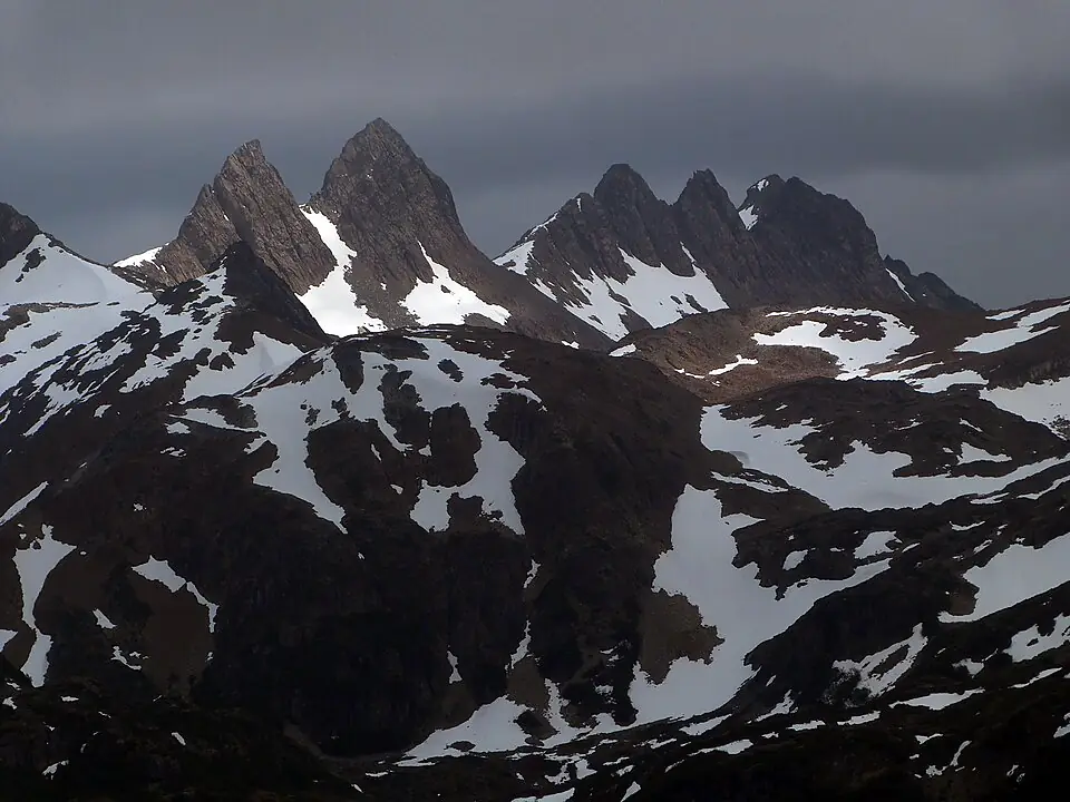
While the famous W Trek in Torres del Paine offers groomed trails and comfortable refugios, the Dientes Circuit offers raw isolation. Here, the “trail” often disappears into peat bogs or scree slopes, and you are more likely to encounter an Andean condor than another hiking group. For those who find Patagonia’s more famous routes too crowded, this is the final frontier of trekking. It is a journey into the “Teeth of Navarino,” a jagged range of basalt peaks that stands as the last significant landmass before the Drake Passage and Antarctica.
The Southernmost Trek: Why Dientes de Navarino?
The primary draw of Isla Navarino is its profound sense of solitude. While the best multi-day treks in Patagonia often see hundreds of hikers per day, the Dientes Circuit averages fewer than twenty. This isolation is a direct result of its geography. Located south of the Beagle Channel, the island is a landscape of dramatic contrasts: sub-antarctic forests of stunted Nothofagus trees give way to high-altitude polar tundra and grey-green rock.
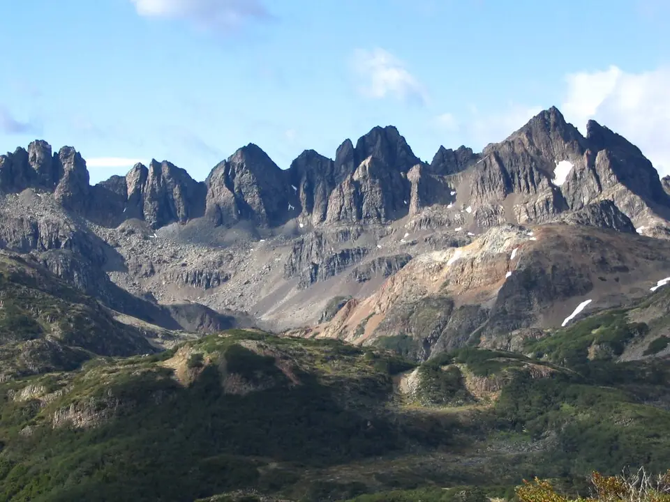
The “Dientes” (Teeth) themselves are a series of jagged, dark basalt spires that dominate the skyline. The terrain is a complex mosaic of high-altitude bogs, glacial lagoons, and steep mountain passes. Unlike the granite towers of the north, the geology here feels older and more weathered. It is a place where the weather is dictated by the immediate proximity of the Southern Ocean, creating an environment that feels significantly more “polar” than the Chilean mainland.
Logistics: How to Get to Isla Navarino in 2026
Reaching the trailhead in Puerto Williams is the first major hurdle of the expedition. Because Isla Navarino is separated from the South American mainland by the Strait of Magellan and the Beagle Channel, you cannot simply drive there. You have three primary options for reaching the island in the 2026/27 season, each requiring significant lead time for bookings.
- Speed: 1 hour vs 30+ hours vs 30 minutes
- Cost: High (approx. $130-170 USD) vs Medium ($120-140 USD) vs Medium ($120-150 USD)
- Reliability: Weather dependent vs Highly reliable vs Weather dependent
- Booking Lead: 3-4 months vs 2 months vs 1-2 weeks
The DAP flight is the most efficient, but the ferry offers an unparalleled 30-hour journey through the fjords for those with extra time.
Most trekkers arrive traveling from Punta Arenas via DAP Airlines. As of the 2026/27 season, flights typically operate daily (Monday–Saturday) using small, 20-seat Twin Otter or King Air aircraft. Because of the plane size, there is a strict weight limit for luggage, usually 10kg for checked bags and 5kg for carry-on, with steep fees for excess weight. For those who prefer the sea, the Transbordadora Austral Broom (TABSA) ferry departs Punta Arenas once per week (typically Thursdays). It is a cargo-heavy vessel that winds through the Alberto de Agostini National Park, offering views of glaciers that are inaccessible by any other means.
If you are coming from Argentina, you must cross the Beagle Channel from Ushuaia. This is handled by small boat operators like Onashaga or Ushuaia Boating. These Zodiac crossings are short but can be cancelled due to high winds. Once you land at Puerto Navarino, a van typically meets the boat to take you the final 50km to Puerto Williams. Note that as of 2025, port taxes (approx. $5-10 USD) are often charged separately from the ticket price.
Regardless of how you arrive, your first stop in Puerto Williams must be the Carabineros (police) station. You are required to register your passport, provide your planned route, and list your emergency equipment. This is a mandatory safety protocol; you must also check back in upon your return to avoid triggering an unnecessary search and rescue operation.
Difficulty and Terrain: What to Expect
The 53km distance of the Dientes de Navarino is deceptive. In a standard mountain environment, a fit hiker might cover this in three days; on Navarino, five days is the standard. The difficulty stems from the lack of a “tread.” You are not walking on a packed dirt path; you are navigating through deep peat bogs (turbales), scrambling over loose volcanic scree, and balancing on beaver dams.
Who this trek is NOT for: This circuit is not suitable for casual hikers or those whose only experience is the W Trek. If you are uncomfortable navigating via GPS in whiteout conditions, scrambling on unstable rock with a 15kg pack, or spending five days in wet boots, this trek will be a miserable and potentially dangerous experience.
Navigation is the primary mental challenge. The trail is marked by a series of 38 “Hitos” (landmarks/signposts) established by the Chilean Ministry of National Property. However, many of these markers are small, fallen, or obscured by snow and fog. In clear weather, the route is intuitive; in a sudden “whiteout” or heavy rain, the trail effectively disappears.
The environmental impact of invasive North American beavers is another factor. Introduced in 1946, beavers have no natural predators on the island and have decimated the local forests. Their dams have flooded large sections of the traditional valleys, forcing trekkers to either balance across the dams themselves or detour through thick, unpathed forest.
The Dientes de Navarino Itinerary: 5 Days at the Edge
This itinerary follows the standard counter-clockwise circuit. While some fast-packers complete it in less time, a five-day pace allows for the inevitable weather delays. This route is significantly more demanding than the W Trek due to the constant elevation changes and technical footing.
Day 1: Puerto Williams to Laguna del Salto
The trek begins with a steep climb from the outskirts of Puerto Williams up to Cerro Bandera. This is your first taste of the wind and your last look at “civilization.” From the summit, you’ll see the Beagle Channel and Ushuaia in the distance before dropping into the valley toward Laguna del Salto. This is a short day (approx. 3-4 hours) designed to test your gear and your legs.
Day 2: Laguna del Salto to Laguna Escondida
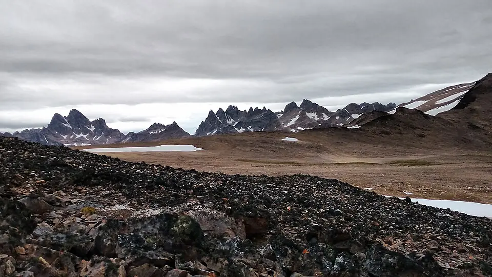
This is where the terrain becomes technical. You will cross Paso Primero and Paso Australia, navigating around the base of the basalt “Teeth.” The views here are some of the most dramatic on the circuit, with jagged spires reflecting in alpine tarns. You will likely spend much of this day on scree slopes.
Day 3: Laguna Escondida to Laguna Martillo
The most remote section of the trek takes you through the “Mordor” landscapes of Paso Ventarrón. The vegetation disappears, replaced by a world of rock and wind. Navigation is critical here as you descend toward Laguna Martillo, a large lake often surrounded by beaver-impacted wetlands.
Day 4: Laguna Martillo to Laguna Guanacos
This is the crux of the trek. You must climb to Paso Virginia, the highest point of the circuit at 859 meters. The climb is steep, but the descent on the other side is the real challenge: a massive, loose scree slope that drops hundreds of meters toward Laguna Guanacos. This section is dangerous in high winds and should be approached with extreme caution.
Day 5: Laguna Guanacos to Puerto Williams
The final day is a long descent through forests and bogs. After four days in the high alpine, the return to the treeline can feel claustrophobic. You will eventually emerge onto a gravel road near the old fish processing plant (Pesquera), from where it is a flat 7km walk or a pre-arranged shuttle back to town.
Weather and Seasonality: The Window for 2026/27
The trekking season on Navarino is short, running from December to March. Outside of this window, the passes are choked with snow and the daylight hours are too short for safe navigation. Even in the height of summer, the “Polar Tundra” climate means you must be prepared for everything.
Unlike the “Steppe” climate of Torres del Paine, which is characterized by high winds and rapid clearing, Navarino weather is often damp, cold, and persistent. Snow is possible in January, and temperatures frequently hover between 5°C and 12°C during the day, dropping toward freezing at night.
The wind on Paso Virginia is the greatest objective hazard. Because the pass acts as a funnel for weather coming off the Drake Passage, gusts can reach speeds that make standing upright impossible. If the forecast or your local intuition suggests a storm, you must be prepared to wait it out in your tent at a lower elevation.
Camping, Water, and Leave No Trace
There are no refugios, no pre-set platforms, and no toilets on the Dientes Circuit. You are camping in a pristine, fragile wilderness.
Water and “Beaver Fever” Water is abundant in every valley, but it is not safe to drink untreated. The invasive beaver population has introduced Giardia lamblia to almost every water source on the island. You must use a high-quality filter (like a Sawyer Squeeze or Katadyn BeFree) or chemical treatment for every drop.
Camping and Fragility The sub-antarctic mosses and lichens grow at an agonizingly slow rate. When choosing a campsite, look for established “hard” ground where others have camped before. Avoid pitching your tent on virgin moss. Because there are no facilities, the “pack it out” rule applies to everything, including human waste in high-altitude areas where it cannot be properly buried.
Fuel Logistics You cannot fly with camping gas canisters. In Puerto Williams, you can usually find EN417 screw-top canisters (Isobutane/Propane) at local ferreterías (hardware stores) or small grocery stores like Simon y Simon. As of the 2026/27 season, stock is generally reliable during the peak months of January and February, but can be spotty in the shoulder season. It is recommended to purchase your fuel immediately upon arrival in town.
Navigation and Safety: Essential Tech
Because the trail is frequently non-existent, a smartphone with a backup power bank is not just a convenience—it is a piece of safety equipment. Do not rely on the physical “Hitos” alone; they are too easily missed in bad weather.
Download the “Bienes Nacionales” digital trekking guide before you arrive. It provides the GPS coordinates for every Hito. Use an app like Gaia GPS or AllTrails with the “Offline Maps” feature enabled, as there is zero cell service once you leave Puerto Williams.
A satellite communication device (Garmin inReach or Zoleo) is strongly recommended. If you break an ankle on Paso Ventarrón, you are at least two days’ walk from help. The Puerto Williams naval base coordinates rescues, but without a satellite messenger, you are dependent on another hiker finding you—and on this trail, that could take days.
Essential Gear for Isla Navarino
Your gear list for Navarino should be more robust than a standard Patagonia packing list. The terrain is wetter and the environment more abrasive.
- Footwear: You need high-cut, waterproof boots with a stiff sole for scree. Lightweight trail runners will be destroyed by the rock and soaked by the bogs within hours.
- Gaiters: These are non-negotiable. They keep the mud and peat out of your boots and protect your trousers from the dense “Krummholz” (stunted forest) branches.
- Shelter: A true 4-season tent or a very high-quality 3-season tent (like a Hilleberg or MSR Access) is required. The winds on the ridges can snap lightweight tent poles.
- Trekking Poles: Essential for testing the depth of bogs before you step into them and for stability on the steep scree descent of Paso Virginia.
To see how this gear fits into a broader trip, or if the Dientes sounds too intense for your current experience level, explore our other guides.
To go deeper into Patagonia’s trekking options:
[LinkCard url=“/gear/patagonia-packing-list/” title=“The Ultimate Gear Guide” teaser=“From 4-season tents to the best waterproof shells, ensure your kit can handle the End of the World.” /] [LinkCard url=“/hikes/best-patagonia-treks/” title=“Top 10 Patagonia Treks” teaser=“If Dientes feels too rugged, discover more accessible multi-day routes across the region.” /]
FAQ
Is the Dientes de Navarino trek harder than the O Circuit? Yes, the Dientes de Navarino trek is significantly harder due to the lack of maintained paths, frequent mud bogs, and the requirement to navigate via GPS rather than clear trail markings. It is also even more isolated than the O Circuit, with no infrastructure or emergency support nearby.
Do I need a guide for the Dientes de Navarino trek? While a guide is not legally required for the Dientes de Navarino trek, it is highly recommended for those without extensive experience in off-trail navigation and remote wilderness survival.
Can I fly to the Dientes de Navarino trek from Ushuaia? No, there are no commercial flights between Ushuaia and Puerto Williams; you must take a small boat or Zodiac crossing across the Beagle Channel to reach the Dientes de Navarino trailhead.
Is there cell service on the Dientes de Navarino trek? There is no cell service on the Dientes de Navarino circuit once you leave the immediate vicinity of Puerto Williams, making a satellite communication device essential for safety.
What is the best month to hike Dientes de Navarino? The best months to hike the Dientes de Navarino are January and February, when you have the most stable daylight and the lowest (though still present) chance of heavy snowfall.
Is the water safe to drink on the Dientes de Navarino trek? While water is abundant, you must filter or treat all water on the Dientes de Navarino trek due to the presence of invasive beavers and the risk of Giardia.