
Tierra del Fuego National Park Guide: 2026 Hikes & Logistics
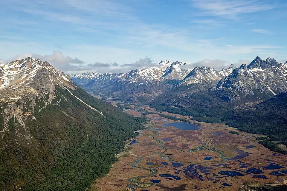
Tierra del Fuego National Park is the only protected area in Argentina where the mountains and sub-Antarctic forests meet the marine coast of the Beagle Channel. Located just 12km west of Ushuaia, it provides the most accessible way to experience the dramatic “End of the World” landscapes through a network of coastal trails, peat bogs, and alpine climbs.
This guide provides the definitive logistical framework for the 2026/27 season. Whether you are navigating the park via the local shuttle system, hiking the rugged Senda Costera, or visiting the iconic Pan-American Highway terminus, you will find the specific timing and pricing details needed to plan an independent visit. For broader context on the region, including where to stay and eat before your trip, consult our Ushuaia destination hub.
Essential Park Logistics: 2026/27 Season
The park is open year-round, but the primary window for hiking and full facility access runs from October through April. During these months, the sun sets as late as 10:00 PM, providing ample daylight for longer treks like Cerro Guanaco, though you should always aim to be off the trails before dusk.
Tierra del Fuego at a Glance
- Distance from Ushuaia: 12km (7.5 miles) via National Route 3
- Gate Hours: 8:00 AM - 8:00 PM daily (High Season)
- Alakush Visitor Center: 10:00 AM - 6:00 PM
- Key Wildlife: Red fox, North American beaver, Andean condor
- Primary Landscape: Magellanic sub-polar forest and marine coastline
- Cell Service: Non-existent once past the entrance gate
While the weather in the park is nearly identical to the city, the coastal winds can make the trails feel significantly colder. For a detailed breakdown of what to expect during your specific travel month, see our guide to Ushuaia weather and seasonality.
If you plan to stay overnight, there are no hotels or lodges inside the park boundaries. The only option for staying within the park is camping at designated sites like Laguna Roca (Lago Acigami). For details on gear requirements and permit processes, visit our Ushuaia camping guide.
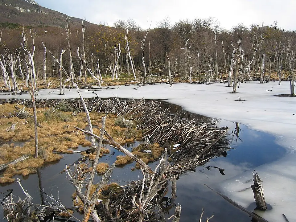
Visitors should be aware of the ecological impact of the North American beaver, an invasive species introduced in the 1940s. You will see “beaver meadows” where once-lush forests have been drowned by dams. While they are fascinating to observe, do not drink from the streams in these areas, as the water can carry parasites.
Tierra del Fuego National Park Entrance Fees
Entrance fees for the 2026 season are tiered based on residency, with international visitors paying the highest rate. It is important to note that the park administration has transitioned toward a digital-first payment system, and relying on cash at the gate can be risky due to frequent connectivity issues with their payment terminals.
As of the 2026/27 season, the international adult fee is approximately 40,000 ARS. Due to high inflation in Argentina, these rates are subject to frequent adjustments; always verify the current price on the official APN (Administración de Parques Nacionales) portal before your visit. One of the most important cost-saving measures is the 50% discount for a second-day visit. To claim this, you must return within 72 hours of your first entry. Crucially, this discount is often only applied if you purchase your tickets through the official Ventaweb portal in advance or validate your ticket at the gate upon exit.
Payment at the gate is accepted in Argentine Pesos (ARS) or via credit card, but the remote location means the card machines fail often. Always carry enough cash to cover your entry just in case. If you purchase online, you can simply show the QR code on your phone or a printed voucher to the ranger.
How to Get to the Park from Ushuaia
Most travelers reach the park via a 20-25 minute drive from downtown Ushuaia. While rental cars offer the most flexibility for photographers wanting to catch the “golden hour” light, the majority of hikers use the efficient local shuttle system that connects the city to the primary trailheads.
- Cost: Mid-range (~$20-25 USD round trip) vs High (Rental) vs Highest (Train + Shuttle)
- Flexibility: Fixed schedule vs Total freedom vs Very restricted
- Accessibility: 7 drop-off points vs Anywhere with a road vs Two specific stations
- Logistics: Departs from Maipú & Juana Fadul vs Pick up at airport/center vs Requires taxi to station
For hikers, the shuttle is the most practical choice as it allows for point-to-point treks like the Senda Costera without needing to walk back to a parked car.
Shuttles depart from the main bus terminal area at the intersection of Maipú and Juana Fadul in downtown Ushuaia. They typically run every hour starting at 8:00 AM or 9:00 AM during the summer months. These minibuses make multiple stops: the Train Station, the Entrance Gate, Bahía Ensenada (Senda Costera trailhead), Laguna Acigami, and Lapataia Bay.
For those who prefer a more structured arrival, a taxi or “remis” can be hired for a fixed rate. This is a good option for groups of four, as the cost is often comparable to four shuttle tickets and includes the convenience of door-to-door service. If you are still planning your arrival into the region, see our guide on how to get to Ushuaia.
The End of the World Train (Tren del Fin del Mundo)
The Southern Fuegian Railway, popularly known as the End of the World Train, is a heritage steam train that follows the final 7km of the route once used by prisoners from the Ushuaia penal colony. While it is a major tourist attraction, it is important to understand its logistical limitations: the train does not take you to the “End of Route 3” or the main hiking trails. It drops you at the “Estación del Parque,” which is still several kilometers from the coast.
The journey begins at the “End of the World” station, located about 8km west of the city. During the ride, you will hear the history of the “wood train” and pass through the Cañadón del Toro. You can choose between Tourist, Superior, and First Class. For the 2026/27 season, Tourist Class tickets for international visitors start at approximately $40 USD (payable in ARS at the current rate), while First Class can exceed $80 USD.
The train ticket does NOT include the National Park entrance fee. You must pay the park entry fee separately, either online or at the entrance gate, even if you are only taking the train into the park.
If you take the train, you will need to coordinate a pickup with a shuttle or taxi at the park station, or be prepared for a long walk along the road to reach the actual trailheads. Most travelers find it more efficient to take the train one way and have a shuttle meet them at the end of the line to continue deeper into the park.
Bahía Ensenada Zaratiegui & The Post Office
Bahía Ensenada Zaratiegui is often the first stop for visitors and serves as the trailhead for the Senda Costera. It is home to the “End of the World Post Office” (Unidad Postal Fin del Mundo), a small corrugated iron shack perched on a pier.
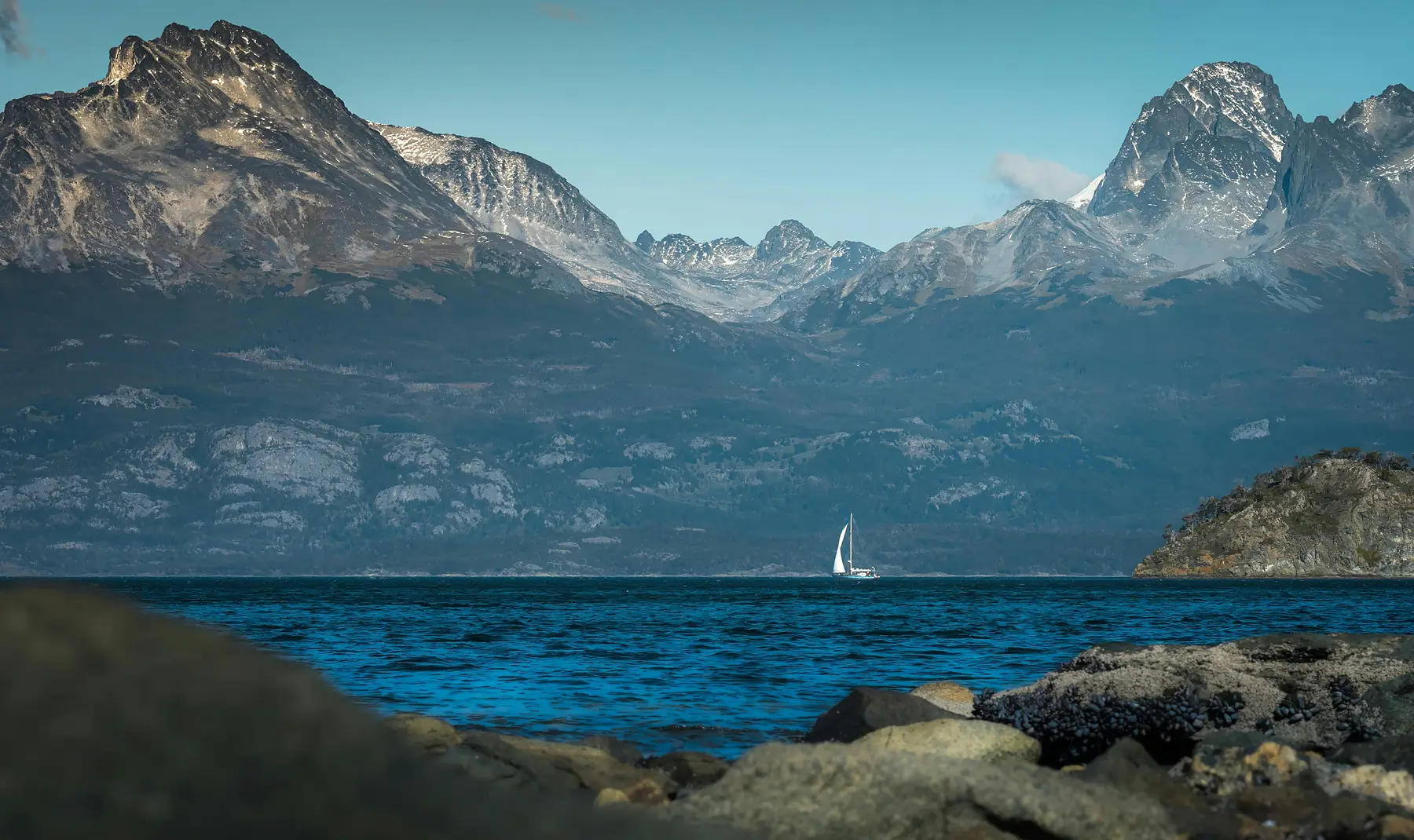
Local Ranger observationThe view from Ensenada is one of the few places where you can see the true border of the world: the dark waters of the Beagle Channel stretching toward the jagged peaks of Isla Navarino in Chile.
The post office’s operational status is notoriously inconsistent as it is a private concession. As of 2026, it is primarily a photo opportunity; while it occasionally opens for visitors to purchase “End of the World” passport stamps or mail postcards, travelers should not rely on it being open. Even if the building is closed, the bay itself offers one of the most stunning vistas in the park, with clear views across the Beagle Channel.
Best Hikes in Tierra del Fuego National Park
The park’s trail system is categorized by color: yellow for easy walks, blue for moderate treks, and red for challenging alpine routes. Most trails are well-maintained, but the Fuegian soil is notoriously peat-heavy, meaning mud is a constant factor even in mid-summer.
For a broader look at how these trails compare to other famous treks in the region, such as Laguna Esmeralda, see our comprehensive guide:
Senda Costera (Moderate)
This 8km trail is widely considered the best “bang for your buck” in the park. It hugs the shoreline of the Beagle Channel, weaving through forest and over rocky outcrops. It takes approximately 3 hours to complete and ends near the Alakush Visitor Center. It is a point-to-point hike, so most people get dropped off at Bahía Ensenada and picked up at Alakush or Lapataia.
Cerro Guanaco (Challenging)
This is the park’s premier summit hike. It is a steep, 8km out-and-back trail that climbs roughly 970 meters. The middle section passes through a very muddy peat bog before emerging into an alpine zone of loose scree.
The reward is a 360-degree view of the entire park, the city of Ushuaia, and the Darwin Range in Chile. Budget 4-6 hours for the round trip and check with rangers at the Alakush Center before starting, as they may close the trail in high winds or poor weather.
Hito XXIV (Easy/Moderate)
This 7km out-and-back trail follows the northern shore of Lago Acigami (formerly Lago Roca) to the international border with Chile. The trail is relatively flat and winds through beautiful lenga forests. While you cannot legally cross into Chile here, the “Hito” (border marker) is a popular turnaround point for those seeking a quieter experience away from the coastal crowds.
Lapataia Bay: The End of Route 3
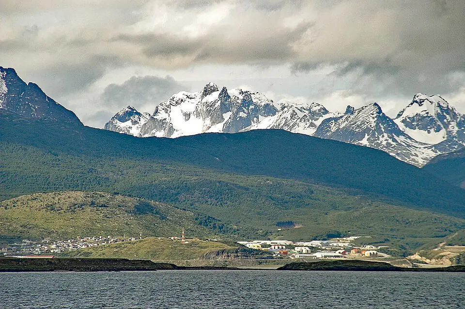
Lapataia Bay marks the literal end of the road. National Route 3 terminates here, forming the southern tip of the Pan-American Highway that stretches all the way to Alaska. The iconic wooden sign indicating the distance to Buenos Aires is the most popular photo spot in the park.
Beyond the photo-op, the Lapataia area features a network of short, interconnected boardwalks that are accessible to almost all fitness levels:
- Paseo de la Isla: An 800m loop that explores the archipelago and the mouth of the Lapataia River.
- Paseo de la Castorera: A short walk to a decommissioned beaver dam, providing a clear look at how these animals reshape the landscape.
- Senda del Turbal: A path through the peat bogs that explains the unique geological formation of the Fuegian soil.
- Mirador Lapataia: A final boardwalk leading to a panoramic view of the bay itself, where the forest meets the fjord-like waters.
The Alakush Visitor Center & Facilities
The Alakush Visitor Center serves as the park’s central hub. Located near the end of the Senda Costera and the shore of Lago Acigami, it is the only place in the park interior with significant facilities.
The center features a large restaurant and coffee shop with floor-to-ceiling windows. Prices are roughly 30-50% higher than in Ushuaia, reflecting the remote location; expect to pay a premium for a standard lunch or coffee. Upstairs, there is a small but well-curated museum dedicated to the Yámana (Yaghan) people, the indigenous nomadic sea-faring inhabitants of the archipelago.
The Yámana People and the Park
The Yámana people lived in this region for thousands of years, navigating the Beagle Channel in bark canoes. The “conchales” (shell middens) found throughout the park are archaeological remains of their ancient campsites. The museum at Alakush provides a vital look at their history and their incredible adaptation to the harsh sub-Antarctic climate.
There is no Wi-Fi or reliable cell service at Alakush, and the restrooms here are the most modern in the park. If you are traveling via shuttle, this is a major pickup and drop-off point, making it a natural place to rest and refuel between hikes.
One-Day Itinerary: The “No-Car” Hiking Blueprint
For travelers relying on the shuttle system, this itinerary maximizes your time on the trails while ensuring you see the most iconic landmarks without needing your own vehicle.
8:30 AM: Departure
Take the first shuttle from the Maipú and Juana Fadul intersection in Ushuaia. Ask the driver to drop you at Bahía Ensenada.
9:00 AM: Post Office & Coastal Hike
Take your photos at the End of the World Post Office and immediately begin the Senda Costera. This 8km trail will take you roughly 3 hours at a steady pace with stops for photos.
12:30 PM: Lunch at Alakush
The Senda Costera ends near the Alakush Visitor Center. This is the perfect time for lunch and a quick visit to the Yámana museum.
1:30 PM: Lapataia Boardwalks
From Alakush, walk the 2km trail (Senda del Turbal) or catch the next shuttle for the short hop to Lapataia Bay. Spend the afternoon walking the Paseo de la Isla and taking your photo at the End of Route 3 sign.
4:30 PM: Return to Ushuaia
Catch the final shuttle of the afternoon from the Lapataia parking lot. Once back in town, we recommend heading to the waterfront for a celebratory King Crab dinner—the perfect end to a day of Fuegian hiking.
FAQ
Is Tierra del Fuego National Park worth visiting? Yes, it is the only park in Argentina that protects a marine coast, and it offers the most accessible sub-Antarctic forest hiking near Ushuaia.
How much is the entrance fee to Tierra del Fuego National Park in 2026? As of the 2026/27 season, the international adult fee is approximately 40,000 ARS, with a 50% discount available for a second consecutive day visit if purchased online or validated at the gate.
Can you see penguins in Tierra del Fuego National Park? No, there are no penguin colonies within Tierra del Fuego National Park; you must book a boat tour to Martillo Island from Ushuaia to see them.
How do I get to Tierra del Fuego National Park from Ushuaia without a car? The most common way is taking the “Regular” shuttle bus from the corner of Maipú and Fadul in downtown Ushuaia, which makes multiple stops throughout the park.
Is the water in Tierra del Fuego National Park safe to drink? While many mountain streams are clean, it is generally advised to bring your own water or buy it at the Alakush Center due to the presence of invasive beavers which can contaminate water sources.
How difficult is the Cerro Guanaco hike in Tierra del Fuego National Park? Cerro Guanaco is considered a challenging hike due to its steep 970-meter elevation gain and potentially muddy peat bog sections, requiring 4 to 6 hours for completion.