
Loma del Pliegue Tumbado Hike: The Best View in El Chaltén (2026)
Loma del Pliegue Tumbado is the premier panoramic day hike in El Chaltén because it is the only trail that provides a simultaneous, unobstructed view of both the Fitz Roy and Cerro Torre massifs from a high-altitude perspective. While most hikers head to the base of these granite spires, this trail takes you above the valleys to a 1,500m vantage point, offering a 360-degree perspective that captures the entire skyline of Los Glaciares National Park in a single frame.
For those looking to escape the high-season crowds of the more famous Laguna de los Tres, Loma del Pliegue Tumbado provides a quieter, more expansive alternative. It is a long, steady climb of 20km round trip that rewards you with views of the Southern Patagonian Ice Field, Lago Viedma, and the turquoise waters of Laguna Torre from a bird’s-eye perspective. Before you set out, it is essential to understand that this trail is highly exposed to the region’s notorious winds, making weather windows even more critical here than on valley-floor treks.
Loma del Pliegue Tumbado Trail Overview & Stats
To help you plan your day, here are the essential logistics for the trek. The trail begins at the Guardaparque Ceferino Fonzo (National Park Visitor Center), located at the southern edge of town. You can view the exact starting point on our El Chaltén trail map.
Loma del Pliegue Tumbado at a Glance
- Distance: 20 km (12.4 miles) round trip
- Elevation Gain: 1,100 m (3,608 feet)
- Time Required: 7-9 hours
- Difficulty: Moderate to Challenging
- Trailhead: Guardaparque Ceferino Fonzo
- Park Entry: Required (Los Glaciares National Park)
The difficulty of this hike is defined by its steady, unrelenting ascent. Unlike trails that feature flat sections through river valleys, this path begins climbing almost immediately and rarely levels off. While the terrain is technically straightforward for the first 8km, the final push to the summit involves navigating loose shale and scree, which can be difficult in high winds.
The trail is marked by yellow-topped stakes. Even if the path becomes obscured by late-season snow or loose rock in the high alpine zone, keep these stakes in sight to ensure you are on the safest route up the ridge.
Why This is El Chaltén’s Best Panoramic Hike
While Laguna de los Tres brings you closer to the granite walls of Fitz Roy, Loma del Pliegue Tumbado is arguably one of the best day hikes in Patagonia because of its scale. From the summit, you aren’t just looking at a mountain; you are looking at an entire geological system.
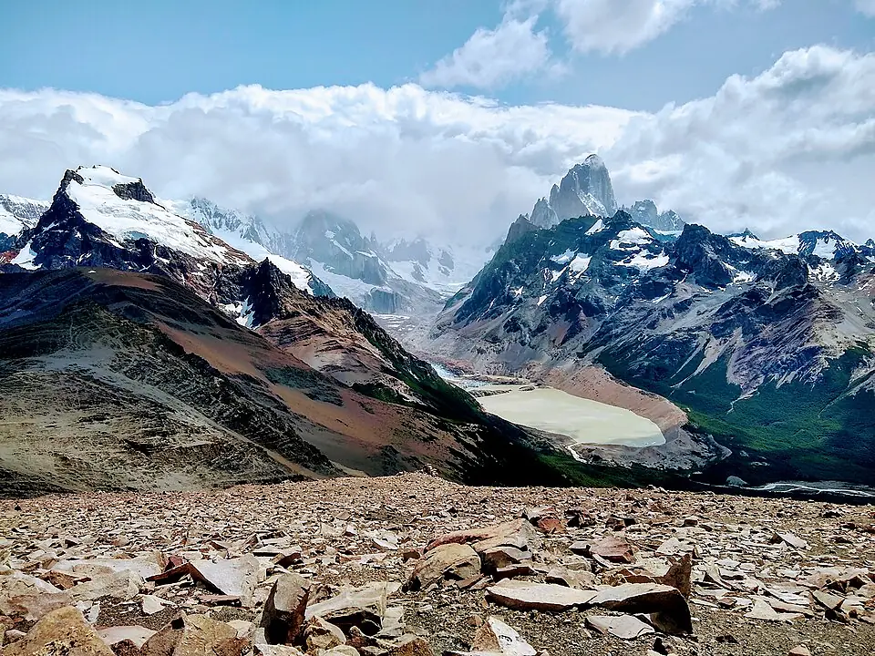
The primary draw is the “Two Peaks, One View” phenomenon. From this specific angle, Mount Fitz Roy and Cerro Torre appear side-by-side, separated by the deep glacial valley that holds Laguna Torre. It is the only place in the park where you can appreciate the sheer distance between these two icons while seeing them both with equal clarity. To the west, the view opens up toward the Southern Patagonian Ice Field, a vast expanse of white that feeds the glaciers you see clinging to the peaks.
Because this trail is less famous than the trek to the base of Fitz Roy, it remains significantly quieter. Even during the peak months of January and February, you may find yourself sharing the summit with only a handful of other hikers, a stark contrast to the “traffic jams” that can occur on the final climb to Laguna de los Tres.
Trail Breakdown: The Journey to the Top
The hike is best visualized in four distinct segments, each with its own terrain and ecological character. If you are basing yourself in El Chaltén, you can walk directly to the trailhead from any accommodation in the southern half of the village.
Section 1: The Ascent from Town
The trail begins at the National Park Visitor Center and immediately climbs through open grasslands. This section offers immediate gratification with views looking back over the village of El Chaltén and the winding Rio Fitz Roy. The path is wide and well-maintained here, though it is completely exposed to the sun.
Section 2: Pampa de las Carretas
After roughly 3km of climbing, the trail enters a high plateau known as Pampa de las Carretas. This is a transition zone where the incline softens briefly. On clear days, this is your first opportunity to see the massive bulk of Mount Huemul across the valley to the south. The vegetation here is low-lying scrub, which provides little protection from the wind but offers wide-open views of the spires ahead.
Section 3: The Lenga Forest
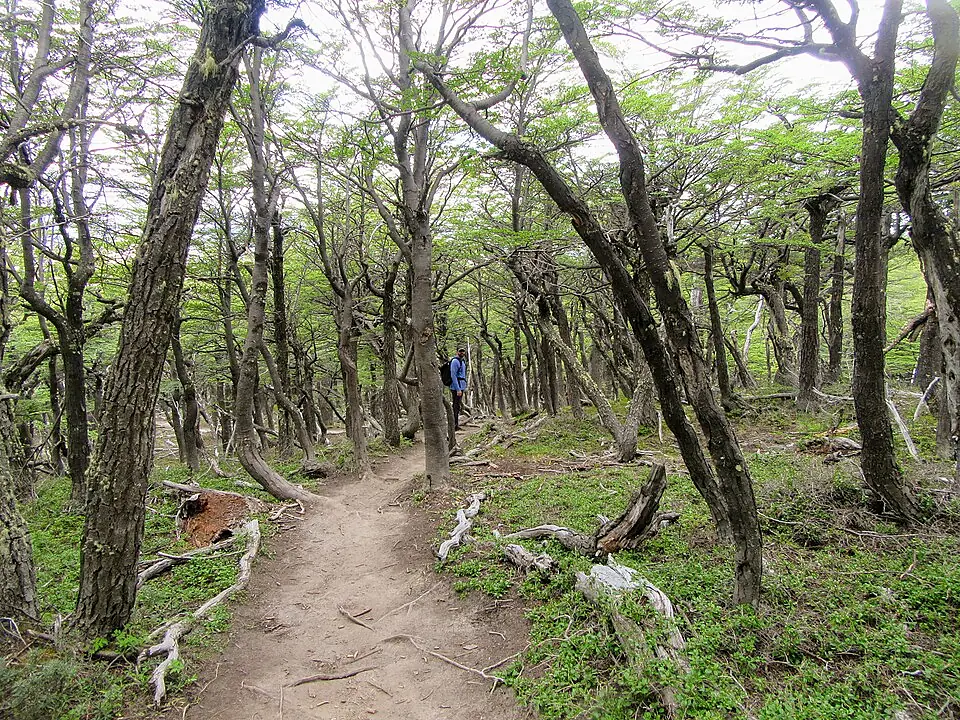
You will eventually enter a beautiful forest of Antarctic Beech (Lenga) trees. This section is a welcome reprieve on hot or windy days, providing shade and a break from the gusts. Keep your eyes and ears open for the Magellanic Woodpecker: the largest woodpecker in South America. You will often hear their rhythmic drumming on the trunks of old-growth trees before you see their bright red heads.
Section 4: The High Alpine Zone
As you emerge from the forest line, the landscape changes dramatically. The trees give way to a barren, lunar landscape of grey rock and scree. This is the most challenging part of the hike. The wind exposure increases significantly here, and the temperature can drop by 5-10 degrees Celsius compared to the forest below. You will follow the yellow stakes as the trail narrows and the incline steepens for the final approach to the Mirador.
Do not underestimate the wind in the high alpine zone. Gusts on this ridge can exceed 80 km/h, which is strong enough to knock a hiker off balance. If the wind makes it difficult to stand, it is safer to turn back at the forest line.
Finding Marine Fossils on Pliegue Tumbado
One of the most surprising features of this hike is the presence of ancient marine life at an altitude of over 1,000 meters. The name “Pliegue Tumbado” refers to the “folded” nature of the geological strata here, which were pushed up from the ocean floor millions of years ago during the formation of the Andes.
As you hike through the rocky section between the upper forest line and the main viewpoint, keep your eyes on the ground. You are looking for small, circular indentations or spiral shapes in the loose grey stones. These are the fossilized remains of ammonites and other sea shells that lived in the ocean roughly 100 million years ago.
The best place to spot these fossils is on the flat, slate-like rocks just off the main path in the final 2km before the Mirador. Look for stones with a distinct “ribbed” texture.
It is important to remember that Los Glaciares National Park is a protected area. While you are encouraged to photograph these fossils, it is strictly illegal to remove them or even move them from their original location. Leaving them exactly where you found them ensures that the next hiker can experience the same sense of discovery.
The Mirador vs. The Summit: Making the Choice
The trail technically has two “end” points: the Mirador (the main viewpoint) and the actual summit of the Loma. Most hikers stop at the Mirador, but the choice to continue depends on your remaining energy and the current wind conditions.
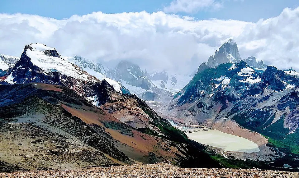
The Mirador (1,250m) is where the trail levels off on a broad, rocky shoulder. From here, you look directly down into the valley toward Laguna Torre and the needle-like spire of Cerro Torre. To your right, Fitz Roy looms large. For 90% of hikers, this is the “payoff” and provides more than enough visual reward for the effort.
The Summit (1,500m) requires an additional 250m of vertical gain over very loose, steep shale. It takes approximately 30-45 minutes of extra climbing from the Mirador. The reward is a true 360-degree view that includes Lago Viedma to the south and a more expansive look at the Southern Patagonian Ice Field.
Assess the Wind
If the wind is gusting hard at the Mirador, it will be significantly more dangerous on the narrow summit ridge. If you can’t stand comfortably, do not attempt the summit.
Check the Time
The descent from the summit back to the Mirador is slow due to the loose rock. Ensure you have at least 4 hours of daylight remaining before committing to the extra climb.
Loma del Pliegue Tumbado vs. Laguna de los Tres
Many hikers with limited time in El Chaltén find themselves choosing between this hike and the more famous Laguna de los Tres. While both are full-day efforts, they offer very different experiences.
To help you decide which trek fits your goals, consider how they compare across these key factors:
- Perspective: Panoramic 360-degree view from above the valleys. vs. Close-up view from the base of the granite walls.
- Crowd Levels: Low to Moderate; a much quieter experience. vs. Very High; the most popular trail in the park.
- Incline Profile: A long, steady, constant climb. vs. Mostly flat for 8km, followed by a brutal 1km vertical scramble.
- Photography: Best in mid-morning as the sun lights up the faces of both massifs. vs. Best at sunrise for the ‘glow’ on Fitz Roy.
Choose Pliegue Tumbado if you want a panoramic 'big picture' view and fewer crowds. Choose Laguna de los Tres if you want to stand at the very base of Fitz Roy and don't mind a busy trail.
Logistics, Fees, and 2026 Regulations
As of the 2026/27 season, Los Glaciares National Park has updated its entry requirements. Hikers are now required to purchase a park pass to access the trails in the El Chaltén sector (Zona Norte). For the 2026/27 season, the general entry fee for foreign visitors is 45,000 ARS (approximately $45–$50 USD depending on the current exchange rate).
You should purchase your ticket in advance online through the official government portal (ventaweb.apn.gob.ar), which will issue a QR code that rangers scan at the Guardaparque Ceferino Fonzo visitor center or other designated checkpoints. Note that tickets are valid for specific durations, and a 50% discount is typically available for a second-day visit if used within 72 hours.
Water and Weather
Unlike the Laguna Torre or Fitz Roy trails, which follow river valleys with frequent glacier-fed streams, water sources on the Loma del Pliegue Tumbado trail are scarce. There are a few small streams in the first 4km, but once you begin the main ascent through the forest and into the alpine zone, there is no reliable water.
Carry at least 2 liters of water per person. The steady climb and high wind exposure will dehydrate you faster than you expect.
Because this trail is a ridge hike, it is the most wind-exposed path in El Chaltén. Before heading out, you should check the specific wind patterns for El Chaltén using Windguru, focusing on the “Goulot” or “Fitz Roy” stations. If winds are forecast above 60 km/h, the high alpine section of this hike will be extremely unpleasant and potentially dangerous.
After completing this 20km journey, you’ll likely be looking for the best places to refuel in El Chaltén. Most restaurants are located a 10-15 minute walk from the trailhead. If you haven’t booked your stay yet, consider looking for accommodation in El Chaltén near the southern trailheads to minimize your walking time on the day of the hike.
FAQ
QUESTION: How hard is the Loma del Pliegue Tumbado hike? ANSWER: It is considered a moderate-to-challenging full-day hike due to its 20km length and 1,100m elevation gain, though the trail is technically easy until the final rocky summit push. The primary challenge is the steady incline and potential for high wind exposure in the upper sections.
QUESTION: Do I need a guide for Loma del Pliegue Tumbado in El Chaltén? ANSWER: No, the trail is well-marked with yellow stakes and clear paths, making it perfectly safe for self-guided hikers in good weather. However, you should be comfortable navigating over loose rock if you plan to go beyond the Mirador to the summit.
QUESTION: Can I see Fitz Roy from the Loma del Pliegue Tumbado trail? ANSWER: Yes, the summit offers a unique 360-degree view that includes both Mount Fitz Roy and Cerro Torre side-by-side. It is widely regarded as the best panoramic view in the entire Los Glaciares National Park.
QUESTION: Is there water available on the Loma del Pliegue Tumbado trek? ANSWER: Unlike other El Chaltén hikes, water sources are limited after the first few kilometers, so you should carry at least 2 liters of water per person. There are no reliable streams once you reach the high alpine zone.
QUESTION: What is the best time of day to start the Loma del Pliegue Tumbado hike? ANSWER: It is best to start by 8:00 AM to ensure you have enough daylight to enjoy the summit and return before the strong afternoon winds typically pick up. Starting early also gives you the best lighting for photography of the massifs.
QUESTION: Are there fossils on the Loma del Pliegue Tumbado trail? ANSWER: Yes, the upper rocky sections of the trail contain 100-million-year-old marine fossils, though it is strictly illegal to remove them from the National Park. Look for ammonite imprints in the grey slate between the forest line and the Mirador.