
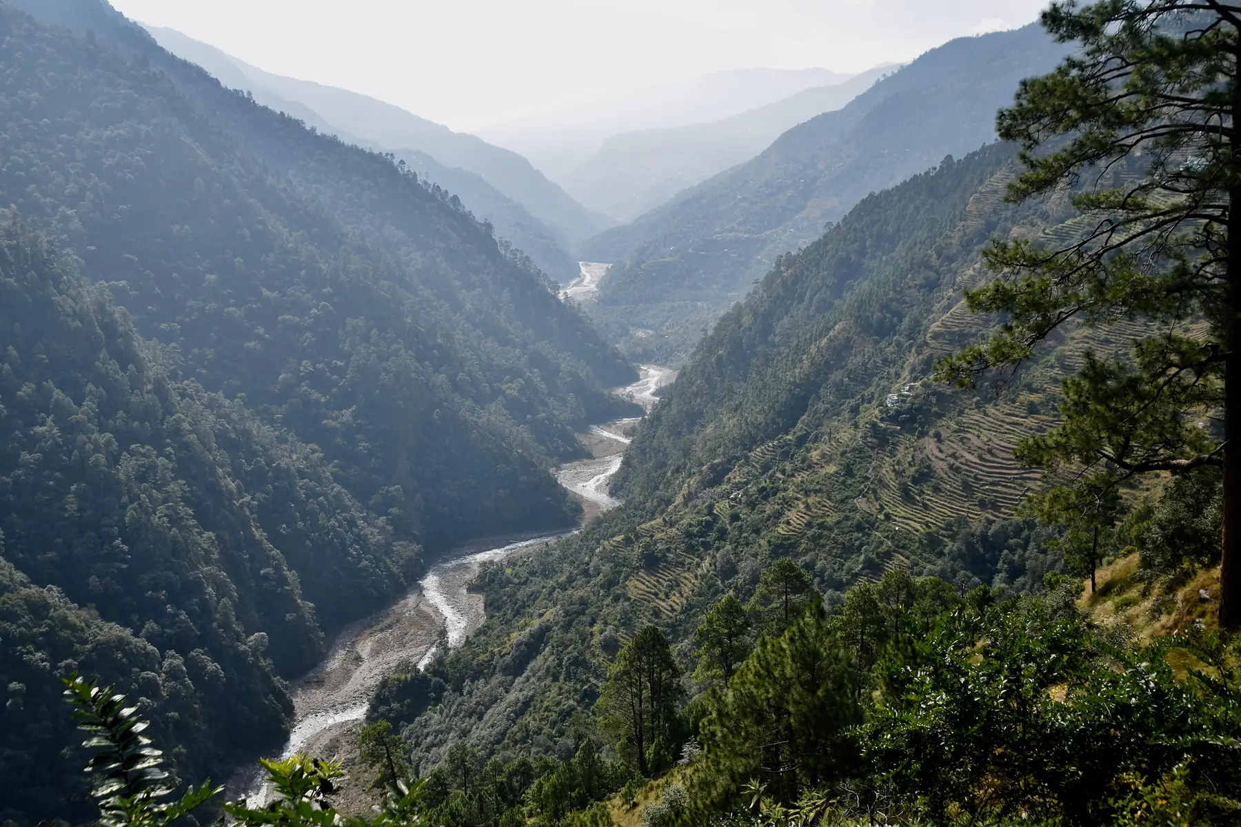
Chaitén Chile: The 2026 Guide to Patagonia’s Gateway Town
Chaitén is the essential northern gateway to the Carretera Austral, serving as both a living monument to volcanic resilience and the primary base for exploring the southern sector of Pumalín National Park. While many travellers treat it as a brief transit point between ferries, Chaitén offers a unique opportunity to witness a town’s rebirth following the 2008 eruption of its namesake volcano, all while providing the best access to the region’s ancient Alerce forests and dramatic coastal fjords.
Chaitén At A Glance
- Location: Palena Province, Los Lagos Region (Northern Carretera Austral)
- Primary Access: Bimodal ferry from Hornopirén or direct flights from Puerto Montt
- Main Attraction: Volcán Chaitén and Pumalín National Park
- Services: Fuel (Copec), Bank (Banco Estado), Hospital, and supermarkets
- Best Visit Window: December to March for stable weather and full trail access
For most visitors, Chaitén is the first true taste of the wilder, more remote Patagonia found along the Carretera Austral. It is a town that was nearly erased from the map, only to be reclaimed by its residents and transformed into a strategic hub for eco-tourism and adventure.
The 2008 Eruption: A Town Reborn
The identity of Chaitén is inseparable from the morning of May 2, 2008, when the Chaitén Volcano erupted for the first time in roughly 9,000 years. This was not a slow lava flow but a violent explosion that sent an ash plume 17 kilometres into the atmosphere. However, it wasn’t the ash alone that destroyed the town: it was the Río Blanco. The volcanic material choked the riverbed, causing a massive lahar (volcanic mudflow) that jumped the banks and carved a new path directly through the town centre, burying houses in meters of silt and ash. Roughly 80% of the town was damaged or rendered uninhabitable by the event.
Today, the town has been remarkably rebuilt, but the scars are intentionally preserved at the Museo de Sitio (Site Museum). Located on the southern edge of the town near the relocated riverbank, this open-air memorial consists of several houses left exactly as they were after the flood: half-buried in hardened volcanic mud. Walking through this area provides a sobering perspective on the power of the landscape you are about to explore.
Despite the disaster, the “Chaitenino” spirit has seen the town return as a fully functional municipality. The infrastructure is now modern, featuring a new airport and a reinforced waterfront (costanera) that offers views of the steaming volcano on clear days. It is no longer a disaster zone but a vibrant, resilient community that serves as a vital link in the Carretera Austral chain.
Logistics: How to Get to Chaitén in 2026/27
Reaching Chaitén requires navigating a combination of ferries, flights, or long-distance drives, with the “Bimodal Route” being the most common choice for those heading south from Puerto Montt. For the 2026/27 season, advance planning is non-negotiable for vehicle travellers, as ferry space on key segments often sells out months in advance.
By Ferry (The Bimodal Route)
The most scenic and popular way to arrive is via the Bimodal Route from Hornopirén. This journey involves two ferry crossings separated by a short drive through the temperate rainforest.
- Segment 1: Hornopirén to Leptepú (approx. 3.5 hours).
- Drive: A 10km gravel transit between Leptepú and Fiordo Largo.
- Segment 2: Fiordo Largo to Caleta Gonzalo (approx. 45 minutes).
For the 2026/27 season, you must book the Hornopirén to Leptepú leg through Somarco or Naviera Austral at least 1–2 months in advance if you are bringing a vehicle during the peak months of January and February. Foot passengers can usually find space, but vehicles are strictly limited.
From Caleta Gonzalo, it is a spectacular 60km drive south through Pumalín National Park to reach Chaitén. For a broader look at regional transport, see our guide on how to get to the Carretera Austral.
By Air
The fastest way to reach Chaitén is a 35-45 minute flight from Puerto Montt’s La Paloma Airfield. Flights land at the new Chaitén Airfield (WCH), located about 20km north of the town. Two main airlines service this route: Aerocord and Pewen (formerly Patagonia Airlines). These small-plane flights offer some of the best aerial views of the fjords and the volcano’s steaming dome, provided the weather cooperates.
By Land and Direct Ferry
If you are driving north from Coyhaique or Puyuhuapi, Chaitén is reached via Route 7. If you are coming from Chiloé, Naviera Austral operates a direct ferry from Quellón to Chaitén, which is a vital link for those doing a “loop” through the archipelago. There is also a direct overnight ferry from Puerto Montt to Chaitén, which bypasses the Bimodal Route entirely.
Hiking the Chaitén Volcano (Volcán Chaitén)
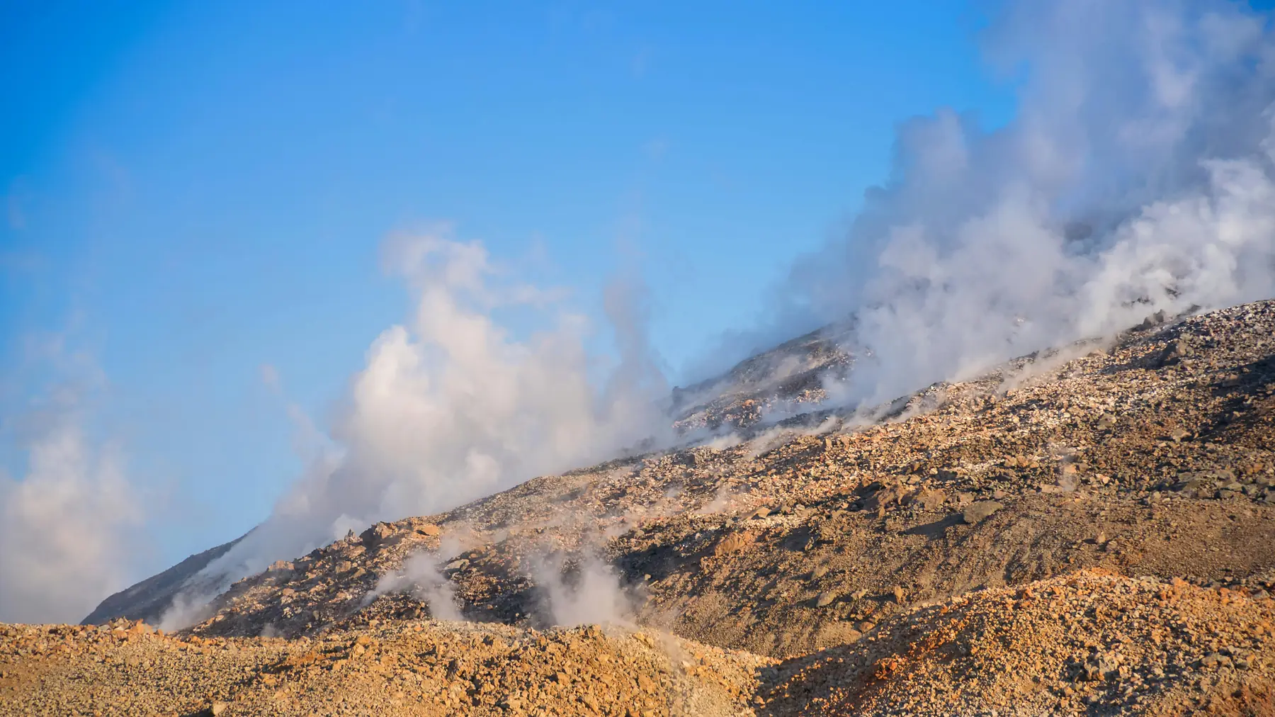
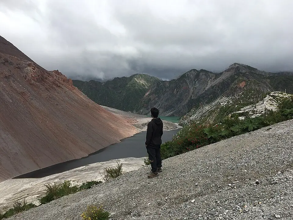
The hike to the crater of Volcán Chaitén is the town’s premier trekking experience, offering a front-row seat to the aftermath of the 2008 eruption. The trailhead is located approximately 24km north of Chaitén along the Carretera Austral. It is a steep, rewarding climb that ranks among the best hikes on the Carretera Austral for its unique volcanic geology.
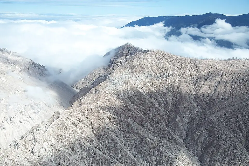
The trail begins in a dense, humid forest that quickly gives way to a “ghost forest” of silver, barkless trees killed by the 2008 heat and ash. As you climb, the vegetation thins, and the ground turns into loose volcanic scree. At the summit, you are treated to a view of the massive, steaming lava dome that continues to grow within the caldera.
Do not attempt to descend into the caldera or approach the steaming dome. The terrain is highly unstable, and the gases emitted can be toxic. Stay strictly on the CONAF-marked trails at the summit ridge.
The hike typically takes 2.5 to 3 hours round trip. While the path is well-maintained, the lack of shade in the burnt forest sections means it can get surprisingly hot on sunny days. Ensure you carry water, as there are no reliable streams once you leave the trailhead area.
Chaitén as the Gateway to Pumalín Douglas Tompkins National Park
While the volcano is the most famous landmark, Chaitén serves as the strategic “Base Camp” for the southern sector of Pumalín National Park. This area contains some of the last remaining stands of ancient Alerce trees, which can live for over 3,000 years.
Staying in Chaitén allows you to easily reach the Sendero Alerces Milenarios (Alerce Trail), a short, accessible boardwalk 28km north of town that winds through a grove of these giants. The town is also the best place to stock up on supplies before heading to the more remote campsites at Caleta Gonzalo or El Amarillo.
The transition from the coastal fjords at Caleta Gonzalo to the interior rainforests around Chaitén is one of the most dramatic ecological shifts in Patagonia. By using Chaitén as a base, you can explore the park’s southern trails during the day and return to the comfort of a local hospedaje and a warm meal in the evening.
Beyond the Volcano: Best Things to Do in Chaitén
If you have an extra day in Chaitén, there are several lesser-known spots that offer a quieter look at the Palena Province’s natural beauty.
Playa Santa Bárbara
Located 12km north of town, Santa Bárbara is a stunning black sand beach at the foot of Morro Vilcún. It is a popular spot for locals on summer afternoons, but the real draw for travellers is the wildlife.
Keep a close watch on the surf at Santa Bárbara. The endemic Toninas (Commerson’s dolphins) are frequently spotted playing in the waves just a few meters from the shore, particularly in the early morning or late evening.
Termas El Amarillo
For recovery after the Chaitén Volcano hike, head 30km south to Termas El Amarillo. These natural hot springs are located within a lush forest setting at the southern edge of Pumalín Park. The facilities are rustic but well-maintained, featuring a large outdoor pool and private baths fed by volcanic thermal waters. The entrance fee for non-residents is approximately 12,000 CLP (as of the 2026/27 season).
Yelcho Glacier (Ventisquero Yelcho)
South of Chaitén, the landscape becomes even more vertical as you approach Lake Yelcho. The hike to the Yelcho Glacier is a hidden gem: a 3 to 4-hour trek that leads to a viewpoint overlooking a massive hanging glacier. It is far less crowded than the trails in Pumalín and offers a taste of the ice-dominated landscapes found further south.
Essential Travel Tips & Services
Chaitén is the last major service hub for travellers heading south until they reach Puyuhuapi or even Coyhaique. It is essential to handle your logistics here before continuing into more remote territory.
- Fuel: The Copec station is located near the waterfront, close to the ferry pier. This is a critical stop; ensure your tank is full before heading south toward Lake Yelcho, as fuel reliability can vary at smaller outposts. You can find its exact location on our Carretera Austral map.
- Money: There is a Banco Estado in the town centre with an ATM. While it is generally reliable, the machine can run out of cash during peak summer weeks or during power outages. Always carry enough Chilean Pesos to cover two days of food and lodging as a backup.
- Connectivity: Entel is the dominant provider in the region and offers the most consistent 4G signal in town. Most hostels provide Wi-Fi, but the speeds are often slow and can be interrupted by the frequent Patagonian rainstorms.
- Weather: Chaitén is located in one of the rainiest regions of Chile. While the summer months are drier, “dry” is a relative term. For a detailed breakdown of what to expect, check our Carretera Austral weather guide.
For those without a rental car, local operators like Chaitur offer reliable shuttle services to the Volcán Chaitén trailhead and other points within Pumalín National Park. They are also an excellent source of up-to-the-minute information on trail conditions and ferry delays.
To continue your journey, most travellers either head east toward the world-class rafting in Futaleufú or continue south along the Carretera Austral toward the hanging glacier of Puyuhuapi.

FAQ
Is Chaitén Chile worth visiting? Absolutely. It offers a unique combination of dramatic volcanic history, direct access to the southern sector of Pumalín National Park, and essential ferry connections that make it a cornerstone of any Carretera Austral itinerary.
Is the Chaitén volcano still active? Yes, the Chaitén volcano is considered active. While there have been no major eruptions since 2008, the lava dome remains in a degassing phase, and the area is constantly monitored by Chilean geological services.
How do I book the ferry to Chaitén? For the 2026/27 season, you should book at least 1–2 months in advance via the Somarco website for the Bimodal route from Hornopirén, or through Naviera Austral for direct ferries from Puerto Montt or Quellón.
Can you see dolphins at Santa Bárbara beach in Chaitén? Yes, endemic Toninas (Commerson’s dolphins) are frequently seen from the shore at Santa Bárbara, especially during the quiet hours of the early morning.
Are there ATMs in Chaitén Chile? Yes, there is a Banco Estado with an ATM in the town centre. However, it is highly recommended to carry backup cash as the machine can occasionally run out during the peak tourist season.
What is the best time of year to visit Chaitén? The best time to visit is during the Patagonian summer, from December to March, when the weather is most stable and the hiking trails in Pumalín National Park are fully open.