
Glacier Grey Hike: Complete 2026 Day Hike & Trail Guide
The Glacier Grey hike is the most efficient way to stand face-to-face with the Southern Patagonian Ice Field without committing to a multi-day trek. While this 25-kilometer round trip is a core segment of the famous W Trek, it is entirely achievable as a standalone day hike for those who prioritize dramatic “ice-to-effort” ratios.
As you move through the valley, the scenery shifts from the turquoise waters of Lago Pehoé to the deep, electric blue of calving ice. This guide provides the specific logistical framework needed to navigate the trail independently, from the 2026 catamaran schedules to the precise turnaround times required to avoid being stranded at the trailhead.
Before diving into the trail sections, it is helpful to understand where this hike sits within the broader context of the park. This trail is located in the western sector of Torres del Paine National Park, a region defined by its intense microclimates and massive glacial systems. For a complete look at the park’s geography, you can reference our Torres del Paine map or explore other Patagonia hikes in the region.
Glacier Grey Hike: Trail Stats & Essential Logistics
A successful day hike to Glacier Grey requires a 7 to 9 hour commitment, beginning and ending at Refugio Paine Grande. Because the trailhead is only accessible by boat across Lago Pehoé, your hiking day is strictly dictated by the catamaran’s morning arrival and evening departure.
Glacier Grey Day Hike: At a Glance
- Total Distance: 25km (15.5 miles) round trip to the main glacier mirador
- Elevation Gain: 600m (1,970 ft) total cumulative gain
- Time Required: 7 - 9 hours including breaks
- Difficulty: Moderate
- Starting Point: Refugio Paine Grande
- Access: Lago Pehoé Catamaran from Pudeto
The trail begins at Refugio Paine Grande, a large mountain hub that serves as the western gateway for the W Trek. Even if you are not staying overnight, the refugio provides essential services for day hikers, including a small shop, restrooms, and a cafe where you can wait for your return ferry. It is the last reliable point for a hot meal until you reach Refugio Grey, 11 kilometers into the hike.
Getting to the Trailhead: The 2026 Pudeto Catamaran Strategy
The most difficult part of the Glacier Grey day hike is not the elevation gain, but the “Pudeto Crux” - the coordination between the bus from Puerto Natales and the Lago Pehoé catamaran. To complete the full 25km hike, you must be on the first catamaran of the day.
For the 2026 season, the journey begins with a 6:30 AM or 7:00 AM bus from the Puerto Natales bus station to the Pudeto ranger station. Operators like Bus Sur are the primary choice for this route. You can find a full breakdown of these transport links in our guide on how to get to Torres del Paine.
Book the Catamaran Online
As of the 2026/27 season, online booking for the Lago Pehoé catamaran is highly recommended and has become the standard for securing a spot on the early boats. While cash (CLP) may still be accepted on board if space permits, the first boat often fills with W Trekkers who have booked in advance.
Target the 8:30 AM or 10:30 AM Departure
Day hikers should aim for the 8:30 AM ferry. Taking the 10:30 AM boat is possible for very fast hikers, but it leaves almost zero margin for error if you want to reach the final viewpoint and return for the last ferry.
Budget for the Crossing
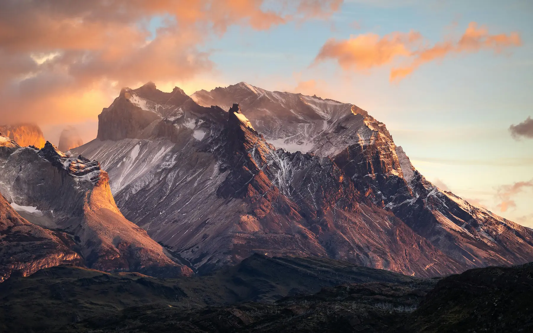
The round-trip catamaran fare for the 2026/27 season is $54,000 CLP (approximately $27,000 CLP per leg). The crossing takes 30 minutes and offers your first views of the Cuernos del Paine.
The last catamaran typically departs Paine Grande for Pudeto at 18:30 (6:30 PM) during the high season. If you miss this boat, there is no road access out of the sector, and Refugio Paine Grande is frequently fully booked months in advance.
Section 1: Paine Grande to Laguna de los Patos
The hike begins with a steady 3-kilometer climb out of the Paine Grande valley. This initial stretch is characterized by rocky terrain and a lack of tree cover, as the area is still recovering from a major human-caused fire in 2011. You will notice the silver, skeletal remains of old trees standing against the new green growth of the recovering ecosystem.
As you ascend, you will enter the “Quebrada de los Vientos” (Windy Gulch). This narrow pass acts as a funnel for the katabatic winds coming off the ice field. Expect sustained winds of 60-80 km/h on exposed sections, which can be strong enough to knock a hiker off balance if they are not prepared.
The first major landmark is Laguna de los Patos (Duck Lagoon). This small, sheltered body of water marks the end of the first significant climb. It is the best place to stop for a water break and to adjust your layers before the trail opens up to the first views of Lago Grey.
Section 2: Mirador Lago Grey (The Halfway Viewpoint)
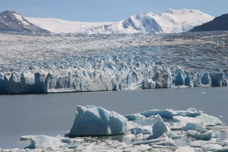
The Mirador Lago Grey is reached at roughly the 6-kilometer mark and provides the first expansive view of the lake. From here, you can see large, electric-blue icebergs that have calved off the glacier and drifted toward the southern end of the lake.
This viewpoint is a critical decision point for day hikers. If you have not reached this mirador by 12:30 PM, you should strongly consider making this your turnaround point. Pushing forward to the glacier face from here adds another 13 kilometers to your total round trip, which may put you at risk of missing the final catamaran.
The wind at Mirador Lago Grey is often the most intense on the entire trail. Before approaching the edge of the viewpoint, ensure your pack cover is secured and your hat is tethered.
The view from here also reveals the scale of the Southern Patagonian Ice Field as it begins to peek over the granite horizon. The contrast between the grey, silt-heavy water of the lake and the bright icebergs is one of the most photographed scenes in Torres del Paine.
Section 3: The Descent to Refugio Grey & The Final Mirador
After leaving the halfway mirador, the trail enters a lush Lenga forest. This section provides a welcome reprieve from the wind and offers the best birdwatching opportunities on the hike. Keep an eye out for the Magellanic Woodpecker, identifiable by its large size and the rhythmic “double tap” it makes on the hardwood trees.
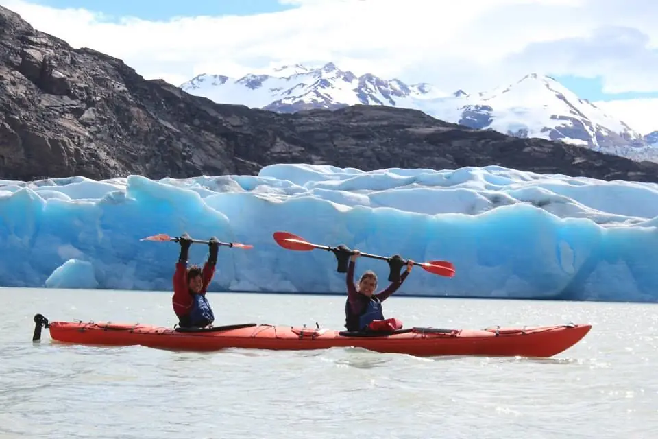
The trail descends toward Refugio Grey, located at the 11-kilometer mark. This facility serves as a base for ice trekking and kayaking excursions, but for day hikers, it is a place to refill water and use the restrooms.
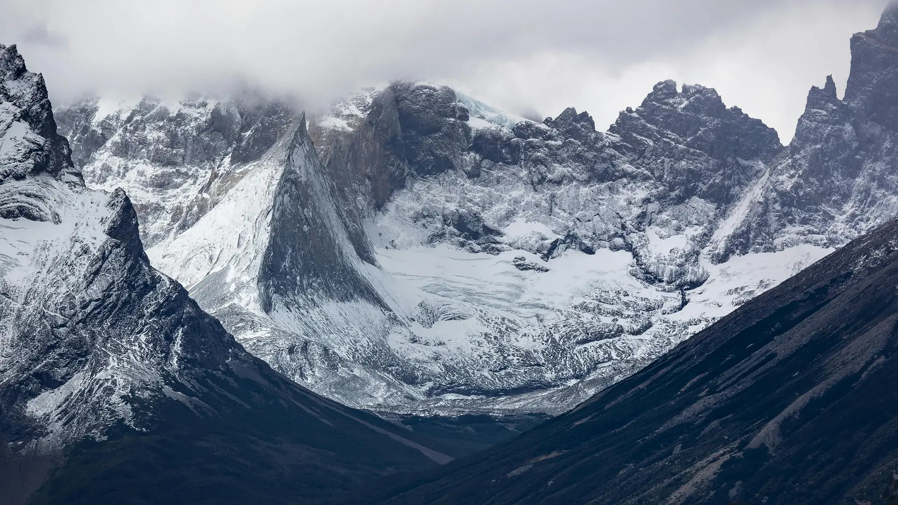
To see the glacier face properly, you must continue roughly 1.5 kilometers past the Refugio. Follow the signs for the “Mirador Glaciar Grey.” The trail leads to a rocky peninsula that juts out into the lake, placing you directly in front of the glacier’s massive calving face. From this vantage point, you can see the three distinct tongues of the glacier and the nunataks - rocky islands - that split the ice flow.
For more information on the glacier’s history and the other ways to explore it, visit our dedicated page on Glacier Grey.
The Bonus View: Continuing to the First Suspension Bridge
If you are a fast hiker and arrived at Refugio Grey before 1:30 PM, you have the option to continue toward the first of the W Trek’s famous suspension bridges. The Puente Braunlich is located about 2 kilometers (40 minutes round trip) past the Refugio.
Crossing this bridge provides a “bird’s eye” view of the glacier. You can look directly down into the deep blue crevasses and see the sheer scale of the ice as it grinds against the mountain walls.
Do not attempt this bonus section if you are feeling fatigued. The return 12.5km hike to Paine Grande involves several short, steep climbs that feel significantly harder on the return leg.
The Alternative Return: Using the Grey III Navigation
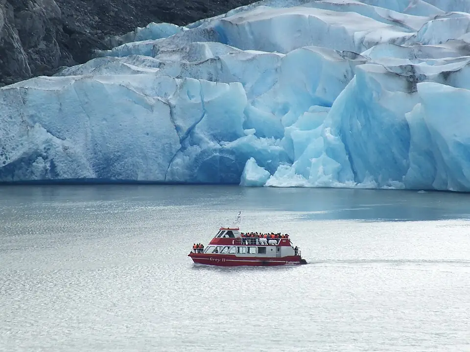
A popular strategy for those who want to see the glacier but avoid the 25km return hike is to use the Grey III Navigation boat. This allows you to hike one way from Paine Grande to Refugio Grey, then take a large catamaran across the lake to Hotel Lago Grey.
This option is significantly more expensive than the standard ferry and requires a separate bus or shuttle transfer from Hotel Lago Grey back to the park entrance. However, it allows you to see the glacier face from the water, which is a completely different perspective than the trail miradors.
If you choose this route, you must book your boat ticket well in advance, as the Grey III Navigation frequently sells out during the peak season. You can find booking details and boat schedules on our Glacier Grey guide.
Essential Gear for the Glacier Grey Trail
The Glacier Grey valley creates its own weather system. Even if it is sunny in Puerto Natales, this trail can be lashed by rain and wind.
- Wind Resistance: Excellent (Hardshell Jacket)
- Wind Resistance: Moderate (Insulated Puffer)
- Waterproofing: Essential and built-in (Hardshell Jacket)
- Waterproofing: Low — not designed for rain (Insulated Puffer)
- Breathability: High (Hardshell Jacket)
- Breathability: Variable (Insulated Puffer)
- Weight: Lightweight and packable (Hardshell Jacket)
- Weight: Lightweight and packable (Insulated Puffer)
On this trail, a high-quality hardshell is more important. The wind will cut right through a puffer, but a hardshell provides the essential barrier needed at the miradors.
Footwear: The trail is rocky and involves several sections of loose scree. Sturdy trekking boots with ankle support are highly recommended.
Hydration: You do not need to carry liters of water. The streams crossing the trail between Paine Grande and Refugio Grey are fed by glacial melt and are generally safe to drink. Use common sense: only take water from fast-moving streams and ensure there is no livestock or human activity upstream.
Sun Protection: The UV index near the ice is exceptionally high due to the reflective nature of the glacier. Apply sunscreen even on cloudy days, and wear polarized sunglasses to protect your eyes from the glare off the ice field.
Related Planning Resources
If you are still organizing the rest of your itinerary, these guides will help you finalize your logistics in Torres del Paine.
FAQ Section
QUESTION: Is the Glacier Grey hike safe to do alone? ANSWER: Yes, the Glacier Grey trail is well-marked and heavily trafficked during the hiking season, making it safe for solo hikers with standard mountain safety awareness.
QUESTION: Can I see Glacier Grey without hiking 25 kilometers? ANSWER: Yes, travelers can take the Grey III Navigation boat tour from Hotel Lago Grey or the O Circuit trek to see Glacier Grey with significantly less (or different) walking.
QUESTION: What is the best time of day to start the Glacier Grey hike? ANSWER: You should aim to be on the first 8:30 AM catamaran from Pudeto to ensure you have enough daylight and time to reach the main viewpoint and return for the last ferry.
QUESTION: Are there toilets on the Glacier Grey trail? ANSWER: Public restrooms are available at the start (Refugio Paine Grande) and at the 11km mark (Refugio Grey), but there are no facilities on the trail between these points.
QUESTION: Do I need trekking poles for the Glacier Grey hike? ANSWER: While not strictly required, trekking poles are highly recommended for the Glacier Grey trail to help with stability during the high-wind sections and the descent into the forest.
QUESTION: Is there cell service on the Glacier Grey hike? ANSWER: There is no reliable cell service on the Glacier Grey trail or at the Refugios; hikers should download offline maps and transport schedules before leaving Puerto Natales.