
Futaleufú Travel Guide: Rafting, Hiking & 2026/27 Logistics
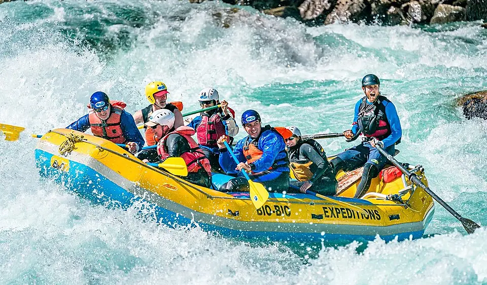
Futaleufú is widely considered the premier whitewater rafting destination on the planet, defined by the turquoise Class IV and V rapids of its namesake river. Located in the northern reaches of the Chilean Lake District, this remote village serves as the adventure capital of the Carretera Austral, drawing professional kayakers and adrenaline seekers to its “Big Water” technicality.
While the river is the primary draw, Futaleufú — translated from the Mapudungun words Futa (Big) and Leufú (River) — is more than a one-dimensional adrenaline hub. The surrounding valley, often described by locals as a “landscape painted by God,” offers a deep immersion into Patagonian gaucho culture, world-class fly fishing, and a network of granite-fringed hiking trails that remain far less crowded than those in the south. Whether you are navigating the “Inferno Canyon” or sharing a traditional lamb asado with a local family, the town represents the raw, unpolished heart of Chilean Patagonia.
Futaleufú At A Glance
- Primary Draw: World-class Class IV and V whitewater rafting and kayaking.
- Location: Northern Carretera Austral, 10km (6 miles) from the Argentine border.
- Best Season: December to March for rafting; November for peak water volume.
- Access: Fastest via Esquel, Argentina (EQS) or scenic via Chaitén, Chile.
- Vibe: High-energy adventure meets traditional mountain village.
Why Futaleufú is the World’s Whitewater Capital
The Futaleufú River earns its global reputation through a rare combination of high water volume, exceptional clarity, and technical complexity. Unlike many glacial rivers that are murky with “rock flour,” the “Futa” is a deep, transparent turquoise, allowing paddlers to see the massive boulders that create its legendary hydraulics.
The river is divided into distinct sections, each offering a different level of intensity. The Inferno Canyon is the most demanding, a tight granite gorge featuring several consecutive Class V rapids that require precise maneuvering. For most travelers, the Bridge to Bridge section is the highlight. This stretch contains some of the river’s most famous Class IV rapids, such as “Mundaca” and “Terminator,” providing massive waves and heart-pounding drops without the extreme technical risk of the upper canyon.
Safety standards in the valley are exceptionally high, reflecting the power of the water. Reputable operators do not run the river with a single raft; instead, they employ a “safety net” consisting of a lead cataraft and multiple safety kayakers who sit downstream of major rapids to assist anyone who falls overboard.
The river’s character shifts significantly with the seasonal cycle. In November and December, late spring snowmelt creates “Big Water” conditions where the rapids are massive, fast, and forgiving of minor technical errors. By February and March, the water level drops, exposing more rocks and turning the river into a “technical” run that requires tighter, more intricate paddling through narrower channels.
Beyond the Rapids: Top Things to Do in Futaleufú
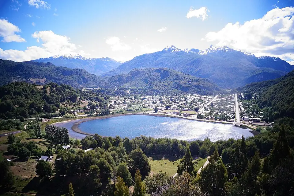
While the river dominates the local economy, the valley’s geography provides ample opportunities for those who prefer to keep their boots dry. The town is nestled at the confluence of the Futaleufú and Espolón rivers, surrounded by a dramatic amphitheater of glaciated peaks and temperate rainforest.
The hiking here is defined by steep elevation gains and panoramic rewards. The Cerro de la Bandera is the essential town hike, a steady climb that offers a 360-degree view of the village and the turquoise ribbon of the river winding toward the horizon. For a more immersive experience, the Reserva Nacional Futaleufú protects the habitat of the endangered Huemul deer and offers trails like “Las Escalas,” which overlooks the valley’s unique microclimate.
For the best photography in the valley, hike to the Piedra del Águila (Eagle’s Rock) in the early morning. The trail leads to a massive granite outcrop that juts over the Espolón valley, providing a vertical perspective of the landscape that is unmatched in the region.
For those interested in the wider adventure offerings in the region, including more technical treks, you can find further inspiration in our guide to Carretera Austral things to do.
If you are looking for specific trail technicalities, distances, and elevation profiles for the region’s most famous paths, consult our comprehensive breakdown of the Carretera Austral’s best hikes.
Beyond the trails, the area is a pilgrimage site for fly fishermen. The Espolón River and Lake Lonconao are famous for wild rainbow and brown trout, with many lodges offering specialized drift boat trips. To experience the local culture, seek out a quincho (a traditional barbecue hut) for a Patagonian lamb roast. This is the social heart of the valley, where the “gaucho” way of life remains a daily reality rather than a tourist performance. You can find recommendations for the most authentic local dining in our guide to Carretera Austral restaurants.
How to Get to Futaleufú: The Three Main Routes
Reaching Futaleufú requires deliberate planning, as it is one of the most geographically isolated towns in Chile. Your choice of route depends on whether you prioritize speed, scenery, or a broader exploration of the Carretera Austral.
The fastest and most efficient entry point is the Argentina Route. By flying from Buenos Aires to Esquel (EQS), you can reach Futaleufú in under two hours by road. The Paso Río Futaleufú border crossing is located just 10 kilometers (6 miles) from the town center. This is the preferred route for travelers focusing exclusively on rafting.
The Bimodal Route is the classic Chilean approach, starting in Puerto Montt. This involves a combination of driving and multiple ferry crossings through Hornopirén and Chaitén. It is significantly slower but offers some of the most spectacular coastal scenery in South America, passing the fringes of Pumalín National Park.
- Travel Time: 2-3 hours from Esquel (including border) vs. 12-14 hours from Puerto Montt
- Scenery: Dry pampa and mountain transition vs. Lush fjords and rainforest
- Complexity: International border crossing vs. Multiple ferry bookings
- Cost: Higher flight costs to Esquel vs. Ferry fees and fuel
Choose the Argentina Route for efficiency and the Bimodal Route if you want the full Chilean road trip experience.
For those already traveling the northern route, the Southern Route connects Futaleufú to Coyhaique via the Carretera Austral and Route CH-235. This is a rugged 8-10 hour drive through the heart of the mountains. To help visualize these connections, we recommend viewing our Carretera Austral map before finalizing your transport.
If you plan to rent a car in Argentina (Esquel) to drive into Chile, you must inform the rental agency at least 72-96 hours in advance. You require a specific notarized permit (Permiso de Salida) and international insurance (Seguro Obligatorio para Vehículos Extranjeros) to cross the border, and agencies charge a significant additional fee for this.
Planning Your Visit: Seasonality and Costs
Timing your trip to Futaleufú is almost entirely dependent on your relationship with the river. While the town is accessible year-round, the adventure infrastructure largely shuts down outside the core summer months.
The peak season runs from mid-December to early March. During this window, all rafting operators are active, and the weather is at its most stable. However, “stable” in this part of Patagonia still means you should expect rain. The river levels are highest in November and December due to snowmelt, which creates the “Big Water” experience. By March, the river is lower and more technical, which many experienced kayakers actually prefer.
Even in the height of summer, the water temperature of the Futaleufú remains around 7-10°C (45-50°F). Reputable rafting companies provide thick 5mm wetsuits and splash jackets, but you should bring your own thermal base layers to wear underneath.
Budgeting for the 2026/27 and 2026/27 seasons requires an understanding that Futaleufú is more expensive than central Chile due to its remoteness. A full day of rafting on the Bridge to Bridge section typically costs between $100 and $160 USD per person. Horse riding and guided fly fishing follow similar premium pricing. For a complete list of what to bring to stay dry and comfortable, check our Patagonia packing list.
Where to Stay: From Luxury Lodges to Riverside Camps
Accommodation in Futaleufú has evolved into two distinct categories: town-centered convenience and riverside immersion. The town itself is small and walkable, making it the best base for independent travelers who want to be near restaurants and the single ATM.
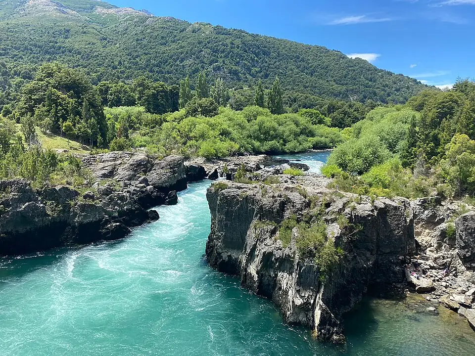
The most unique way to experience the valley is through its “Rafting Camps.” These are semi-permanent glamping sites located directly on the banks of the river, often accessible only by boat or private trail. These camps typically offer hot tubs, platform tents with real beds, and a “coffee-in-tent” service that has become a signature of the Futaleufú experience.
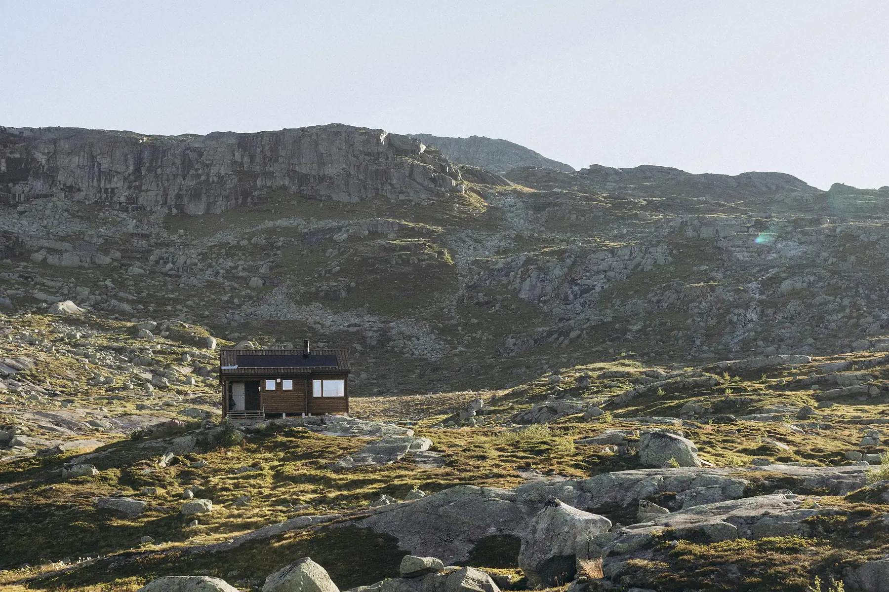
For those seeking high-end comfort, luxury lodges like Uman or Raudal provide world-class amenities, including spas and fine dining, set against the backdrop of the granite spires. These lodges are generally located 15-20 minutes outside of town and require a private vehicle or lodge-arranged transport.
Essential Logistics: Border Crossings, Cash, and Connectivity
Practicality is the key to a smooth trip in this corner of Patagonia. While the town is modernizing, it still operates on “frontier logic” in several key ways.
Currency and Cash: The town relies heavily on Chilean Pesos (CLP). While many rafting operators and high-end lodges now accept credit cards, smaller guesthouses, local markets, and cafes often do not. There is only one ATM in the town center (Banco Estado), and it is notorious for running out of cash during the peak weeks of January and February. Travelers should withdraw sufficient pesos in Chaitén, Coyhaique, or Esquel before arriving.
Border Crossing Logistics: If you are entering from Argentina, you will pass through Paso Río Futaleufú (known locally as “El Límite”). You must keep the PDI (investigative police) paper given to you at Chilean immigration; you will need it to leave the country. As of the 2026/27 season, border hours are typically 08:00 to 20:00 during the summer (November-March) and 08:00 to 19:00 in the winter, but you should verify with the Pasos Fronterizos official website for real-time changes.
Connectivity: Digital nomads should be aware that while Starlink is now common in many lodges and some town cafes, mobile cell service is spotty. Once you leave the town limits and head into the Río Azul or Espolón valleys, you should expect to be entirely offline.
FAQ
Is the whitewater rafting in Futaleufú safe for beginners? Yes, while the Futaleufú River is famous for Class V rapids, the “Bridge to Bridge” section offers world-class Class III and IV whitewater that is suitable for adventurous beginners when accompanied by professional guides and safety kayakers.
How do I get to Futaleufú from Argentina? The easiest way is to fly into Esquel (EQS), then take a taxi, private transfer, or bus to the Paso Río Futaleufú border crossing, which is only 10 kilometers (6 miles) from the town center.
What is the best month to visit Futaleufú for rafting? January and February offer the most reliable weather and stable water levels, though late November and December provide higher water volumes for those seeking maximum adrenaline.
Do I need a 4x4 vehicle to visit Futaleufú? While a 4x4 is not strictly necessary to reach Futaleufú via the main roads, it is highly recommended for exploring side valleys like Río Azul or for driving the gravel sections of the Carretera Austral comfortably.
Are there things to do in Futaleufú for non-rafters? Absolutely; Futaleufú offers exceptional fly fishing, world-class hiking trails like Piedra del Águila, horse riding with local gauchos, and mountain biking through temperate rainforests.
Is there an ATM in the town of Futaleufú? Yes, there is a Banco Estado ATM located in the town center, but it frequently runs out of cash during the peak January/February season, so travelers should carry Chilean Pesos (CLP) as a backup.